
Physical Geography
Physical geography focuses on geography as an Earth science (and is sometimes called Earth System Science).
Physical geography is a branch of geography that focuses on the study of the natural features and processes of the Earth’s surface. It includes the examination of landforms, climate, vegetation, soils, and water resources. Physical geographers use a range of scientific methods and tools to analyze and understand the complex interactions between the Earth’s physical systems.
Learn about the different branches of geography that fall under the physical geography category: climatology, geomorphology, biogeography, and more.

Can Using a Waterless Barrier Prevent the Expansion of Invasive Species?
In western Australia, researchers have proposed a waterless barrier method to halt the spread of cane toads.

Help Map Out Australia’s Dead Trees
By using a GPS-enabled smartphone, volunteers can capture imagery of tree health around Australia to help researchers map out where trees are dying in Australia.

How the Last 160 Years Have Changed the Earth’s Climate
Since the Industrial Revolution, this level has been rising continuously, reaching 410 ppm in 2018.
The First South Atlantic Tropical Storm Since 2010
Iba is the first tropical storm to form in the South Atlantic since 2010.

NASA Satellite Captures Image of Meteor Over the Bering Sea
On December 18, 2018, the Multi-angle Imaging SpectroRadiometer (MISR) instrument on NASA's Terra satellite detected the aftermath of an explosion of a fireball (a very bright meteor) 16 miles (26 kilometers) over the Bering Sea.

Fossil Finds Reveal More About the ‘Cambrian explosion’ – When Oceans First Developed Complex Life
Recent fossil finds in China reveal Cambrian seas were more diverse than thought.

Is a Vitamin Deficiency Killing Wildlife?
Researchers believed that thiamine (Vitamin B1) deficiency is playing a role in declining populations of some wildlife.

Warmer Oceans Will Make Hurricanes More Intense
Since hurricanes draw their energy from ocean heat, warmer waters can increase both their intensity and duration.

How Climate Change is Affecting Tick Season
As the global climate warms, it is more likely that some ticks will remain active through the warmer winters and can expand their habitats into new areas.

Using Dark Fiber to Measure Seismic Activity
Researchers wanted to test if unlit fiber cable could be used to collect measurements of seismic activity to fill in spatial gaps in the data.
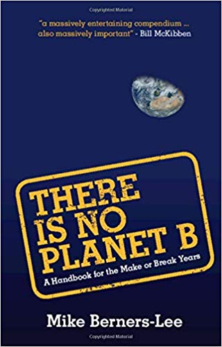
Review | There is No Planet B: A Handbook for the Make or Break Years
Mike Berners-Lee presents an ‘evidence-based practical guide to the make or break choices we face now’ in the Anthropocene age.

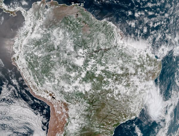
Deforestation Is Drying Up Atmospheric Rivers
Deforestation has a dramatic impact on climate, reducing evapotranspiration which feed atmospheric rivers.

Ice Circles
Ice circles are a rare occurrence in rivers, streams, and creeks worldwide.

Using Repeat Photography to Capture Landscape Change
By capturing the same view through photography, researchers can study how the landscape is changing over time.

Ethiopia’s Church Forests Are Pockets of Biodiversity
Also known as coptic forests, church forests range in size from a few acres to 300 hectares and provide a range of spiritual and ecological benefits to the local community.

What’s the Tallest Point in Niger?
Located in northern Niger, Mont Idoukal-n-Taghes rises to a summit height of 2,022 meters (6,634 feet) above sea level.

Waipā Garden in Kauai, Hawaii Now Holds the 24-Hour Precipitation Record for the United States
A rainfall gauge located at the Waipā Foundation in Kauai, Hawaii set the record for the most rainfall in a 24-hour period in the United States.

Study Discovers That This Methane Depleting Atmospheric Molecule Can Recycle Itself
The hydroxyl radical’s reactivity has earned it the nickname “air detergent” - because of the way it effectively breaks down other gasses in the atmosphere, especially methane.

Measuring the Neutrino Tomography of Earth
In November of 2018, an international team of physicists managed to measure Earth’s mass by using neutrino tomography and the data captured by the South Pole’s IceCube Neutrino Observatory.

What is Negative Rainfall?
Negative rain(fall) occurs when a particular area experiences more atmospheric evaporation than water downpour over a period of time.

Defining Biogeographic Regions
A recent paper published in Applied Geography explored ways to improve the determination of biogeographic regions using clustering techniques.

Atmospheric Rivers
Atmospheric Rivers are trails of moisture in the atmosphere composed of condensed water vapor.

Tracking the Carbon Cycle in North America: 2018 Report
In November 2018, the United States Carbon Cycle Science Program released a report, entitled Second State of the Carbon Cycle Report (SOCCR-2), about the nature of the carbon cycle in North America, covering Canada, the United States, and Mexico.

Ground Movement in Norway
Data from InSAR Norway has helped the Geological Survey of Norway learn where there are areas of significant ground movement in both natural and urban areas of Norway.

How Much of the Earth is Covered by Clouds?
Exactly how much of the world is covered in clouds?
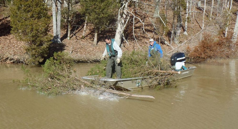
Using Christmas Trees for Habitat Restoration
Upcycling Christmas trees helps to restore fish habitat, restore sand dunes, and supports native marsh grass growth.