
ArcGIS tutorial

Change Detection Using Kernel Density Analysis in ArcGIS Pro
This GIS tutorial provides step-by-step instructions for how to use two point datasets to detect changes in ArcGIS Pro using kernel density.
GIS Tutorials
Online GIS tutorials from Geography Realm for mapping and data analysis.
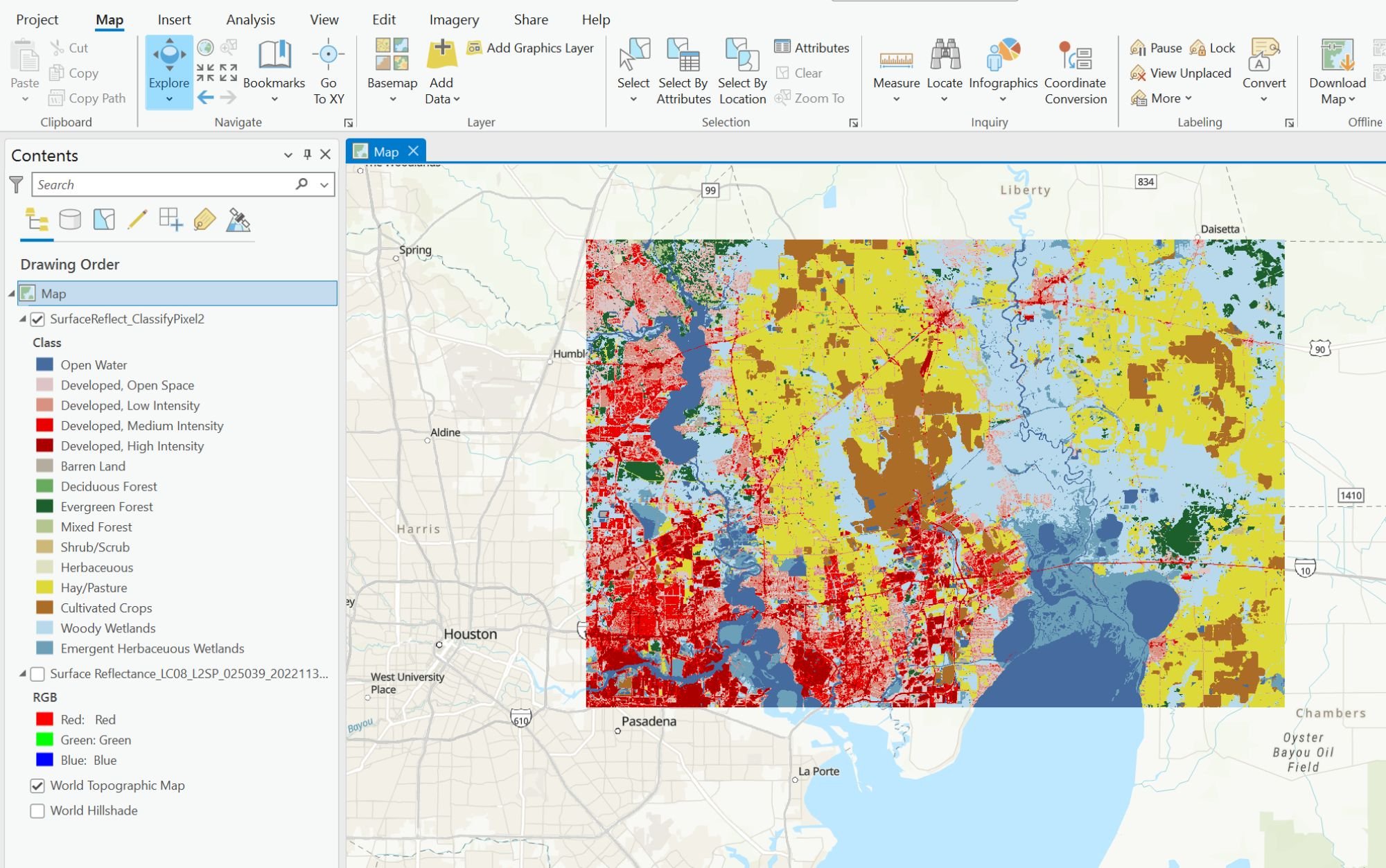
Using Deep Learning to Map Land Cover in ArcGIS Pro
This GIS tutorial provides step-by-step instructions on how to use deep learning models and Landsat 8 satellite imagery in ArcGIS to classify land cover.
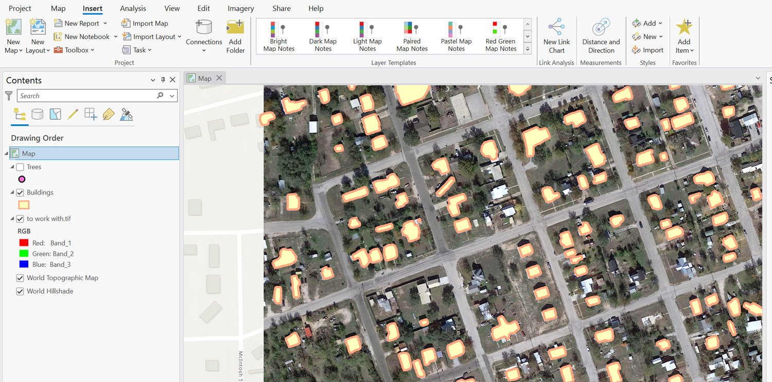
Extracting Building Footprints and Trees from Imagery Using ArcGIS Pro
This tutorial teaches you how to extract trees and building footprints from satellite imagery using ArcGIS Pro.

Mapping Earthquakes with ArcGIS Pro
This step-by-step tutorial shows you how to use USGS data and ArcGIS Pro to map earthquakes and geological faults.

Mapping Buildings in 2.5D Using ArcGIS Pro
Learn how to find and use building footprint data from OpenStreetMap to create a 2.5D map in ArcGIS Pro.
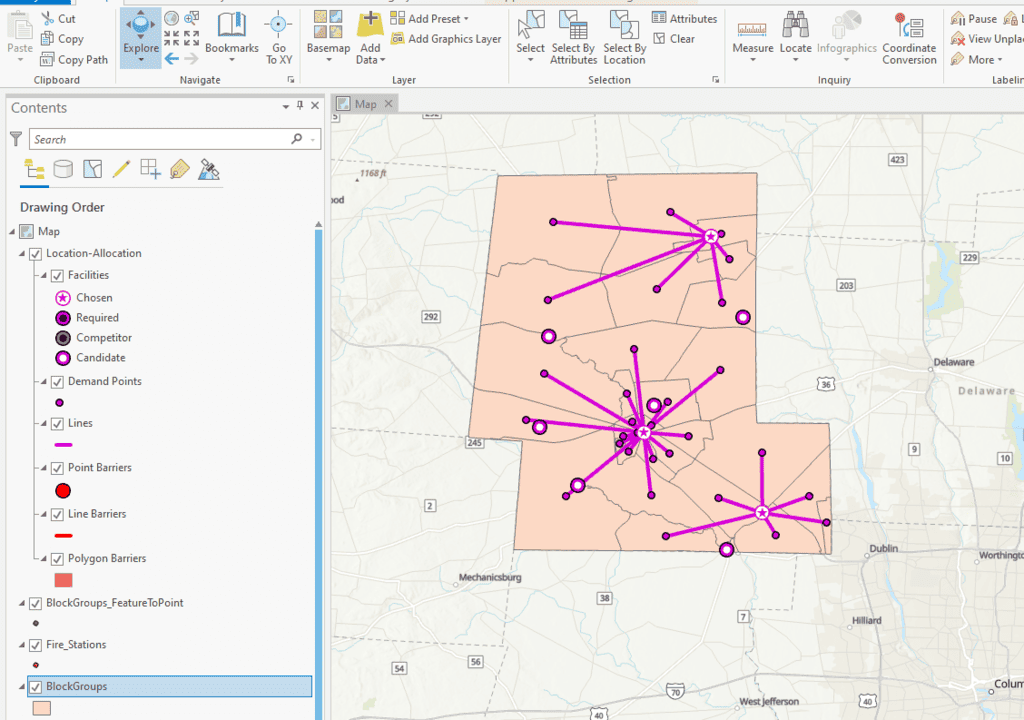
How to Perform Location Allocation Analysis in ArcGIS Pro
This ArcGIS Pro tutorial uses hospital and fire station GIS data to analyze services areas and location allocation.
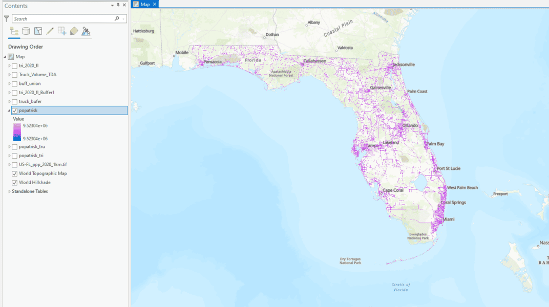
How to Use ArcGIS Pro to Determine the Population Impacted by Air Pollution
Learn to estimate air pollution's impact on people with geospatial methods using ArcGIS Pro and data from Toxic Release Inventory, Worldpop, and ArcGIS Hub.
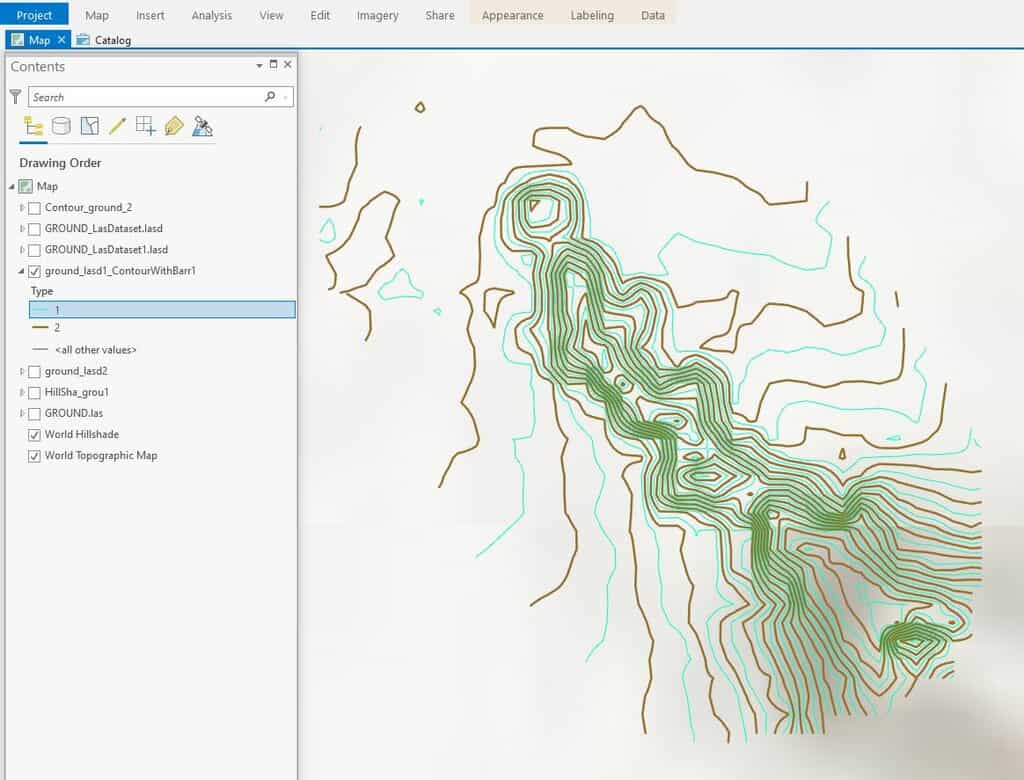
How To Create Contours in ArcGIS Pro from LIDAR Data
This ArcGIS Pro tutorial shows how to add LIDAR data from the National Map to ArcGIS Pro and create topography contours.
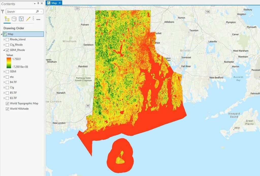
How to use ArcGIS Pro and Landsat 8 Imagery to Calculate Chlorophyll Index and Global Environmental Monitoring Index
Learn to create a chlorophyll index using Landsat 8 imagery in ArcGIS Pro with this step-by-step GIS tutorial.

How to Use ArcGIS Pro for Supervised Classification
This ArcGIS Pro tutorial provides a step-by-step guide for performing supervised classification on Landsat 8 imagery using remote sensing and GIS techniques.

How to Use ArcGIS Pro for Fire Risk Mapping
Tutorial showing how to map fire risk for a region with slope, elevation, aspect, and land use data in ArcGIS Pro.
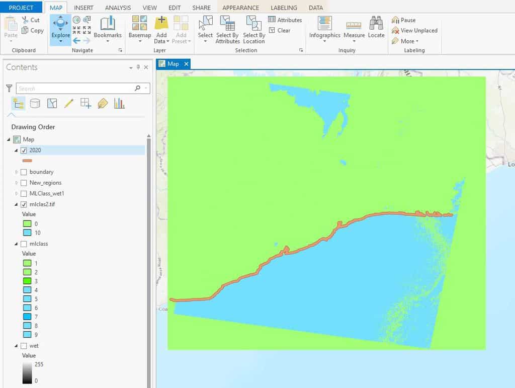
How to Use ArcGIS Pro for Automatic Shoreline Delineation from Landsat Imagery
Learn how to extract shorelines in ArcGIS Pro using the Tasseled Cap and NDVI indices with the Landsat toolkit for automatic shoreline delineation.
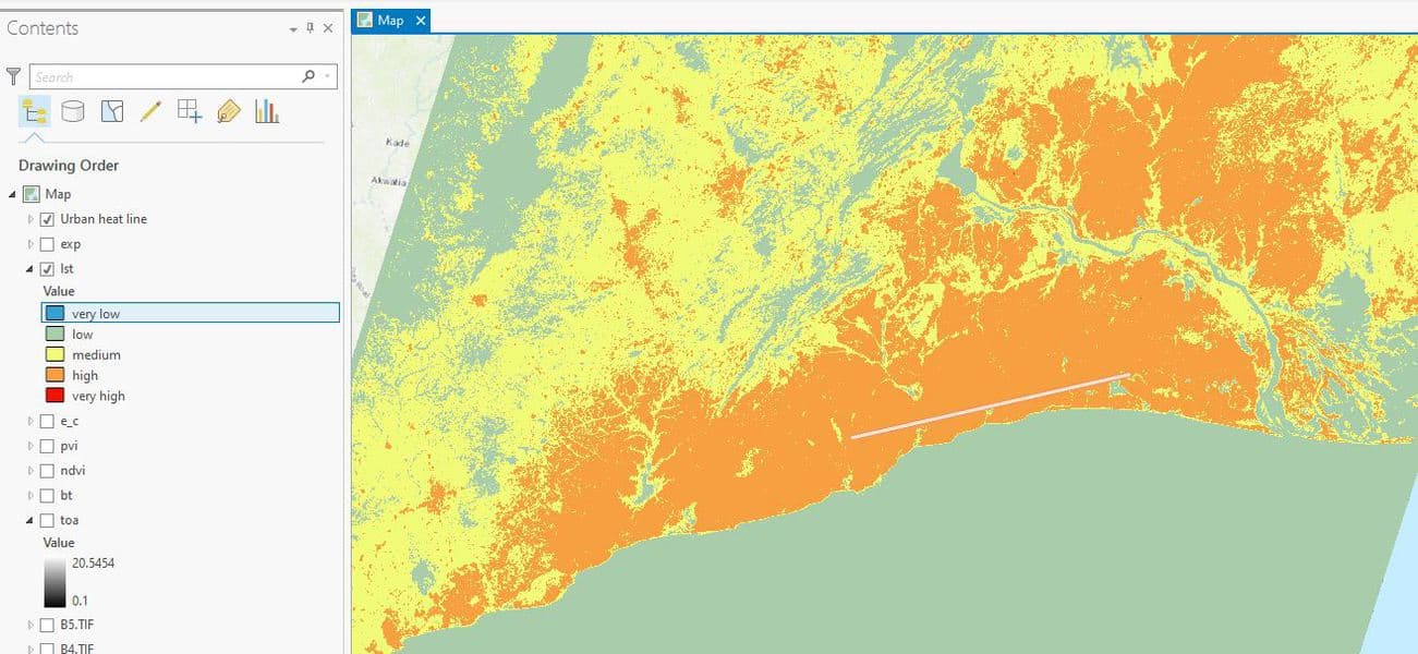
How to Use ArcGIS Pro to Map Urban Heat Islands
This ArcGIS Pro tutorial demonstrates how to assess urban heat in a region.
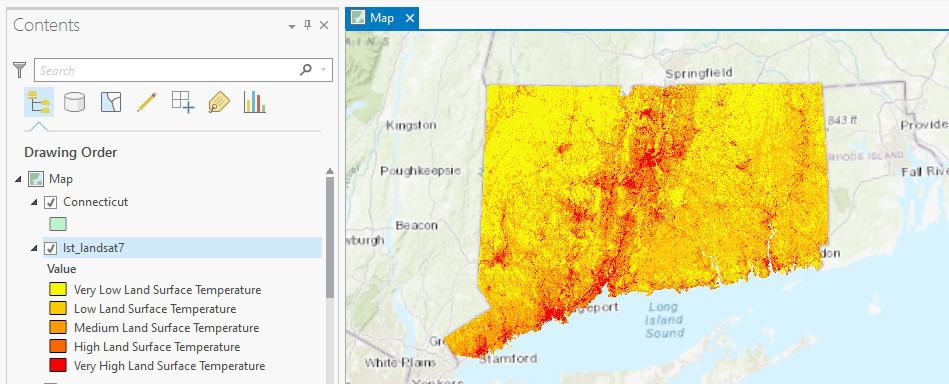
How to Use ArcGIS Pro to Calculate Land Surface Temperature (LST) from Landsat Imagery
This ArcGIS Pro tutorial utilizes spatial data science and remote sensing techniques to calculate land surface temperatures using Landsat imagery.

How to Use ArcGIS Pro to Assess Landslide Susceptibility
This tutorial explains how landslide susceptibility can be assessed using ArcGIS Pro.

Building a Model with ArcGIS ModelBuilder Saves Time
Emmanuel Jolaiya shows users how to use ArcGIS ModelBuilder to develop a model for for analyzing and manipulating GIS Data.

Automatic Raster Reclassification with ArcMap Model Builder Based on Raster Statistics
Alexandros Voukenas writes about the problem of automatic raster reclassification based on its statistics, using ArcMap’s Model Builder with this step-by-step guide with relevant screenshots and explanations

These Two ArcGIS Books are Free from Esri
Esri offers two free ArcGIS books: '10 Big Ideas about Applying The Science of Where' & 'Instructional Guide for The ArcGIS Imagery Book'.
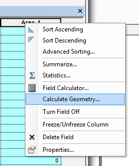
Calculating Polygon Area in ArcMap
Here are the steps for calculating the area of a polygon using ArcGIS.
How to Convert a KML File into an ArcGIS Compatible Format
This quick tutorial shows you how to convert a KML file so you can add it to ArcGIS.
Digitizing Using ArcGIS
This tutorial reviews basic digitizing using the editor toolbar in ArcGIS desktop.
Clip Analysis using ArcGIS Desktop
The video tutorial below demonstrates how to use clip analysis using ArcGIS 9.2.