
Articles

Review | The Best American Travel Writing 2019
The 'Best American Travel Writing 2019' features pieces on either dangerous places or the pursuit of the exotic as well-informed as they are well-written.

Community Involvement in OpenStreetMap
While we often assume that the OpenStreetMap (OSM) community is primarily made up of individuals, large corporations are increasingly active in the development of OSM.

Artist Creates Tapestry of the World
An artist from Portugal named Vanessa Barragão has created a unique map tapestry of the world inspired by nature.

World Bank and Geospatial Data
The World Bank in August 2018 launched the Integrated Geospatial Information Framework, which is seen as a way for GIS data to be provided for governments, NGOs, and companies to make more informed decisions that not only benefit their economies but also enable sustainable development.
How Scientists Used Satellite Imagery to Find an Untouched Mountain Rainforest
Dr. Julian Bayliss, a Welsh researcher, used Google Earth satellite images to pinpoint a small rainforest at the summit of Mount Lico.

The Largest Seaweed Bloom Ever Took Place In 2018
In 2018, a 20 million ton Sargassum seaweed bloom formed an 8,850-kilometer belt stretching from the West African coast to the Gulf of Mexico.

In The Last Three Years Antarctica Lost Ice the Size of Greenland
A recent report published by the Proceedings of the National Academy of Sciences analyzed satellite data that showed Antarctica’s rapid sea ice decline.
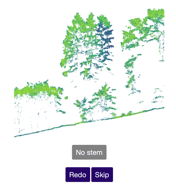
Help Identify Tree Stems from Drone Data
The Tree Mapping project uses crowd sourcing to accurate identify tree stems from laser scanning point cloud data acquired via UAV.
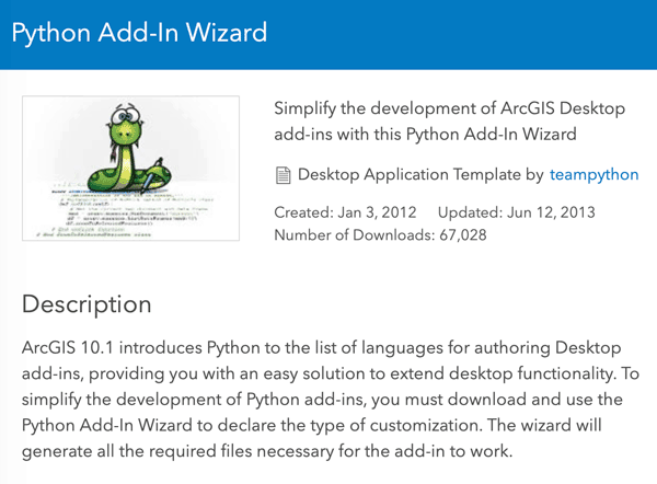
Customize ArcMap with Python Add-Ins
Daniel Fourquet walks users through the process of using Python to create Add-Ins for ArcMap.

Satellite Imagery Shows How Much of South Dakota’s Flooded Fields Were Unable to be Farmed
In August of 2019, the U.S. Department of Agriculture reported that South Dakota had 3.9 million “prevented planting” acres.
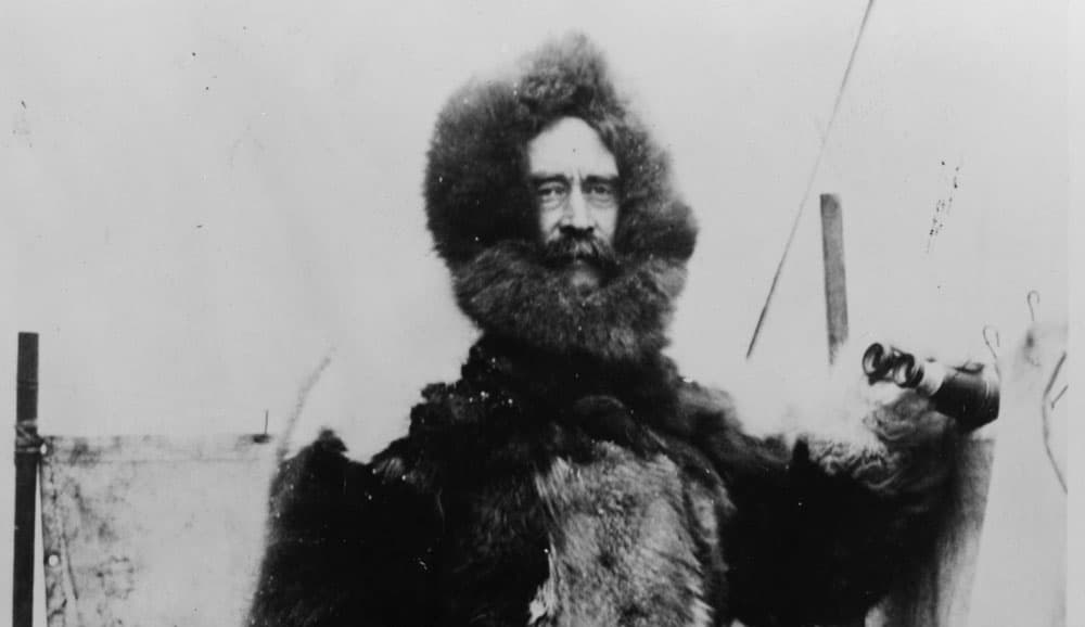
Review | Peary’s Arctic Quest
Peary’s Arctic Quest: Untold Stories from Robert E. Peary’s North Pole Expeditions is both a rigorous scholarly work and a popular exposition of Robert Peary’s Arctic achievements and his legacy.

Studies Show Acid Rain May Make Trees Thirstier
The Forest Service created an artificial environment in a forest in West Virginia to study how acid rain could influence processes in that forest.

Himalayan Glacier Melt Mapped By Analyzing Old Spy Photographs
Declassified Cold War-era spy satellite photographs have shown how much the melting of hundreds of Himalayan glaciers has accelerated in recent decades.

How Advances in Computer Mapping Shaped the Early Days of GIS
Greg Bunce, from the State of Utah’s Automated Geographic Reference Center, presents a walk through the history of mapping and geospatial advances that led to the early days of GIS.
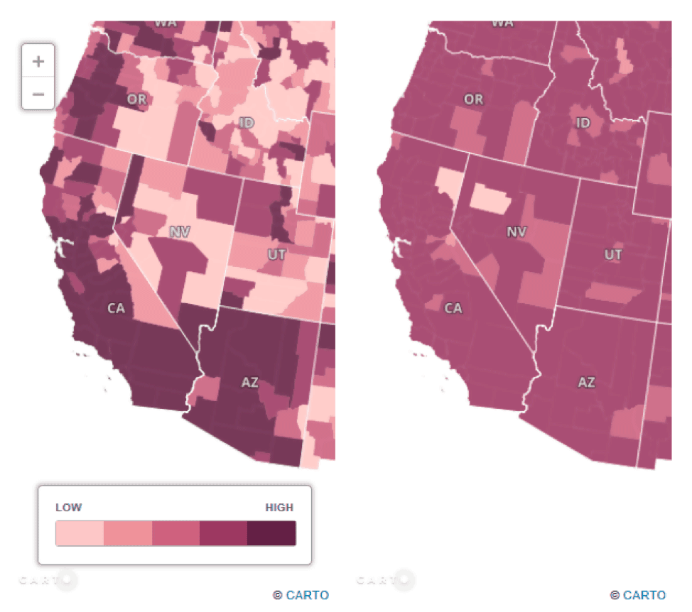
Thematic Mapping With CARTO
CARTO, which is an open-source software built on PostGIS and PostgreSQL, is an online mapping platform which allows end-users to produce a variety of Web GIS end products, including thematic maps.

Finding Pleasant Routes Using GIS
GIS is being to used to plan pedestrian routes not based on the fastest way but centered on finding the quietest, shadiest, or most pleasant paths.

Africa’s First Vertical Urban Forest
Vertical forests are buildings that integrate natural resources like trees, shrubs, and food-producing plants into spaces that can also be used as housing or offices.

Indonesia Will be Moving Its Capital
Driven by congestion and the gradual sinking of Jakarta, Indonesia announced that it will be moving its capital to a location on the island of Borneo.

How to Calculate the Boundaries of an UTM Zone
A UTM coordinate system's eastern and western borders can be easily determined.

Using Geospatial Analysis to Map the Optimal Places for Tropical Rainforest Restoration
Using peer-reviewed GIS datasets and remote sensing data, 88% of the needed restoration effort could focus on just six countries that are likely to help restore tropical rainforest growth.

New Study Maps Out the Global Pattern of Soil-based Carbon Storage
Researchers from the Crowther Lab recently published a study in Science which reviewed existing research on soil communities and how climate change will accelerate the loss of carbon stored in the world's soil.

Caltrans Plans to Build the World’s Largest Wildlife Crossing in California
With a proposed design spanning 200 feet (61 meters) across the 101 freeway, Caltrans in Southern California is moving along with plans to build the world's largest wildlife crossing and the first of its kind near a major city.

Review | On the Plain of Snakes: A Mexican Journey
In On the Plain of Snakes: A Mexican Journey, Theroux is determined to experience the real Mexico, as a traveler, not a tourist.


What the Rise of Small Satellites Means for Geospatial Data
Small scale satellites are changing how we can acquire our data as geospatial analysts.

Geography Facts About the Amazon River
The Amazon River is one of the world's longest and largest rivers. Here are some interesting geographical facts about the Amazon River.