
Articles

Aralkum Desert: The World’s Newest Desert
Replacing the shrinking areas of the Aral Sea, the Aralkum Desert is located in Uzbekistan and Kazakhstan, making it the world's youngest desert.

Verifying Ancient Roman History with GIS
Tom Whitley, an Assistant Professor of Archaeology at the University of Western Australia (UWA), used GIS to test population estimates and patterns of migration and war to see how the historical aspects known about the Gallic Wars measures up to geophysical evidence.

Remotely Tracking Growth of the Sugarcane Industry in São Paulo, Brazil
The use of remote sensing technologies to track the development of the sugarcane industry is a topic of much attention

The Intersection of Health Sciences and Geography
Geography can often play a very large role in the health concerns of certain populations.

Crowdshipping: the Newest Development in Mobile GPS
Crowdshipping is the delivery of goods based on the selection of a courier closest to the delivery route. The service ...

Meet a Geographer: Kristina Jacob
Kristina Jacob, a GIS professional, shares her thought about what drew her to both geography and photography.

Unique Features of the Australasian Geographic Zone
Australasia is a unique geographical and ecological zone compromised of Australia, New Zealand, New Guinea, and other small islands nearby.

Introduction to Climate Change
Changes that are normally brought about by climatic variations have caused major environmental concerns worldwide. These changes without doubt bring ...

National Climate Assessment Report Released
The National Climate Assessment, an important report on the impacts on climate change in the United States today and in ...

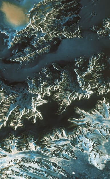
GIS Data of the World’s Glaciers
An international group of seventy scientists hailing from more than eighteen countries have created the first global datasets of the ...

Richat Structure: A Geologic Wonder
The Richat Structure, a geologic wonder viewable from space, is a striking circular feature found in the Sahara Desert in ...

When Streets Have No Trees
The presence of trees in cities yields multiple benefits.

Teaching Basic Map Skills To Young Children
These books and online resources help teach young children spatial skills and map making.

Five Fun Facts About International Borders
Learn about some of the most fascinating international borders in the world.

Tobler’s First Law of Geography
The first law of geography was developed by Waldo Tobler in 1970 and it makes the observation that 'everything is usually related to all else but those which are near to each other are more related when compared to those that are further away’.
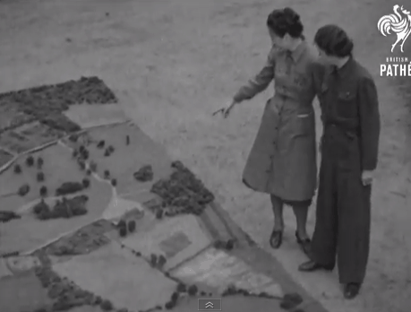
Sunday Maptinee: Map Films from British Pathé
British Pathé has released a trove of map and cartography related movies dating back to the 1930s.
How Deforestation Affects Physical Geography
Deforestation is a problem we are likely all familiar with, even in passing. We drive or walk by small or ...

How Rivers Change the Landscape
Rivers twist and turn, shaping the environment around them just as the physical geography of the surrounding landscape shapes them.

ASTER and the Spectral Recipe for Finding Gold
In the last section of this series, we took a look at both the ASTER sensor and the vast library of ...

NASA’s Global Precipitation Measurement
Water is essential for life on the Earth, and the supply of this precious liquid is constantly being recycled through ...

How to Share ArcMap (.mxd) Files
Learn how to set up your GIS data and symbol sets so that you can share ArcMap .mxd files with others.

Overview of Public Health and GIS
This article provides an overview of the use of GIS as in public health. It includes a short history of its development as a tool in the field, explains how GIS is used, different data sources and how the privacy of sensitive health information is maintained. Examples of current research using GIS within the public health field are also provided.
First Satellite Images from Sentinel-1A
Launched on April 3 and reaching operational altitude on April 11, the first images captured by the European Space Agency’s ...

Call for Translators: gvSIG
The developers of open source GIS software gvSIG have issued a call for translators. gvSIG is a freely downloadable GIS ...

Overview of Fuzzy Logic Site Selection in GIS
Site selection is a type of GIS analysis that is used to determine the best site for something and fuzzy logic is one site selection method. It assigns membership values to locations that range from 0 to 1 and is commonly used to find ideal habitat for plants and animals. This article examines fuzzy logic and explains how and when to use it.

Maps Show How Tech Bus Stops Are Affecting San Francisco Evictions
The Anti-Eviction Mapping Project has plotted out the incidences of “no-fault” evictions in San Francisco against shuttle stops for technical workers. Many ...