
Articles

Overview of Weighted Site Selection and Suitability Analysis
Site selection is a type of analysis used in GIS to determine the best place or site for something. Weighted site selection analysis is one type of site selection that allows users to rank raster cells and assign a relative importance value to each layer. This article examines weighted site selection by explaining how it works and when it should be used. It also provides an example of a weighted site selection project for reference.
GPS Experts Call for Safeguards After GLONASS Outage
The Russian GLONASS global satellite navigation system went down for 13 hours on April 2, but it’s not causing much ...
Overview of Least Cost Path Analysis
This article presents a summary of least cost path analysis, an important tool in GIS. Least cost path analysis is a distance analysis tool within GIS that uses the least cost path (the path between two locations that costs the least to those travelling along it) to determine the most cost-effective route between a source and destination. This article provides an overview of that topic as well as the requirements and steps for creating a least cost path analysis.

Volcanoes and Glaciers in Iceland
Iceland is a country of varied geography, topography, and landscape.

Overview of Flow Mapping
Flow maps are a type of map used in cartography to show the movement of objects between different areas on the Earth’s surface.

3D Mapping with Google Smartphones
Project Tango is an initiative from Google that could revolutionize how the world is mapped and navigated.

The ASTER Spectral Library – a True Monument of Remote Sensing Data
In the first part of this series, Cameron Windham from Apollo Mapping takes a look at the nuts and bolts of the widely-used ASTER Spectral Library.

GIS and Gaming
This article delves into the convergence of GIS and the video game industry, exploring their existing partnership and mutual benefits.
Join the Crowdsourced Effort to Search for the Missing Malaysian Airlines Flight
Malaysian Airlines flight 370 disappeared on Saturday, March 8, 2014. The flight left Kuala Lumpur in Malaysia on March 8 ...
Use of GIS in Agriculture
By using GIS to map current (and potential) farmland scientists and farmers can work together to create more effective and efficient farming techniques.

Imagery and Its Use in GIS
Most imagery for use in GIS projects consist of satellite images or aerial photographs but it can also include, thermal images, digital elevation models (DEMs), scanned maps and land classification maps. This article examines imagery and how to effectively gather, store, process and interpret it for a variety of different GIS projects.
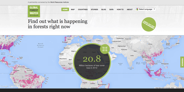
Global Forest Watch: A Real-Time Mapping Project
Data from Global Forest Watch, an online forest monitoring and alert system is now available via an online mapping platform. Users of this data portal can add maps, datasets, and applications to their forest projects and better analyze indicators of forest change.

Aquatic Dead Zones
Aquatic dead zones are bodies of water where the oxygen conditions are so low that marine life is unable to be supported.

Changing Geography of the Dead Sea
We’ve all seen the pictures- tourists floating in a picturesque lake surrounded by a mountainous desert environment, calmly reading flipping ...

Cartographic Anomalies: How Map Projections Have Shaped Our Perceptions of the World
Elizabeth Borneman explores how cartography and cartographic projections help and hinder our perception of the world.

The Rainforest Magician – Optical Illusions and the Spectra of the Canopy
The findings of a recent paper published in Nature found a sun-sensor geometry arrangement was the cause for historically high readings of green-ness in the rainforest canopy.

Danie Krige and Kriging
This article provides a biography of a Danie Krige, and presents a short overview of geostatistics and kriging.
“Interoperability” for the Surveying Profession
Gavin Schrock, PLS, the editor of Professional Surveyor Magazine, writes about the surveying field changing in the face of the ...

What is is the Difference Between Web GIS and Internet GIS?
Majid Hojaty, a MSc student of GIS and Remote Sensing with Tehran University, Iran, discusses the differences between web GIS and Internet GIS.
Why Leaders Should Learn Geography
Anne-Laure Fréant talks about the importance of geographic knowledge in today's society.

GPS Pet Trackers
The three most popular pet tracking GPS systems are reviewed in this article: the PetTronix RoamEO, Garmin GTU 10, and Tagg Pet Tracker.

Maps as People: Anthropomorphic Maps
Cartographers have been creatively crafting heads and bodies out of mountain ranges, coastlines, and other physical features. These anthropomorphic maps were intended mostly as propaganda pieces to show off the might of one country or stereotype foreign lands.

Underwater Global Warming
Scientists are using satellites and remote sensing to better understand changes in sea-surface temperatures.

Satellites Show the Thinning of Alaskan Ice
In general, climate change is a term that refers to the significant transformations in global weather patterns over an extended ...
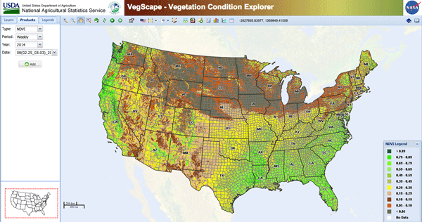
Satellite Imagery Maps Out How Bad the California Drought Really is in 2014
California has been suffering from historical drought conditions. Almost all of California is experiencing drought conditions. Many parts of California ...

The Usability of a Web Mapping Application with a Million Rows of Data
Manuel Timita write about Illustreets, a web mapping application built with Open Source software, open data, and emerging GIS technologies (i.e. CartoDB).