
Mark Altaweel

Detecting Spatial Patterns in Drug Abuse With GIS
Drug abuse has been shown to have clear spatial patterns that GIS has helped to demonstrate.
GIS and Topic Modeling
Topic modeling is a thriving field in humanities and social sciences, with GIS being use to identify trends in social media.

Geography and Segregation
Socio-economic classes, ethnic groups, and race are some of the main factors that affect the geography of segregated populations.
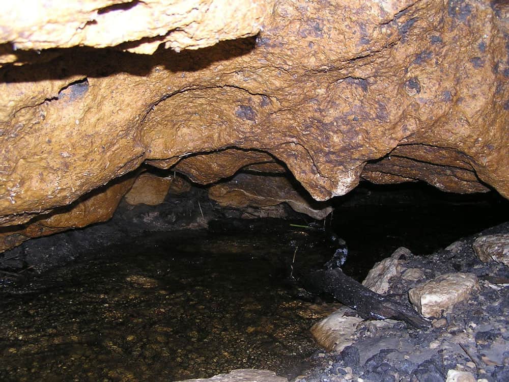
GIS and Karstic Cave Monitoring
GIS and remote sensing have been used to predict likely regions where caves can be found.

Monitoring Livestock Using GIS
GIS and other geospatial technologies are being used to monitor livestock, understand the role that cattle play in climate change, and estimate biofuel.
Sports Geography
Sports, by nature, have location and spatial phenomena that are terrestrial, there are human-environment relationships, and regions have variations with how given sports are played.

Navigation, GIS, and Voice Command
Progress has been made on developing GIS and GPS technology capable of interpreting natural language and voice commands.

Geography and Family Structure
Factors of geography, economics, and social trends have contributed to diverse ranges of household formation.
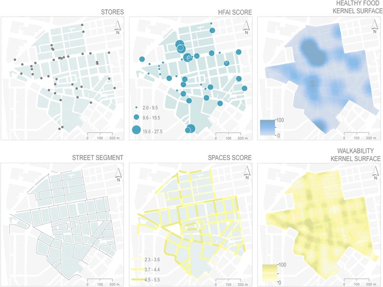
GIS and Obesity
GIS has been used to measure the built environment and its relationship to obesity.

GIS and the Geography of Religion
GIS has become an important historical and contemporary analytical tool used to explain past and current social trends shaping and being shaped by religions.
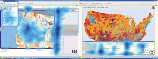
Analyzing Eye Movement For Better Map Design
With new and growing areas where eye monitoring and GIS can be utilized together, big data techniques will be a leading way in which visual and analytical understanding of spatial cognition will be understood in coming years.
Geography of Science
Despite the role of the Internet in allowing greater global connectivity, local geography still plays a dominant role in shaping science.

Geography and the Law
Law geographers have advanced the understanding that law also requires knowledge of geographic and other factors that may intersect in how law is developed and applied.

The Need For Ethics in GIS
The consideration of a code of ethics in GIS has mostly been overlooked as a critical component in geospatial education and certification.
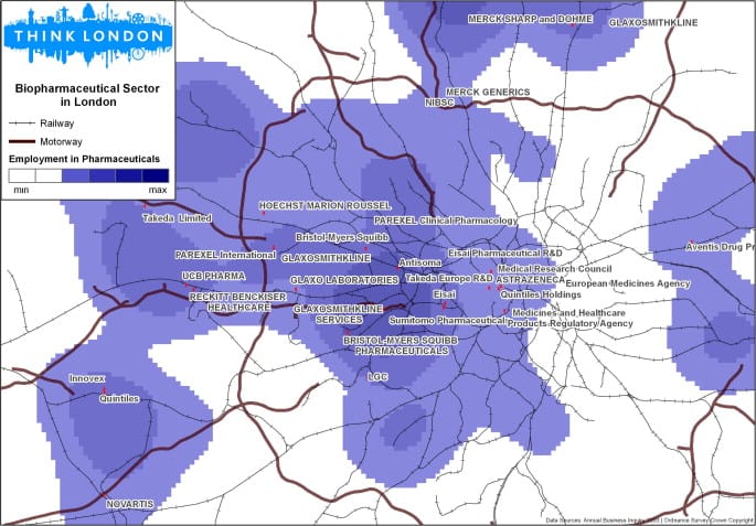
GIS and Entrepreneurs
GIS aids in investment decision-making by unveiling spatial patterns key to entrepreneurial success like labor concentration, knowledge, and opportunities.

How GIS Can Help With Football Game Analysis
Football, or Soccer, is a spatial strategy game involving tactical player movements, which can be analyzed effectively using Geographic Information Systems (GIS).
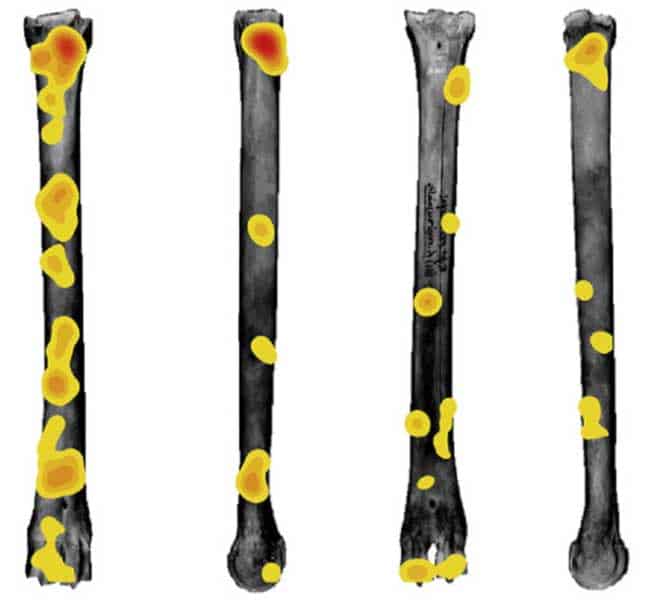
How GIS Helps with Researching Human Evolution
GIS has now provided new avenues of research that has helped physical anthropologists better understand how different hominid species evolve to different environments.
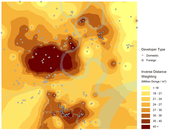
Utilizing GIS for Investment Opportunities
GIS-based spatial understanding can crucially inform where and how to invest in specific markets.

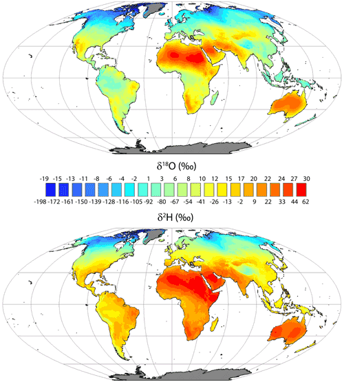
Geography and Paleoclimate
Paleoclimate has had a major effect in shaping not only physical geography but also biodiversity in different parts of the Earth.
Using GIS in the Insurance Industry
Location has a large impact for the insurance industry, as a variety of natural or even social risks, such as crime, could affect insurance rates for life and property.
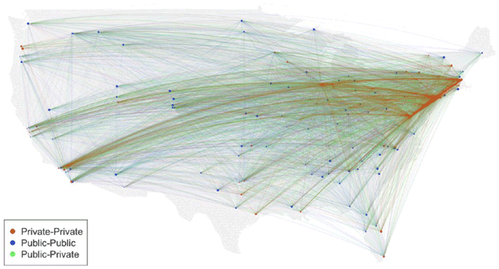
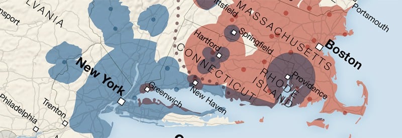
Using GIS to Analyze the Death of Distance Hypothesis
Recent studies using GIS show that geographic factors continue to play a strong role in regulating social, economic, and general Internet use despite technologies that was purported to mitigate the effect of distance.

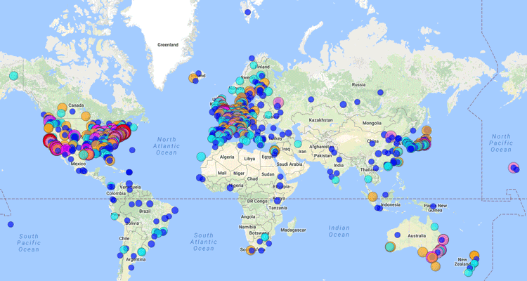
Finding Love Using GIS
The omnipresence of location, GIS functionality in mapping, and measuring potential dates near you, has had a substantial social change in the dating world.
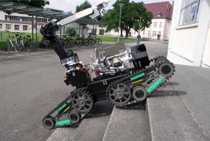
How Robots Can Help Improve GIS Data
Robotic platforms are actively used to collect spatial data, including GPS data, to help map floor plans and wider areas.

The Importance of Geomorphology for Physical Geographers
Geomorphology is the study of Earth’s landforms created by mostly physical processes.
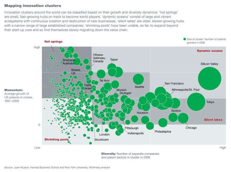
Geography of Innovation
By merging innovation theory with geography, researchers can explain why areas like Silicon Valley consistently lead in innovation.
Using GIS to Study Plant Behavior
The application of plant biology with GIS has potentially important implications for the study of plant behavior affecting important factors such as the Earth’s climate and agricultural supplies.