
Mark Altaweel

Using Drones and Remote Sensing for Mapping and Counting Animals
Remote sensing data from satellite and UAV imagery has been used by researchers in the mapping and observation of wildlife, in particular counting the number of animals in remote locations.

Black Marble: Nighttime Lights Data from NASA
NASA's Black Marble provides a suite of nighttime geospatial data acquired from Suomi satellite's Visible Infrared Imaging Radiometer Suite instrument.

Mapping Minerals with Satellite Imagery
Mapping minerals with remote sensing was one of the main motivating reasons for creating the earliest multispectral satellite systems.

Geography and Religion
Geographers study religions and their development based on the role that geography intersects with other important social components within a human geographic approach.

Detecting Flooded Roads From Satellite Imagery
Mapping flood damage by manually examine imagery is a time-intensive and expensive process. New, automated methods using satellite data that compare pre and post-flood conditions are being developed.

Using GIS to Study Gentrification
Amid US gentrification trends, municipalities are increasingly using GIS to study its impacts.

The Use of Drones in Human and Physical Geography
With the widespread use of drones, methods are likely to be further refined to improve not only the use of UAVs in physical measurements in geography but even expanded to areas of the social sciences.

Can High Tech Analysis of the Vinland Map Finally Answer Questions About its Authenticity?
Yale University is using high tech imagery analysis such as reflectance transformation imaging (RTI) to determine the authenticity of the Vinland Map, a purported 15th-century world map that has long been widely believed to be a 20th century forgery.

Rapid Ocean Floor Mapping
Rapid ocean floor mapping is considered one of humanity’s grand challenges. To highlight this challenge, Xprise recently announced the finalists for its grand challenges competition to rapidly map the ocean floors.

Visualizing Temporal Data with GIS
While mapping spatiotemporal data has remained a challenge, increasingly we are seeing tools that are available on common open source platforms (e.g., R statistical package and QGIS) or commercial platforms such as ArcGIS.
Mapping How Birds Are Affected by Human Activity
GIS and spatial analysis have demonstrated the complexity of how anthropogenic disturbances could affect birds and bird habitats.

The Role of GIS in Predicting Road Conditions
Recent developments in GIS and analytical applications have demonstrated that predicting road conditions, and thus preventing traffic accidents and possibly even traffic in the first place, is possible.

High Altitude Pseudo-Satellites
High altitude pseudo-satellites (HAPS) are systems or platforms that usually float or operate for long periods, sometimes for months, at about 20 km above the Earth’s surface and can be potentially used to complement earth observation satellites.

Transforming Satellite Imagery Classification with Deep Learning
Deep learning has a potential to transform image classification and its use for the spatial sciences, including GIS.

Monitoring Algal Blooms with Remote Sensing
Given the importance of knowing how blooms affect aquatic life, remote sensing techniques using a variety of available imagery have been developed.
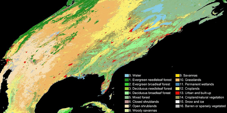
An Algorithm to More Accurately Classify Land Cover Using Landsat Imagery
Hankui Zhang, from South Dakota State University, has developed a new classification technique that combine satellite images from MODIS and Landsat.
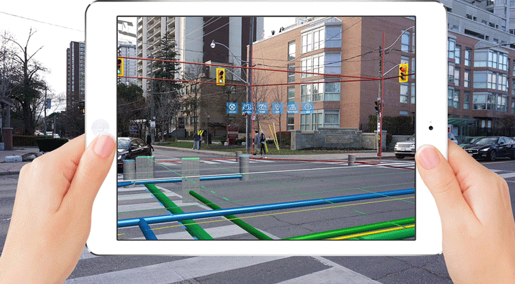
Holographic GIS
As mobile and handheld devices increasingly use virtual reality and augmented reality applications, GIS has been incorporated to deploy spatial databases that apply holographic capabilities.
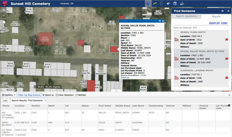
Using GIS to Analyze the Geography of Cemeteries
In addition to studying historic burial sites, GIS has also been shown to be effective in managing modern cemeteries, particularly as space becomes an increasing problem in densely populated regions.

Visualizing Climate Change With Maps
The choice of labeling and color can have a pronounced influence in shaping opinions when visualizing climate change on maps.
GIS and Gerrymandering
GIS can be used to detect and also assist in gerrymandering when developing new district maps.

GIS and Territorial Disputes
The use of GIS for mapping territorial disputes has played both a positive and negative role in resolving these disputes.

Seafloor Mapping Techniques
Today, seafloor mapping is essentially a form of remote sensing that uses similar concepts and applications to satellite-based systems, albeit adapted to the complex environment of the oceans.
The Rise of Femtosatellites
Femtosatellites, very small-scale satellites (weighing less than 100 grams / 0.22 lbs), have developed over the last fifteen years thanks to advances in nanotechnology.

Rapid Response Monitoring Tools
With rapid data access, new vehicles and tools that can go almost anywhere (e.g., such as unmanned aerial vehicles), and more efficient computing, we are witnessing an age of rapid response monitoring that addresses environmental and social problems as they develop.

UAVs, GIS, and Ecology
With the relatively cheap price and increasing effectiveness of unmanned aerial vehicles (UAVs), often called drones, we are seeing much more accurate estimates and understanding of ecological change.

Monitoring Air Pollution with Sentinel-5P
Sentinel-5p will be one of the first satellites that provides high resolution pollution monitoring and will provide a large data capture that enables daily and even hourly monitoring.