
Mark Altaweel

Using GIS in Golf Course Management
GIS has a growing role in golf from managing courses to facilitating the symbiotic relationship between golf courses and environmental protection.
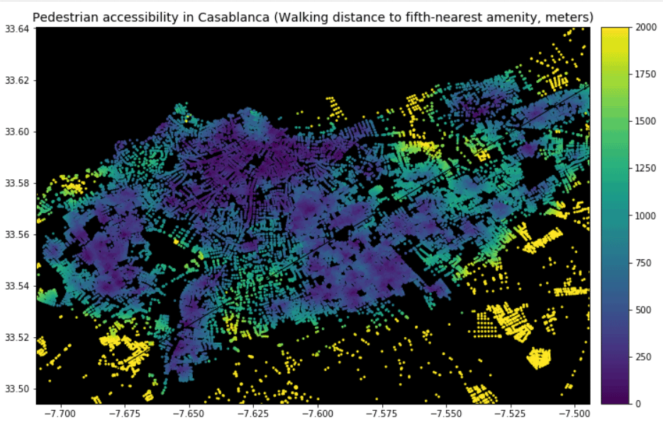
Using GIS to Analyze Pedestrian Accessibility
GIS tools to compute pedestrian accessibility are not just available to governments, academics, or companies, but are also free and open source.
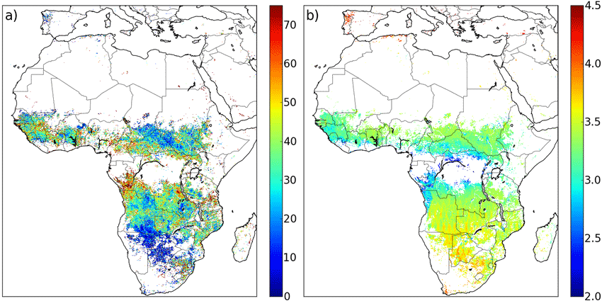
Geospatial Climate Models Show How Fire Seasons Are Changing
Changing technologies, including new satellite systems, and better climate and fire modeling, including the integration of these tools and data capture methods, will likely mean improved fire modeling in the future.

Tracking the Carbon Cycle in North America: 2018 Report
In November 2018, the United States Carbon Cycle Science Program released a report, entitled Second State of the Carbon Cycle Report (SOCCR-2), about the nature of the carbon cycle in North America, covering Canada, the United States, and Mexico.
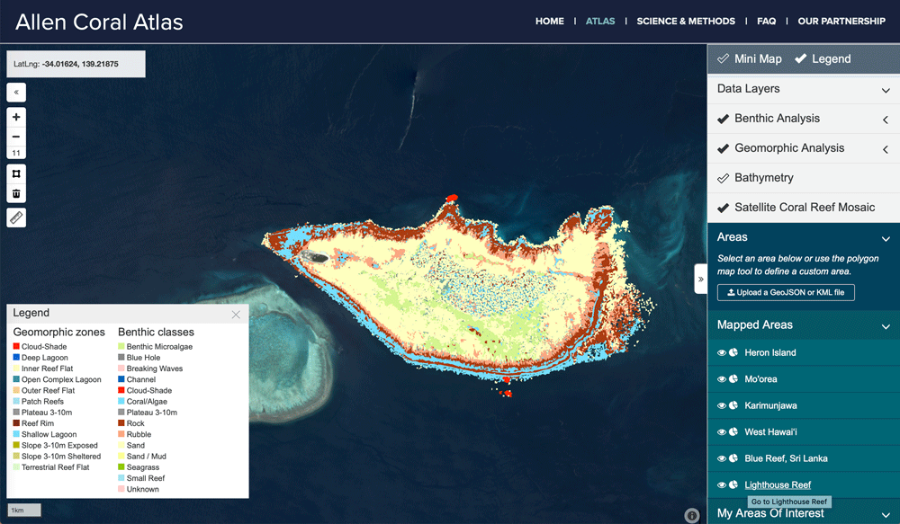
Mapping Coral Reefs
Scientists have been developing better ways to fuse data from different satellite systems and data capture, while also developing classification algorithms to better map coral reefs.
The End of the Rainbow: Picking Color Schemes in GIS
The color symbology in displaying a GIS data on a map is an important decision to make in communicating geographic data.

Optimizing Traffic with Autonomous Vehicles and Machine Learning
Improving traffic can be achieved by incorporating geospatial technology in autonomous cars, such as sensors and external information.

When AI Goes Wrong in Spatial Reasoning
Machines can learn ‘wrong’ or biased information, creating large problems and poor conclusions when it comes to spatial data.
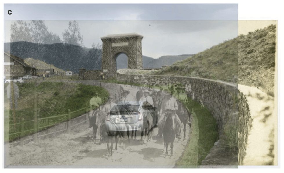
Using Ground-level Imagery to Map Landscape Change
Ground-level photographs have great value to demonstrate landscape change from a human eye-level perspective.

How Does GPS Technology Affect Our Understanding of Place?
How is an over reliance on GPS technology affecting our understanding and experience of place?

Using Satellite Imagery to Map Obesity Rates
One study recently looked at about 150,000 high resolution satellite images of cities in the United States along with census data of these areas in order to understand obesity rates in the built environment.

Understanding Climate Change Through Historical Shipping Logs
Geographic information and weather data recorded by ship crews are a valuable source of historical information that could be utilized to understand how our climate has changed.

The Equal Earth Map Projection
Researchers recently announced the development of the Equal Earth map projection, which has quickly gained influence due to its ability in maintaining accurate area without distortion.

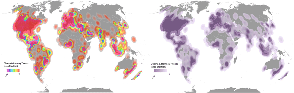
What Makes Maps Go Viral?
The study of viral geography could be a new, emerging field where researchers are now beginning to look at the elements that make a map viral.

Forecasting Cholera Using Remote Sensing
The NASA cholera forecasting tool effectively takes satellite observations on environmental conditions and combines the data with information on infrastructure and conditions in a country.

Startups and the Future of Spatial Analysis
A growing number of startups are developing new approaches to advanced spatial analysis for everyday solutions across many fields and industries.
GIS and Security Applications
The use of GIS in security software applications allows greater enhancements not just to monitoring but also planning and forecasting potential security threats, both from physical and cyber threats.

GIS and Cancer Screening
GIS can aid cancer screening, especially for cancers linked to environmental, socio-economic, and resource factors.

Accessing Real-time Satellite Imagery and Data
NASA's LANCE and EarthNow, a space imaging business, are paving the path to real-time and near real-time satellite data.

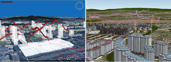
Creating Ground-level Views from Satellite Imagery
Recreating a ground-level image and perspective using satellite imagery has only recently been developed.

Geospatial Artificial Intelligence: Emerging Trends and Challenges
There are both challenges and opportunities that Artificial Intelligence (AI) has in applying geospatial and GIS knowledge that also addresses issues of time and spatial bias.

Future of Mobile Spatial Applications and Image Recognition
Image recognition software and algorithm development is likely to be increasingly applied with spatial applications.

Improving Geospatial Data Search
Open standards and protocols have facilitated data sharing and application for spatial information on the web such as using Web Map Service (WMS).
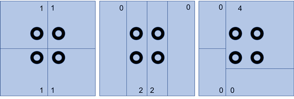
The Modifiable Areal Unit Problem and GIS
For most GIS practitioners, modifiable areal unit problem (MAUP) is something to be aware of when different analytical techniques are applied.
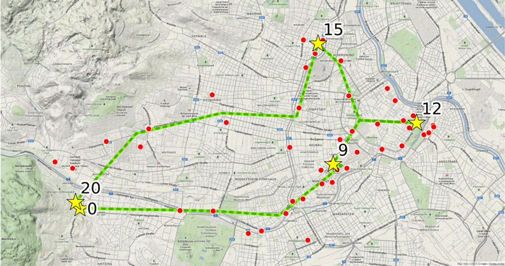
Using Cell Phone Data to Map Urban Activity Patterns
Mapping mobile cellular data has a major potential in allowing a better understanding of how we use urban spaces, including transport networks and access to events and venues.

Spatial Challenges of Navigating Rural Roads for Self-Driving Cars
Researchers from MIT are testing the use of GPS and LiDAR to enable autonomous navigation in rural areas lacking detailed 3D maps.