
Mark Altaweel

Von Thünen Model of Agricultural Land Use: An Overview
German geographer Johann Heinrich von Thünen created one of the first geographical models related to agricultural land use.

The Use of Gravimetry Satellites for Measuring Ice and Sea Level Change
Satellites now allow researchers to make more accurate mass measurements to large areas covered by ice and understand the effects of snow and ice melt on sea level change.

Machine Learning and Object Detection in Spatial Analysis
Picterra offers a relatively easy to use interface that allows users train AI on satellite and aerial imagery to detect features.

Why GRASS Delivers Powerful GIS Capabilities
A recent MapScaping podcast with Markus Neteler, chairman on the GRASS GIS Project Steering Committee, makes it is clear that GRASS will continue to be a powerful GIS open source effort for years to come.

Geospatial Technology and Challenges of Contemporary Agriculture
Farmers have greater access to geospatial tools that can help mitigate some agricultural challenges.

Mapping Sea-Level Rise with Sentinel-6
The recent launch of Sentinel-6 Michael Freilich/Jason CS is the latest mission that will collect high resolution sea level measurements.

Understanding Central Place Theory: Key Concepts in Urban Geography
In 1933, Walter Christaller introduced Central Place Theory (CPT) as a way to explain the location, number, and size of settlements.

Mapping Carbon Dioxide Emissions from Soil Respiration
Researchers recently developed a map of the global distribution of mean annual soil respiration (Rs) between 2000 and 2014.

Converting Historical Maps to Satellite-Like Imagery
Old maps and images can now be converted to make them similar to our modern satellite-base views, giving stylized views a more realistic appearance.

The Potential Role of GIS in COVID-19 Vaccine Distribution
GIS can play a role in developing protocols for the distribution of COVID-19 vaccines.
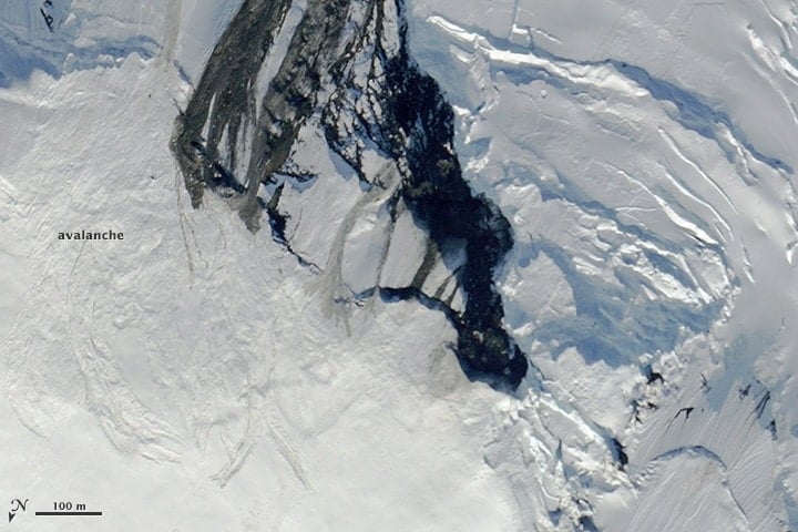
Forecasting and Mitigating Avalanches Using GIS
GIS and computational specialists have been developing models and methods to better forecast the likelihood of avalanches.

How to Communicate with Maps
Making maps requires a careful balance between science, art, and knowledge of your target audience. Features a MapScaping podcast with Esri's John Nelson.
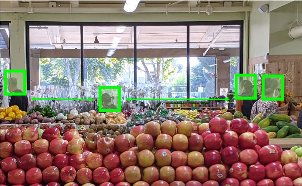
Recent Developments in Spatial Analysis and Computer Vision
Computer vision offers spatial analysts the possibility to conduct a variety of analyses without using traditional spatial tools.

GIS and SQL
One way to leverage the power of GIS as a data service and analytical tool is to better integrate relational database capabilities.

Using Spatial Methods to Combat Gerrymandering After the 2020 US Census
The challenge for GIS is to create methods that can better determine what less biased district maps look like that are acceptable to the judiciary.

The Important of Mapping Trees for Wildfire Management
The California Forest Observatory, created by Salo Sciences, has applied a new artificial intelligence tool that maps every tree in California.

Self-employment in GIS
Self-employment in the GIS industry may seem daunting, but a recent MapScaping podcast with Kurt Menke, founder of Birds Eye View GIS, discusses how to build your own business.

Using GIS to Improve Hurricane Evacuation and Preparedness
As hurricane season gets underway in the Atlantic, GIS is being use to better prepare communities and property from the devastating effects of storms.

Using GIS to Monitor the West Coast Wildfires
With fires raging in California, Oregon, and Washington, scientists, activists, geospatial companies, and others are using GIS and spatial data to better inform and protect communities.

Earthquake Detection Using Smartphones
Using aggregated accelerometer data across many smartphones, many of us can now better access a large-scale earthquake warning system.
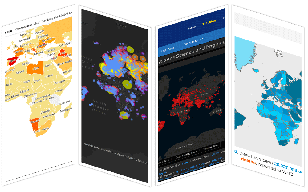
Online COVID-19 Maps and the ‘Infodemic’
Researchers have been evaluating the effectiveness and accuracy of online CoVID-19 maps.

Mapping Climate Refuges
Climate refugia are places which can withstand climate change better than other regions and buffer the impacts of climate change.

The Spatial Internet of Things
The development of small sensors is providing a variety of real-time geospatial data.

The Geography of Music
Music has a number of important geographical links that affect the economic, politics, and tastes of music.

H3: Open Source Geospatial Indexing System
H3, developed by Uber, divides the Earth into hexagons.

Spatial Relationships Between Public Transport and Ride-Hailing
Researchers have studied the effects of ride sharing on public transportation.