
GIS and Geospatial Technologies
Articles focusing on the application of geographic information systems (GIS), geospatial technologies, remote sensing, LiDAR, and Global Positioning System (GPS). These technologies serve as critical tools for understanding and interacting with our physical environment. GIS allows for the mapping and analysis of spatial data Geospatial technologies refer to the various tools used to measure and analyze Earth’s lands and resources. Remote sensing provides a way to collect data from a distance, often via satellites or high-flying aircraft, and is commonly used for environmental monitoring and military applications.
GIS subcategories :
GIS Career | GIS Data | GIS Industry | GIS Learning | GIS Software | GPS | Remote Sensing | Spatial Analysis

Personalized GIS
In personalized GIS, software is being developed to anticipate our needs and provide recommendations based on our behavior, past preferences, and the preferences of others.

UCLA Researchers are Using Geospatial Technologies to Identify Potential Ancient Buddhist Sites
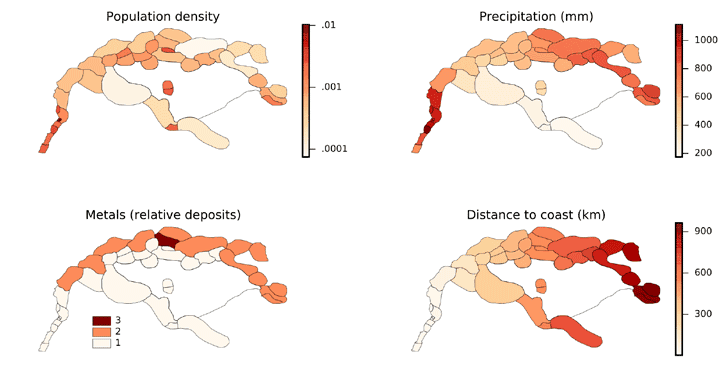
Archaeologist Monica Smith and geographer Thomas Gillespie identified 121 locations that they hope will reveal some of Ashoka’s edicts using GIS analys

New Project Maps the Loss of Natural Spaces in American West
At DisappearingWest.org, you can actively monitor the loss of natural land as the American West continues to be developed with maps, statistics, and explanations for this trend.

GIS and Human Anatomy
Mapping and monitoring the human body in real time using GIS is one area of great opportunity for medical and healthcare professionals.

Terrapattern: Search Engine for Satellite Imagery
Terrapattern lets users perform "similar-image" searches in unlabeled satellite imagery using deep learning machine vision techniques.

Multi-view GIS
Multi-view GIS provides different perspectives of space and time for a given geographic area.

Real-time Collaborative GIS
Real-time collaborative GIS (RCGIS) enables users, from domain experts to common citizens, to collaborate on given issues and share data easily through a distributed framework.

Why the Canadian Arctic Needs to be Mapped
The Canadian Hydrographic Service is in charge of mapping the Canadian Arctic, but they’ve only gotten about 10% of the way through Canada’s Arctic holdings.

4D GIS and Prediction
For the last two decades, GIS technologies have increasingly been used to incorporate not only spatial relationships but also analyzing and visualizing space across time. Spatial-temporal GIS, or 4D GIS, has, in particular, become essential in areas where GIS is needed for predicting dimensions across time.

Using an Interactive Web and Desktop Based Spatial Technology to Monitor Performance of Public Health Outcome in Developing Countries
FGIS (FHI Geographical Information System) is browser-based interactive data visualization and mapping application that runs on the FHI360 Nigeria intranet, an online resource that serves as a common framework for sharing geographic resources about FHI360 programs in Nigeria.

GIS and NoSQL Databases
Relational databases present some limitations to scaling, preventing or limiting the applicability of big data and real-time data problems utilized within GIS. More and more GIS software companies and developers are adopting NoSQL formats where data retrieval is generally faster and easier to structure. NoSQL also facilitates analysis and integration within a variety of tools, which is why open source GIS has proven to be the most useful arena for NoSQL databases.

GIS and Natural Language Processing
Within GIS, natural language processing can be utilized for spatial understanding of where events, places, or people may relate to a given phenomenon.
Proportional Hazard Modeling and GIS
By integrating GIS with proportional hazard modeling, we are now beginning to see GIS increasing its analytical modeling repertoire for the sciences that leverage factors of spatial and time to better understand how emergence and evolution of given processes develops, even when uncertainty is persistent for areas of research.

Mapping Soil Moisture in Ethiopia Using Remote Sensing Techniques
Remote sensing can be used to assess soil moisture across a region. Learn more about two methods NASA has used to map out soil moisture in Ethiopia.

Agent-Based Modeling and GIS
The need to understand emergent phenomenon in a variety of fields has led to not only greater use of agent-based models (ABMs), but we are increasingly seeing tools that integrate GIS with ABMs.

Making Nottingham City Council’s Open Data Available
David A. Eagle, Managing Consultant takes a look at how 1Spatial helped Nottingham City Council harness FME in to streamline the availability of open data to the public, reducing its need to spend staff hours on Freedom of Information Act requests.

Using Remote Sensing to Map Rice Paddy Drop in the Mekong Delta
Satellites including Europe’s Sentinel-1A can now track the rise and fall of different agricultural products around the world. The satellite’s imagery showed that rice production in the Mekong Delta has decreased in the past year.

Making a Career in Geointelligence
Sangeeta Deogawanka talks about building a career in Geointelligence, covering areas like security, intelligence, policy analysis, and first response.

Isodistance and Isochrone Maps
Isodistance measures routes of equal time and isochrone measures routes of equal travel times although both are typically represented as bands of polygons.

Mapping of Apparent Fish Available Zones in Indian Reservoirs
This study by Thankam Theresa Paul, Sandhya KM, Manoharan SM and Usha U takes a look at the spatial relationship between physico-chemical variables and fish production using inverse distance weighting.

New Earthquake Maps from the USGS Also Factor Human Activity Induced Causes
The United States Geological Survey has created a new map that highlights where natural and man-made earthquakes could cause damage around the country.

Thematic Mapping with MapInfo and Excel
This tutorial by Nick Williams, a MapInfo trainer at Acuity Training, aims to provide an example of how data analysis and cleansing using Excel can be combined with presentation and mapping using MapInfo.

Is Sexism a Problem in GIS?
This article takes a look the state of sexism in GIS and reports how those working in the field have spoken about how sexism has impacted them.

Using Landsat Imagery to Find Shipwrecks
Satellite imagery from Landsat 8 has been used by a Belgian marine research institute to detect shallow water shipwrecks. Satellite imagery from Landsat 8 can detect the concentration of sand and silt particles in the ocean, which can then be used to pinpoint a potential shipwreck location.

Google’s PlaNet: Geolocating Photos Using Artificial Intelligence
Google and researchers at the RheinischWestfälische Technische Hochschule Aachen University have developed an artificial intelligence system capable of identifying locations more consistently accurately than a human is able to do.

A Look at GIS Salaries
Learn about the average GIS salaries for GIS technicians, analysts, developers, and more.