
GIS and Geospatial Technologies
Articles focusing on the application of geographic information systems (GIS), geospatial technologies, remote sensing, LiDAR, and Global Positioning System (GPS). These technologies serve as critical tools for understanding and interacting with our physical environment. GIS allows for the mapping and analysis of spatial data Geospatial technologies refer to the various tools used to measure and analyze Earth’s lands and resources. Remote sensing provides a way to collect data from a distance, often via satellites or high-flying aircraft, and is commonly used for environmental monitoring and military applications.
GIS subcategories :
GIS Career | GIS Data | GIS Industry | GIS Learning | GIS Software | GPS | Remote Sensing | Spatial Analysis

How to Use ArcGIS Pro to Map Flood Susceptibility
This tutorial makes use of spatial data science and remote sensing techniques to assess the susceptibility of floods using ArcGIS Pro.
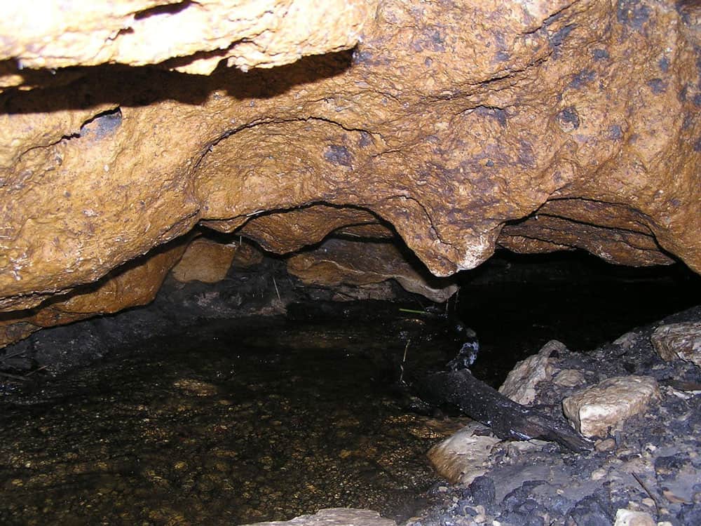
Mapping Underground Features
In recent decades, mapping underground features, such as physical structures or even sounds, has substantially improved.

GIS and Rewilding Efforts
GIS and geographical techniques help identify the best locations for successful rewilding and improve decisions on what to rewild.

USGS Releases Two Decades of Land Cover Change for the Contiguous United States
The USGS has updated land cover maps for the conterminous United States, which show how the country's landscapes have changed over the last 18 years.

Open-Source Web-GIS Development Roadmap
This article will provide a step-by-step learning guide to support your Web-GIS development journey, based on the authors' years of experience and extensive research.

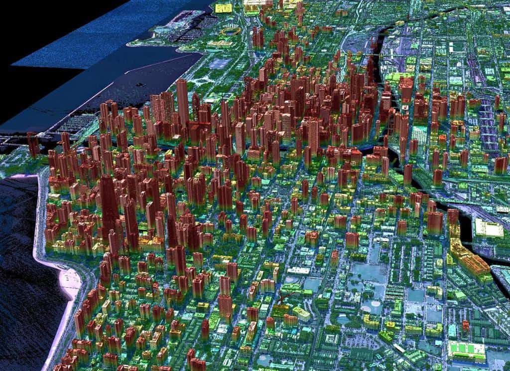
Next-generation Lidar: Seeing the Forest Through the Trees
Next-generation Geiger-mode lidar’s high density and multi-angle looks offer a better chance of seeing through tree foliage to map what's underneath.

2020 Global Land Use Data
A GIS dataset of land cover for the entire world was recently released.

6 Open Source Powered Projects to Enrich Your GIS Programming Skills
This article presents six projects with suggested tools, prerequisites and learning resources that would help you to improve your geospatial programming skills.

Efforts to Combat Map Vandalism in OpenStreetMap Data
Map vandalism is the deliberate wrong change or update to map data, such as adding an incorrect name for a street or place.
GDAL: Geospatial Data Abstraction Library
The Geospatial Data Abstraction Library (GDAL) is a set of software tools used by GIS platforms such as ArcGIS, QGIS, and GRASS GIS.

Super-resolution Imaging
Super-resolution is a technique derived from computer vision approaches that tries to increase the quality of an image by employing algorithms and upsampling to improve image sampling.

Mapping Our World, Saving Lives with Humanitarian OpenStreetMap Team
The “Mapping our World: Saving Lives” episode of the AfricaGeoConvo Podcast, examines the world of mapping and volunteering, with Geoffrey Kateregga.
Geiger-mode Lidar and Geospatial Data Acquisition
Paul Nash discuses Geiger-mode lidar and its use in geospatial data acquisition.

Ethics in GIS
With more ways to gather geospatial data and share that information, ethics has become even more important to consider.

3 Tips to Help You Get a GIS Promotion
This article from Bootcamp GIS provides tips for how to get promoted in GIS.

Cybersecurity and GIS
GIS can play an important role in ensuring protection of vital infrastructure and data networks.

How to Use ArcGIS Pro to Estimate Areas Prone to Malaria
This tutorial uses Spatial Data Science and Remote Sensing techniques (ArcGIS Pro) to estimate areas that are prone to malaria using ArcGIS Pro.

Preparing for a GIS Job Interview
Navigating the interview process for a GIS position can be challenging due to the field's wide skillset requirements - here are some tips.

Terrestrial Ecoregions GIS Data
The terrestrial ecoregions dataset is available both in shapefile format and as a Google Engine dataset.

5 Reasons why the GIS industry continues to grow
If you work in GIS, you have seen tremendous growth in software sales, services, and solutions over the past 20 years.

Securing a Funded GIS Graduate Program
Adebowale Daniel and Nnenna Nkata from the AfricaGeoconvo podcast share important information about securing a GIS graduate program.

Carbon Mapper: A Collaboration to Map Greenhouse Gas Emissions
A new, non-profit organization, Carbon Mapper, is attempting to create better ways to pinpoint methane and CO2 emissions.

Views of Earth from Space
Over the decades, Earth has been captured from near and far by astronauts and spacecraft from space.

Open Geospatial Standards
The creation of geospatial standards is critical for sharing data among different technologies and industries.
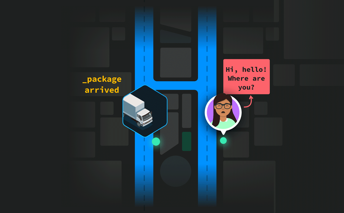
Last-Mile Problem: Achieve Pinpoint Accuracy With Hyperlocal Maps
Curated points-of-interest of a hyperlocal mapping and routing solution enable enterprises to lower cancellations and achieve higher map accuracy.

Autonomous UAVs and Geospatial Data
Autonomous UAVs are already performing a variety of tasks using geospatial data obtained in-flight.