
GIS and Geospatial Technologies
Articles focusing on the application of geographic information systems (GIS), geospatial technologies, remote sensing, LiDAR, and Global Positioning System (GPS). These technologies serve as critical tools for understanding and interacting with our physical environment. GIS allows for the mapping and analysis of spatial data Geospatial technologies refer to the various tools used to measure and analyze Earth’s lands and resources. Remote sensing provides a way to collect data from a distance, often via satellites or high-flying aircraft, and is commonly used for environmental monitoring and military applications.
GIS subcategories :
GIS Career | GIS Data | GIS Industry | GIS Learning | GIS Software | GPS | Remote Sensing | Spatial Analysis
Google Launches AI powered Tree Canopy Lab
Google is using artificial intelligence to develop maps of tree canopy from its aerial imagery.

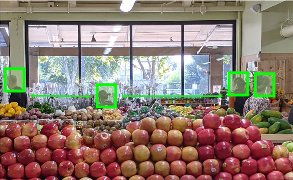
Spatially Intelligent Warehouses
The adoption of warehouse spatial intelligence (WSI) can help to reduce waste, producing mainly what we need rather than over producing while ensuring needed products can reach consumers more quickly.

Benefits of Satellite-Based Augmentation Systems
Satellite-Based augmentation system (SBAS) services provide capabilities to improve location data for global positioning system (GPS) devices.

Hub for Free Remote Sensing Materials
Esri has launched a hub that will serve as the collection point for free remote sensing and imagery materials

How the Biotech Industry is Using Spatial Analysis
The biotech industry is using spatial analysis as part of its efforts to develop rapid medical advancements that can help fight some of our most challenging diseases.

Using GIS to Map Election Results Based on Where People Live
Greg Bunce, from the State of Utah’s Automated Geographic Reference Center, presents an approach that uses GIS to create more representative election results maps.

Openlayers: Geospatial JavaScript Library
One of the most under-utilized programming languages in geospatial analysis and processing is JavaScript.

Businesses Using Open Source GIS
Businesses are using open source GIS software, finding that there are a lot of benefits along the way.

The Use of Gravimetry Satellites for Measuring Ice and Sea Level Change
Satellites now allow researchers to make more accurate mass measurements to large areas covered by ice and understand the effects of snow and ice melt on sea level change.

Understanding and mapping ZIP Codes
Resources for accessing ZIP code data. Ben Fry has created zipdecode that shows the location of all the ZIP codes in the United States.

Using Map Projections with Maptitude
Stewart Berry discusses how Maptitude works with different map projections.

Machine Learning and Object Detection in Spatial Analysis
Picterra offers a relatively easy to use interface that allows users train AI on satellite and aerial imagery to detect features.

Free Online Geocoder
Online geocoder services will generate latitude and longitude coordinates for a list of addresses.
WebGIS Section 2: Overview of Tools and Technologies For WebGIS
This article introduces you to some of the open-source tools used in WebGIS.

Why GRASS Delivers Powerful GIS Capabilities
A recent MapScaping podcast with Markus Neteler, chairman on the GRASS GIS Project Steering Committee, makes it is clear that GRASS will continue to be a powerful GIS open source effort for years to come.

Series: WebGIS Using Open Source Tools
Emmanuel Jolaiya's series on WebGIS using open source geospatial tools and technologies.
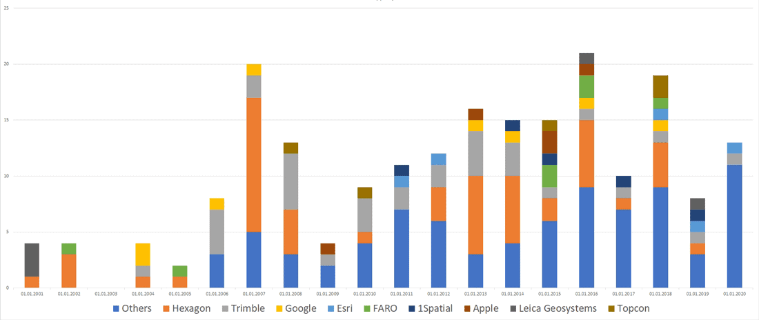
Mergers and Acquisitions in the Geospatial Market (2001-2020)
Andrey Pirogov, founder of GISGeo Project, takes a look at mergers and acquisitions in the geospatial technology market from 2001 to September 2020.

Mapping Sea-Level Rise with Sentinel-6
The recent launch of Sentinel-6 Michael Freilich/Jason CS is the latest mission that will collect high resolution sea level measurements.

QGIS Style Sharing Repository
A new tool has been deployed that lets QGIS users share style files.

Mapping Carbon Dioxide Emissions from Soil Respiration
Researchers recently developed a map of the global distribution of mean annual soil respiration (Rs) between 2000 and 2014.

Converting Historical Maps to Satellite-Like Imagery
Old maps and images can now be converted to make them similar to our modern satellite-base views, giving stylized views a more realistic appearance.

The Potential Role of GIS in COVID-19 Vaccine Distribution
GIS can play a role in developing protocols for the distribution of COVID-19 vaccines.

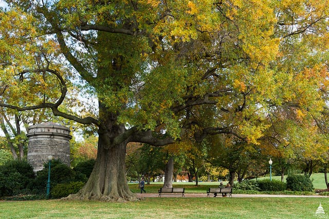
Halloween GIS Fun
Looking to add a little geo to your Halloween beyond the proliferation of Halloween Trick or Treater online maps? Halloween ...
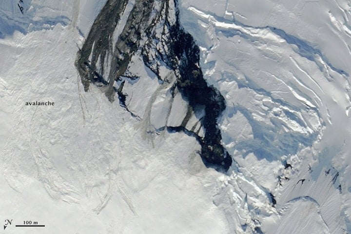
Forecasting and Mitigating Avalanches Using GIS
GIS and computational specialists have been developing models and methods to better forecast the likelihood of avalanches.
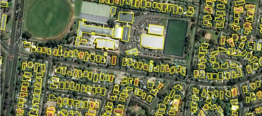
11,334,866 Building Footprints for Australia
Microsoft has released 11,334,866 building footprints covering the country of Australia.
Recent Developments in Spatial Analysis and Computer Vision
Computer vision offers spatial analysts the possibility to conduct a variety of analyses without using traditional spatial tools.