
Articles

The “Bystander Effect” With Crowdsourcing GIS Data
A recent research article found that users are less inclined to contribute to crowdsourced geospatial sites like OpenStreetMap and Waze if they know others are already contributing.

Ten Reasons Why Spatial Data Quality Matters More Now Than Ever
Geographer Josephy Kerski writes about 10 key reasons why geospatial data quality matters.

New Maps For Ungulate Migration Routes Across the Western U.S.
Federal and state wildlife biologists have come together to create a unique map of ungulate migrations across the American West.

Quick Geography Facts About Planet Earth
Find quick information about planet earth including the age, mass, volume, and make up of the earth's crust.
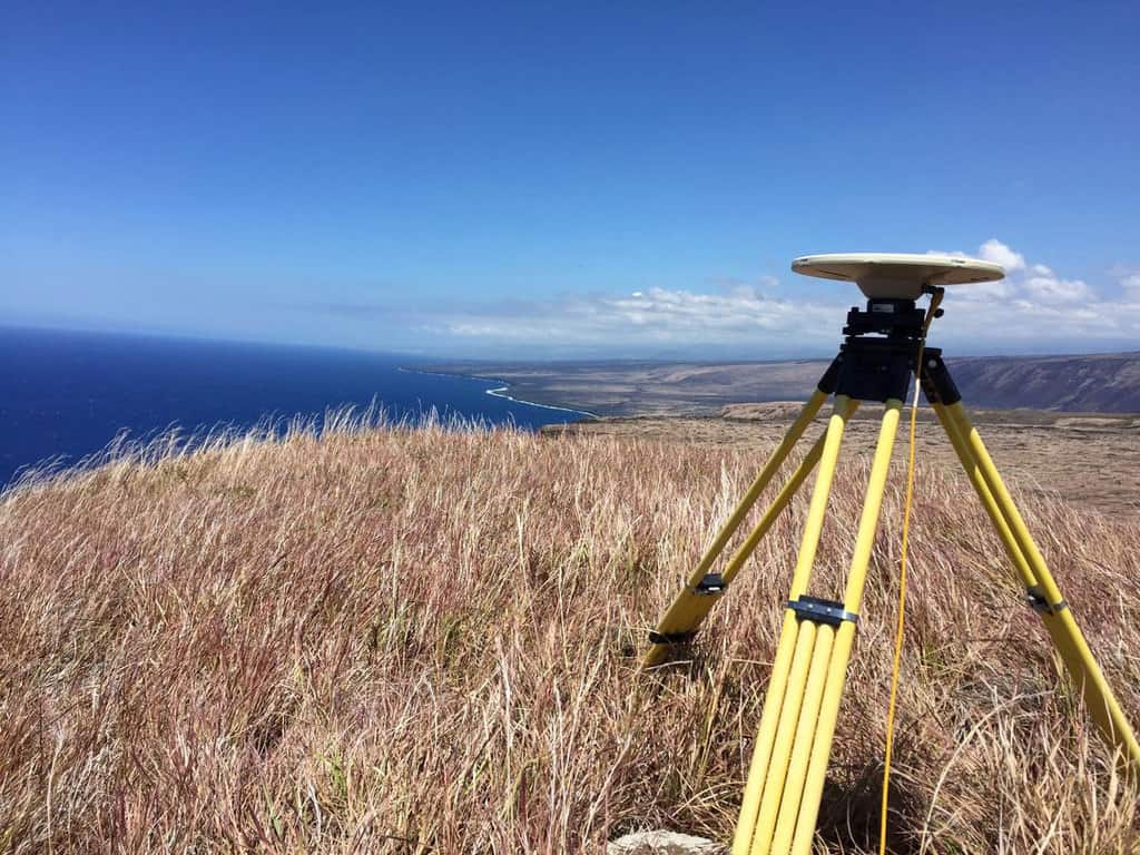
The Past, Present, and Future of GNSS
The Global Navigation Satellite System (GNSS) has emerged as the standard navigation system that provides global positioning for devices we use every day.

Atlas of the Human Planet: Free GIS Data and Tools
The Atlas of the Human Planet 2020 provides GIS Data for research, policy, and action that can be used to document the presence of humanity on Earth.

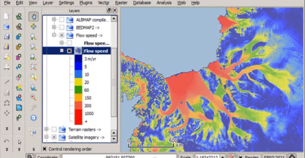
Quantarctica – Free GIS Data for QGIS
Quantarctica is a collection of freely downloadable GIS data for Antartica.

What is a Cartifact?
A cartifact is an object containing a map that is used primarily for design rather than as a source of information.

Mapping the Ocean Floor by 2030
A MapScaping podcast episode with NOAA's Samuel Greenaway discusses how mapping the seafloor will be a major challenge this decade.

Mount Fuji’s Snow is at a 20-Year Low
Satellite data that has tracked snow cover on Mount Fuji shows that the 2020 snow levels are the lowest since 2000.

Mapping Ground Subsidence
Synthetic Aperture Radar (SAR) can map subtle differences in the rates of subsidence.

NextBillion AI Solves HyperLocal Geospatial Infrastructures To Advance Mapping Ecosystems
NextBillion AI builds AI-based geospatial infrastructures to strengthen logistics, transportation, and supply chain services throughout the ecosystem.

The Geography Behind Being a GIS Professional
In a recent GIS podcast, Sarah Taigel discusses how being a professional geographer can provide key advantages to using GIS analysis.

Climate Change is Shrinking Forests in North America
The impact of climate change is reducing the amount of habitat where the trees of North America can thrive.

West Virginia’s First National Park
West Virginia's New River Gorge National Park and Preserve became the latest national park when it was designated as such by the U.S. Congress in December of 2020.

Augmented Reality and Computer Vision in Navigation
The use and field of AR and computer vision are rapidly changing in how these technologies are being used in navigation.

World’s Largest Active Geyser
Located in the Norris Geyser Basin in Yellowstone National Park is Steamboat Geyser, the world's largest active geyser.
Google Launches AI powered Tree Canopy Lab
Google is using artificial intelligence to develop maps of tree canopy from its aerial imagery.

Using Stingrays to Map the Ocean Floor
One research lab in Japan is looking at using marine life to collect 3D geospatial data about the ocean floor.

Spatially Intelligent Warehouses
The adoption of warehouse spatial intelligence (WSI) can help to reduce waste, producing mainly what we need rather than over producing while ensuring needed products can reach consumers more quickly.

Benefits of Satellite-Based Augmentation Systems
Satellite-Based augmentation system (SBAS) services provide capabilities to improve location data for global positioning system (GPS) devices.

Hub for Free Remote Sensing Materials
Esri has launched a hub that will serve as the collection point for free remote sensing and imagery materials

What are the Branches of Geography?
Geography is divided into two main branches: human geography and physical geography.

Flooding Can Help Protect Wetlands From Climate Change
Targeted flooding may be one tool that conservationists and wetland restoration specialists have to make wetland areas more resilient in the face of climate change.