
Articles

Generalization in GIS
Generalization is the method used in GIS to reduce detail in data. Learn about how to generalize GIS data using QGIS, ArcGIS, and other software tools.

Gap Analysis
Gap analysis in ecology identifies areas where species lack protection, comparing actual habitats to areas conserved in order to guide conservation efforts.

Land Surveying and GIS Revisited: An Unnecessary Drama
Joseph Magnotta presents an opinion piece about the relationship between surveyors and the GIS industry and why it doesn't need to be contentious.

Mapping Digital Attacks Around the World
The site Digital Attack Maps shows the leading Distributed Denial of Service (DDoS) attacks happening at the moment.

Latest Release of MapInfo Focuses on an Easier to Use Mapping Experience
Pitney Bowes, the maker of MapInfo, has released an updated version of the GIS software that is aimed towards lowering ...
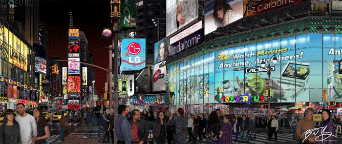
Bert Monroy – An Artist at the Intersection of Geography and Art
Kristina Jacobs interviews Bert Monroy about his geography themed art.

How GIS is Being Used in Conservation Biology
GIS has a central role in analyzing the geographic distribution of endangered species, in measuring and monitoring biodiversity, and in identifying priorities for conservation management.

Mastering Geography
Here are some people who have amazing memories when it comes to geography.

Four Ways GIS is Being Used to Help Populations Vulnerable to Long Term Climate Change
GIS is changing the way vulnerable populations relate with their natural world and resources to keep ahead of imminent climate changes.

Using Geospatial Technologies to Map Illegal Fishing
Worldwide overfishing is having a devastating effect on marine ecosystems. A 2014 report from the United Nations Food and Agriculture Organization ...

Island Biogeography
The biogeography of islands is a fascinating topic that extends to more than just island locations. The ‘island’ part of ...

Continents and Population Density
The worksheet below is aimed towards helping elementary school students uses graphs to learn about the different continents and the ...

New Study Discovers the Worst Drought of the Millennium Occurred in 1934
According to the National Aeronautics and Space Administration (NASA), the worst drought of the last thousand years occurred in 1934 ...

Mapping the California Drought with Open Data
The Center for Integrated Data Analytics (CIDA) of the United States Geological Survey has created an open source visual description of California's ongoing drought using free and publicly available GIS data sources

Using Drones to Create Fast Orthorectified Maps
Computer scientist Mark Pritt, along with colleagues at Lockheed Martin in Gaithersburg, Maryland, developed a new algorithm to handle thousands of images and speed up the process of creating an orthorectified map from UAV aerial imagery.

Finding Low Tech Solutions for Nairobi’s Commuters
How do you help commuters navigate traffic when only 19% of the population owns a smartphone? IBM's Nairobi Labs has released a solution for commuters that uses low resolution traffic cameras to predict traffic patterns that are relayed via SMS.

Tourism in North Korea
More and more people are flocking to the tightly controlled state for a peek into one of the most mysterious nations on Earth.

How GIS is Being Used in Real Estate
What do GIS and real estate have in common? They both place a very high importance on location. For real estate ...

How GIS is Being Used to Help Native Americans
Native Americans use GIS for heritage/environmental protection, economic development, education, health, transportation, land use, and resource management.
Relative Direction Versus Compass Direction
Learn about the difference between relative directions and compass directions.

The Oldest Known Map of the World
The oldest known world map is the Babylonian Map of the World known as the Imago Mundi.

Putting the Trees Back on the Map: How GIS is Helping Reforest South America
GIS is being used in creative ways – including covert spy tracking of illegal logging deep in the Amazon – to help put and keep trees back on South America’s map. The simplification of tools and availability of web systems has empowered technicians, NGOs, and governments alike to address corruption and illegal logging with transparent map-based monitoring.

GIS in Urban Planning
Frank Stafford, a graduate of Cambridge University with a background in Civil Engineering writes about why GIS is being used in Urban Planning.
QGIS versus ArcGIS
When considering which GIS desktop software to adopt, two of the most popular choices are Esri’s ArcGIS and Quantum GIS, ...

Geography Awareness Week
Geography Awareness Week is a weeklong event geared towards getting people more involved in the geographical world around them. Geography ...

Finding Fossils with Remote Sensing
In the field of paleontology, finding fossils is often a substantial undertaking. Researchers usually have to assemble crews of up ...