
Caitlin Dempsey

Over 2000 Sentinel-1 Satellite Images Were Used to Create a Map of Land Deformation in the United Kingdom
A new map of the United Kingdom map tracks areas of land subsidence and uplift based on processed data from Sentinel-1's Synthetic Aperture Radar (SAR).

Tool from Sentinel Hub Lets You Create Time-lapse GIFs from Satellite Imagery
The EO Browser allows creating animated GIFs from satellite image time series. This tutorial demonstrates how to create your own time-lapse GIF.
An Eye Protein May Be What Allows Birds to Sense Magnetic North
New research proposes that Cry4, a light-sensitive protein found in the eye's retina may be responsible for magnetoreception in birds.

What is a MXD File?
Files with the extension .mxd are ArcMap document files and stands for Map Exchange Document.

NASA Wants You to Send Your Name to the Sun
To celebrate an upcoming groundbreaking mission to the Sun's atmosphere, NASA is inviting the public to submit their names to be added to a microchip which will be placed onboard the Parker Solar Probe.

The Great Pacific Garbage Patch is Much Larger Than Previously Thought
Researchers using surface trawl samples and aerial imagery surveys have calculated the amount of plastic debris in the Great Pacific Garbage Patch.

St. Patrick’s Day Maps and Geography
Find maps about Irish surnames and the geography of St. Patrick's day from the US Census.

Researchers Analyzed over 22 Billion Shipping Positions to Map the Global Footprint of Industrial Fishing
To map out global fishing activity, over 22 billion AIS messages between 2012 and 2016 were analyzed by researchers.
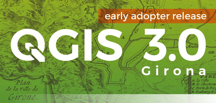
QGIS 3.0 Released
Version 3.0 of QGIS, the popular free and open source GIS software, was released today.

GIS Certification versus Certificate Programs
GIS certification and certificate programs are two similarly named yet different markers of a person's GIS education and skills achievements.

Geography of the Winter Olympic Games
Learn about the Olympic Winter Games' geography.
Using Virtual Reality to Promote Information Literacy among Students
Virtual reality (VR) is emerging as an effective technology that librarians can use to help develop geographic information literacy among students of all ages.

A Victorian Teenager Created These Comical Maps of Different European Countries
In the 1860s, a young girl decided to amuse her sick brother by creating maps of various European countries.

How to Add a Map from Mapbox to QGIS
This tutorial will show you how to take a map style you have created in Mapbox and load it into a QGIS session.

Debris from the 2011 Japanese Tsunami Carried Almost 300 Marine Species Across the Pacific Ocean
A group of researchers inventoried what marine species traveled across the Pacific Ocean between 2012 and 2017 as the result of a biological rafting event created by the 2011 Japanese Tsunami.

How Often Does it Snow in the Sahara Desert?
The sight of snow in the Sahara Desert is rare, but it does happen on occasion.

Free GIS Data Viewers
Free data viewers for a variety of GIS data formats. These viewers allow you to display geographic data as well as perform some basic GIS functions.

How to Geocode Addresses Using QGIS
If you have a CSV formatted file containing addresses, you can take advantage of QGIS to map out those addresses. This article contains step by step instructions for geocoding addresses using QGIS.

Nighttime Illumination Continues to Grow Worldwide
A new study used remotely sensed data from an earth observation satellite to analyze the rate of increase in artificial night lights between 2012 and 2016.

Map of Cold and Hot Temperature Anomalies Across the World
NASA has compiled a temperature anomaly map of the world using data acquired between December 26, 2017 and January 2, 2018.

Mappy New Year! Celebrate with Vintage Map Postcards
To celebrate the New Year, here are some vintage map themed postcards.

Watch Landsat 8 Imagery Acquisition in Near Real-time
The FarEarth Global Observer offers visitors the opportunity to view near-live streams of Landsat 8 imagery being acquired in near real-time.

Holiday Season Gift Ideas Created by the GIS Community
Looking for a holiday gift idea for the geographers in your life and want to support the GIS community? Listed here are some great gift ideas produced by geographers.

GIS File Formats
Listed here are some of the more common file formats along with associated file extension for GIS file types.

How to Save a Selection as a New File Using QGIS
Learn how to save a selection from a GIS dataset to a new GIS file using QGIS with this quick video tutorial.

Hurricanes, Sea Salt, Dust, and Smoke
This visualization from the Global Modeling and Assimilation Office (GMAO) at NASA's Goddard Space Flight Center shows how particles flow around the Earth's atmosphere.