
Caitlin Dempsey
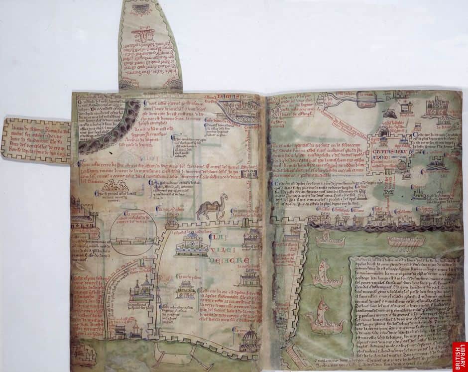
A Brief Look at Medieval Maps and Travel Guides
For many medieval maps created by European cartographers, locations were represented not by their geographic size but sized based on their importance to Christianity.
A Brief Introduction to Medieval Music
Music was an important aspect of Medieval life.

2018 Gift Giving Ideas for Geographers and Cartographers
If you're looking for a unique or thoughtful gift for the geo-enthusiast, check out this guide for interesting geography and cartography related gifts for a wide range of budgets.

How to Make a Tile Grid Map Using Google Sheets
This tutorial provides instructions on how to create a tile grid map using Google Sheets.
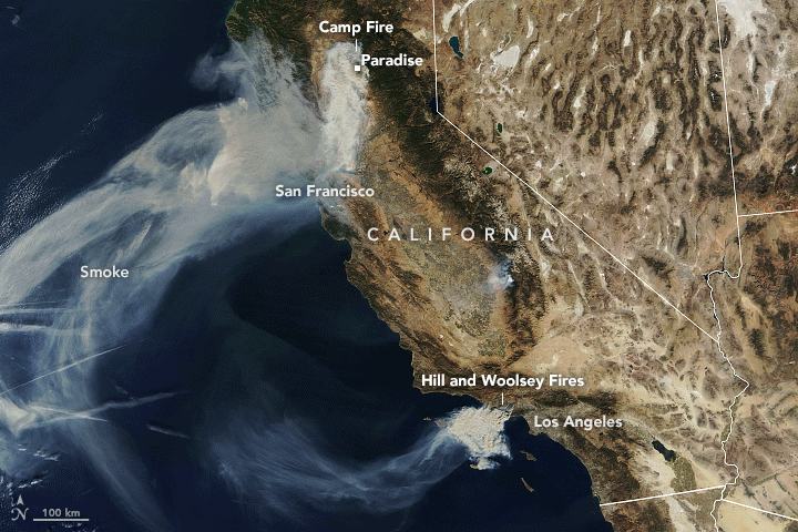
Smoke from the Camp Fire is Making Northern California Air Among the Unhealthiest in the World
The continual arrival of smoke from the Camp Fire has pushed cities in the northern California area to air pollution levels to some of the highest around the world.

Planting Trees with Drones
BioCarbon Engineering is working with Worldview International Foundation and Worldview Impact Foundation to develop an innovative way to speed up tree reforestation projects with the use of drones.

Geography of Fortune 1000 Companies in 2018
Geography of the Fortune 1000 for 2018: learn about which states and cities have the highest number of Fortune 1000 companies.
Map and List of Fortune 1000 Companies for 2018
Map and list of Fortune 1000 companies for 2018, according to Fortune Magazine.
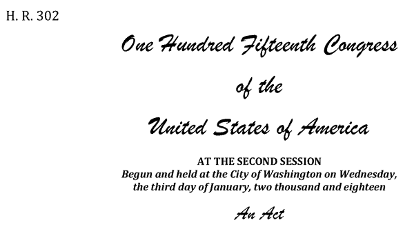
Geospatial Data Act Passes With Industry Support
The Geospatial Data Act of 2018 (GDA) was enacted on October 5, 2018, when the President signed it as a component of the Federal Aviation Administration (FAA) Reauthorization Act (H.R. 302).

QGIS Map Design, 2nd Edition
Updated to be used with QGIS 3.4, the second edition of QGIS Map Design is now available in its final version.

Geography of Fortune 1000 Companies in 2017
Explore the geographic distribution of Fortune 1000 companies for 2017.

Map and List of Fortune 1000 Companies for 2017
List of Fortune 1000 companies for 2017. This page also includes an interactive map showing the mapped location of each Fortune 1000 company in 2017.

How to Change the Label Language When Using Natural Earth’s Quick Start QGIS Files
One quirk with the version 3 of the Natural Earth quick start kit .qgs file is that when you load it in to a session of QGIS, it can display labels in a language you weren't expecting.

How to Use the Equal Earth Map Projection in Different GIS and Mapping Software Applications
Listed here are GIS and mapping resources that have incorporated the Equal Earth Map Projection.

World’s Largest Water Bridge
The world's largest sea bridge/tunnel system, which took nine years to build, connects Hong Kong to Macau and the mainland Chinese city of Zhuhai.

How to Get the Map View in QGIS to Resize Properly on a Mac
One Mac OS specific bug is the map view canvas doesn't fill the available space in QGIS 3.x versions. Learn how to fix this.

How to Populate a Cell with the ZIP Code Based on an Address in Google Sheets
You can set up a simple function in Google Sheets to be able to populate a separate column with ZIP code dat based on address data.

Awesome Public Datasets
If you're looking for sources of public data tucked into web sites, then check out Awesome Public Datasets, Free GIS Datasets, and Open Data Inception's map of open data portals.

NOAA Offers Post-Hurricane Aerial Imagery
NOAA has been capturing aerial imagery showing the post-Hurricane Michael destruction across the Florida Panhandle.

Earth from Above: Green River
An astronaut aboard the International Space Station captured a segment of the river around Boxknot Bend just north of Canyonlands National Park.

Tracking Post-Storm Water Movement Using GPS
NASA researchers recently published a study which uses GPS technology to track water volume and movement post-Harvey

Mapping Tree Species in the Amazon Using Satellite Imagery and Machine Learning
Researchers have modeled tree species distribution in Peruvian lowland Amazonia using satellite imagery and machine learning techniques.

Detecting Storm Intensity from Satellite Imagery Using Machine Learning
The Deep Learning-based Hurricane Intensity Estimator is an experimental portal that uses machine learning techniques to analyze spatial patterns in infrared satellite imagery in order to predict tropical cyclone intensity.

High Resolution Elevation Data for Antarctica
Recently two high resolution digital elevation models of Antarctica were released for the public to free use.

Google Launches ‘Dataset Search’
Google latest Beta launch, Dataset Search, is designed to make it easier for users to search for and find datasets found across the web.

The Largest Endorheic Lake in the World
The largest endorheic lake also happens to be the largest overall lake in the world.