
Caitlin Dempsey

Using Geotagged Photos to Map Cats
I Know Where Your Cat Lives is a project that mapped out a million geotagged photos of cats from several social media platforms.

Helping Chimpanzee Conservation Efforts with Satellite Imagery
NASA has partnered with the Jane Goodall Institute to provide satellite imagery and the analysis needed to understand where habitat loss is the most extreme to protect chimpanzees in the wild.

Learn How to Access and Use Sentinel-3 Data
Learn how to download and use earth observation data from ESA's Sentinel-3 satellite.

A Review of Timesheet.js
Timesheet.js is a basic tool calls a JavaScript file and uses a code-based configuration to create a simple timeline that can be embedded into a HTML file.

Geography Mnemonic to Learn the Countries of Central America
Use a mnemonic to remember the countries of Central America in order from north to south: Belize, Guatemala, El Salvador, Honduras, Nicaragua, Costa Rica, and Panama.

Geography Mnemonics to Help Learn About the Great Lakes
Learning the names of the Great Lakes can be aided through the use of mnemonics, a learning device that uses patterns to help with recall.

How to Teach Children the Cardinal Directions
Here is a simple and effective tip for teaching children cardinal directions (north, east, south, and west).

Geo Quiz: Name the Human Activity Visible from Space
This geography quiz features ten satellite images each showing an anthropogenic activity. Can you figure out what the human activity shown on each image is?

Geo Quiz: Which Country is Bigger?
This quiz challenges you to figure out which country is bigger based on a world map using the Mercator map projection.

What Causes Gaps in the Clouds?
Air will rise and fall around large geographic features such as islands and icebergs, affecting the formation of clouds.

Changing Map Scale Using a Pantograph
A pantograph was one of the ways used to either reduce or enlarge the size of a map while reproducing an accurate copy of the original map.

Where are the Desolation Islands?
Located in the southern Indian Ocean off the eastern coast of Africa and just north of Antarctica, the Kerguelen Islands have earned the nickname "Desolation Islands" due to their remote location.

What are the Three Plates that Make up the Mendocino Triple Junction?
The Mendocino Triple Junction is located in the Pacific Ocean near Cape Mendocino in northern California.

Match Scribbles to Features on the Earth
Land Lines is an experimental online tool that matches drawn gestures on the screen with landforms extracted from satellite imagery.

Test Your Topsy Turvy Geography Smarts with this Map Skills Game
‘Up Side Down’, tests your map acumen by either zooming in to a tilted location that you have to identify or placed disparate features together and quizzes you on which one is the answer to the question.

3 Ways to Send a Geo Season’s Greetings
Here are three ways you can pass along your end of the year cheer to geography enthusiasts no matter where they live.
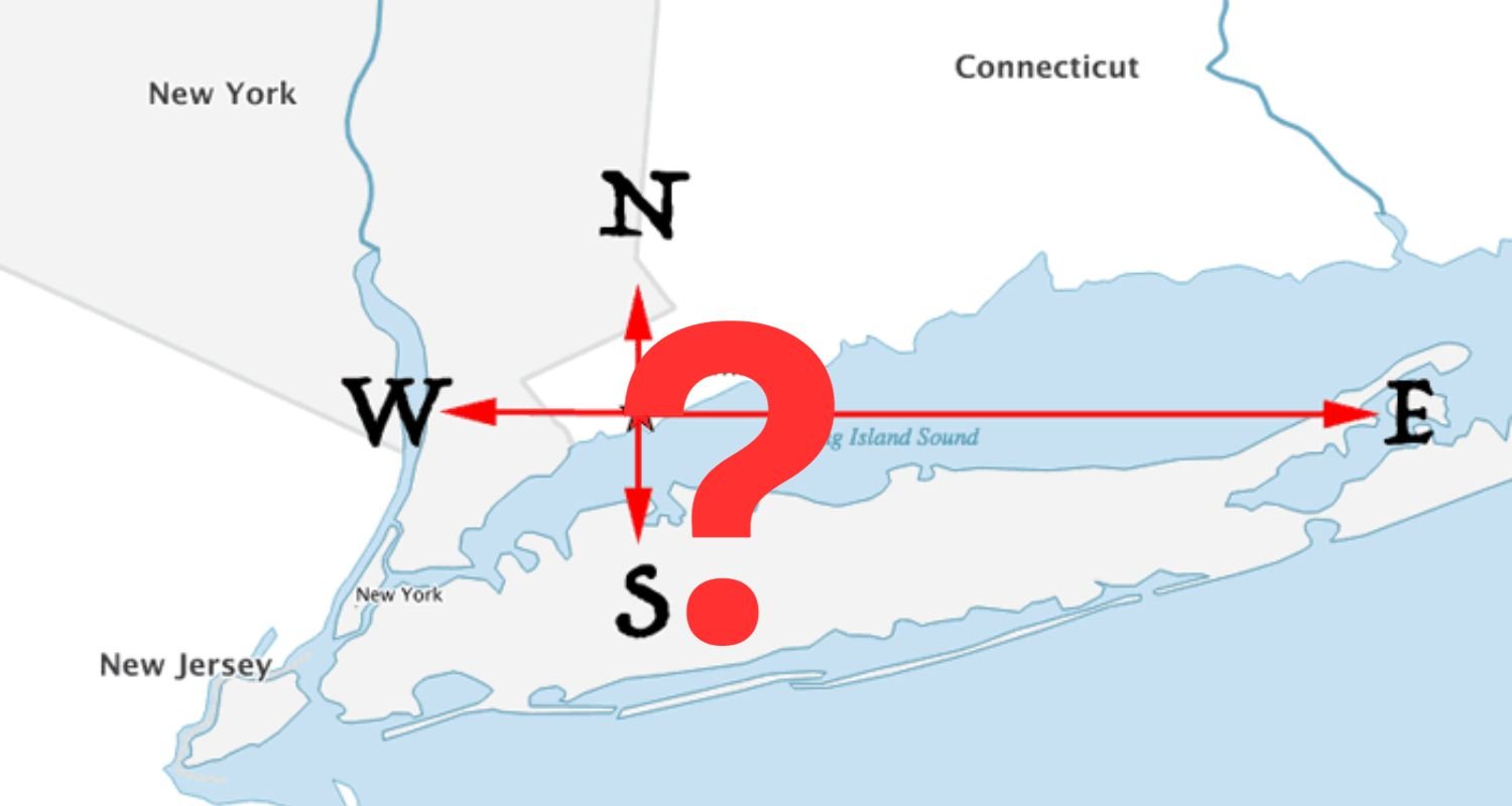
From Which U.S. City Can You Travel North, South, East, or West and End up in the Same State?
Can you answer this geography riddle? From which United States city can you travel due north, south, east, or west and still enter the same bordering state?
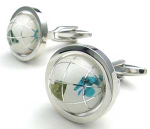
7 Fun Stocking Stuffer Gifts for Geographers
Looking for items for your favorite geographer's Christmas stocking? The items on this list make perfect gifts for the geogeek in your life for gift exchanges with small budgets.

7 Nifty Gift Ideas for the GIS Person in Your Life
Whether you are looking for gifts for Christmas, Hanukah, Kwanzaa, Festivus, or just looking for a special gift for any time of the year, here are some gift ideas for a range of budgets. From silly to serious, find the perfect GIS gift idea on this list.

What are Qanats?
Qanat are underground water channels developed during ancient times to carry water using gravity via a gentle downward slope.

Collecting GIS Data with Drones
Drones are rapidly being adopted as a way to quickly collect aerial imagery and other forms of geospatial data.
Connecting to GPS in Tunnels
Waze is testing out technology it calls "Waze Beacons" to keep drivers connected to GPS navigation systems in tunnels.

Turning the Continents of the World into Animals
Kentaro Nagai continues the tradition of envisioning"maps as animals" and reworks the continents as part of his artistic piece from 2007 entitled, "The Twelve Animals."

Geography of Fortune 1000 Companies in 2016
This article takes a look at the geographic distribution of Fortune 1000 companies within the United States for 2016.
Fortune 1000 Companies List for 2016
Table of Fortune 1000 companies which can be filtered to produce a list Fortune 1000 companies by state or by city.

Is Germany Landlocked?
The easiest way to tell if a country is landlocked is to take a look at a map of the country and the surrounding geography.