
Geo Contributor

Using GIS to Track Historical Land Cover Change and Growth Rate at Fort McCoy
Christian Rodriguez outlines the process to track land cover changes on a military installation using ArcGIS.

Improving Urban Decision Making with Open Earth Observations
Steven Ramage, Head of External Relations, Group on Earth Observations (GEO), outlines innovative partnerships and activities GEO has been working on globally using open Earth data, GIS, and cloud technologies.

The Importance of GIS
David Falk writes about how GIS plays an important role in his career as an Army Officer, in his field as an engineer, and in his civilian life as potential homeowner and resident.
Tips for Leading a Remote Team during Covid-19
Jeffrey Skahill with Quantum Spatial shares some strategies he uses to successfully lead a remote team.

The Politics of Defining Central New Jersey
In the state of New Jersey, one of the most contentious arguments its citizens have is the existence of the region ‘central Jersey.’
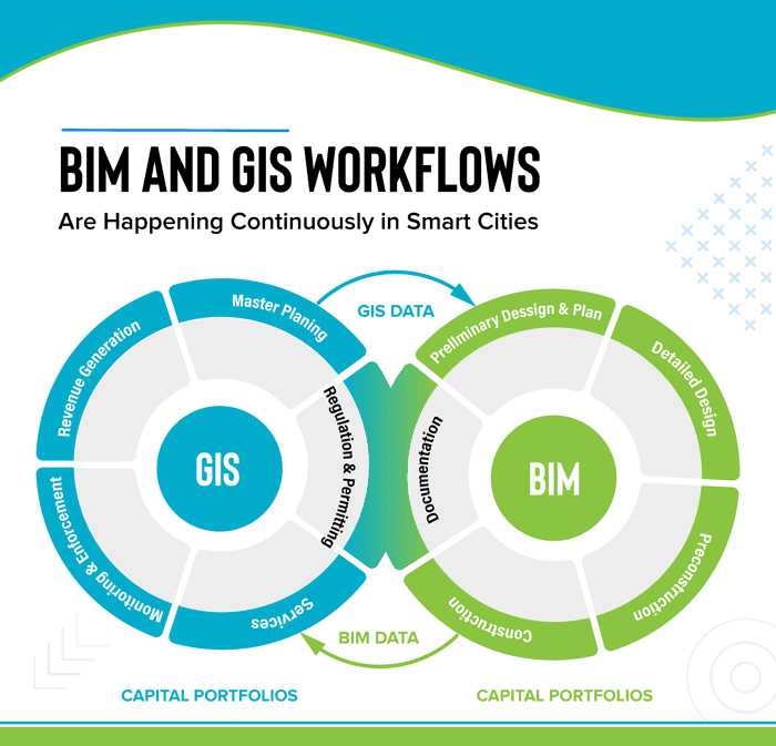
GIS and BIM Integration in Infrastructure Design and Construction
The latest advancements in geospatial services are making changes in the AEC industry. BIM for infrastructure design helps improve the workflow and saves valuable data through every stage of the process. Read about how GIS and BIM integration will transform these industries.

How GIS is Used in All Phases of Emergency Management
In this guest article, Brian Sekita discusses how GIS is vital to all phases of the emergency management process.

Learn How GIS and Earth Observation Can be Used to Support the United Nations Sustainable Development Goals
Earth Observation and GIS technologies have a huge impact on both monitoring the implementation of the United Nation's sustainable development goals.

Understanding LiDAR Technologies
This article presents insights from the new IDTechEx report titled “Lidar 2020-2030” IDTechEx report.

The Critical Role of GIS in NG9-1-1
Drew Fioranelli, GISP, Public Safety GIS Market Maker, and Annie Cahill, Public Safety GIS Technical Manager with DATAMARK, discuss the history of 9-1-1 infrastructure as well as the foundational role of GIS and GIS professionals in the transition to Next Generation 9-1-1 (NG9-1-1) .
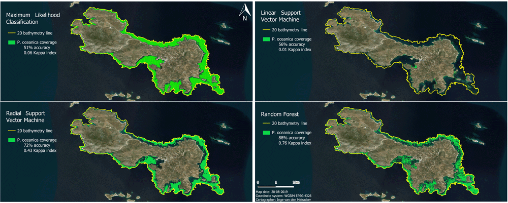
Mapping the Subsea Forests of the Mediterranean
Inge van den Meiracker writes about her research internship in Greece where she modeled and mapped the seagrass distribution in the Southeast Aegean Sea using sonar data, remote sensing techniques, and GIS.
Customize ArcMap with Python Add-Ins
Daniel Fourquet walks users through the process of using Python to create Add-Ins for ArcMap.

How Advances in Computer Mapping Shaped the Early Days of GIS
Greg Bunce, from the State of Utah’s Automated Geographic Reference Center, presents a walk through the history of mapping and geospatial advances that led to the early days of GIS.

3 Ways Geospatial Data is Changing the Way We Manage the Environment Around Us
Dr. Michael Flaxman, director of Geodesign Technologies and Geospatial Community Advocate for OmniSci, presents three example of how newly available geospatial data is being leveraged.

A Case Study on Converting a Geodatabase From ArcGIS for Use in QGIS
In this article Charles Altendorf outlines a method he developed to convert GIS data located in a geodatabase created in ArcGIS into open source data that can be used in QGIS.

Next Generation Asset Management with iSTAR Pulsar
Danny Sullivan writes about how 360 imaging company NCTech's vehicle-mounted iSTAR Pulsar camera is being used by Icon Spatial as part of an asset management project for a major highway operator Australia.

Latest Release of ArcGIS Online Introduces New Features and Enhanced Capabilities
Bernard Szukalski, Esri tech evangelist and product strategist, introduces new features and enhancements to the latest release of ArcGIS Online.

How the Last 160 Years Have Changed the Earth’s Climate
Since the Industrial Revolution, this level has been rising continuously, reaching 410 ppm in 2018.

Fossil Finds Reveal More About the ‘Cambrian explosion’ – When Oceans First Developed Complex Life
Recent fossil finds in China reveal Cambrian seas were more diverse than thought.

Warmer Oceans Will Make Hurricanes More Intense
Since hurricanes draw their energy from ocean heat, warmer waters can increase both their intensity and duration.

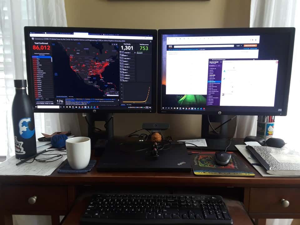
Lessons From a Viral Map
As public engagement becomes more and more important to society, it’s useful for scientists to know what makes maps and other geospatial content go viral.

Are Safaris the Best Answer for Elephant Conservation?
Tourism can be a great conservation tool as long as it is monitored closely.
The Wide Impact of Tropical Cyclone Idai
The effects of Tropical cyclone Idai were felt as far south as South Africa

How Climate Change is Affecting Tick Season
As the global climate warms, it is more likely that some ticks will remain active through the warmer winters and can expand their habitats into new areas.

LandViewer Has Added New Remote Sensing and Satellite Imagery Analytics
This article by EOS, a company which creates solutions for Earth observation imagery processing and analysis, introduces a host of updated capabilities in its LandViewer tool.

Defining Biogeographic Regions
A recent paper published in Applied Geography explored ways to improve the determination of biogeographic regions using clustering techniques.