
Articles

Geography and Depression Research
Researchers have looked into how spatial understanding might better enlighten us about mental health and despair.

Mapping Trees in West Africa
Researchers used high resolution satellite imagery and machine learning to map trees in West Africa.

USGS Releases Two Decades of Land Cover Change for the Contiguous United States
The USGS has updated land cover maps for the conterminous United States, which show how the country's landscapes have changed over the last 18 years.


Open-Source Web-GIS Development Roadmap
This article will provide a step-by-step learning guide to support your Web-GIS development journey, based on the authors' years of experience and extensive research.

California’s Drought is Driving Reservoirs to Near Historic Lows in 2021
The second year of California's drought is driving down water levels in the state's reservoirs in 2021.

Geography of U.S. Lakes
Within its borders, the United States is home to a vast wealth of lakes.
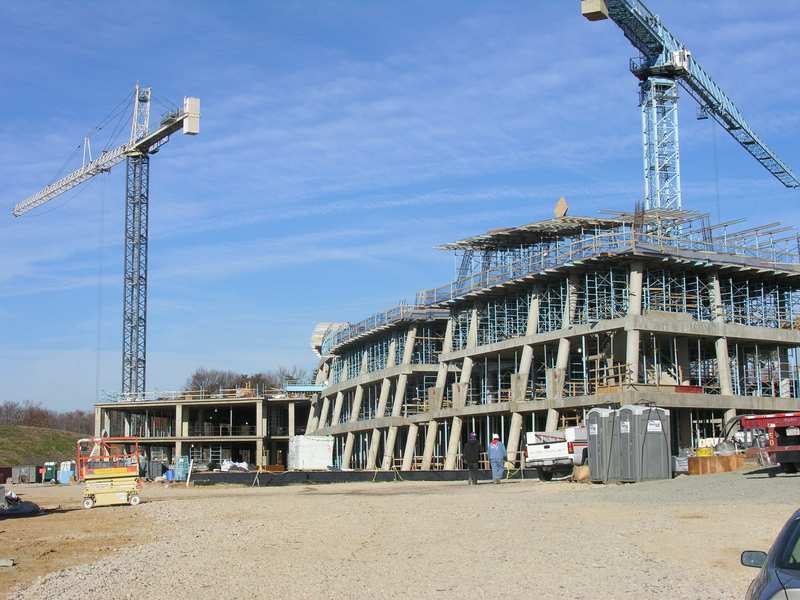
GIS and Building Safety
Both during the construction phase, and after, building safety can be better modeled and understood using GIS.

Next-generation Lidar: Seeing the Forest Through the Trees
Next-generation Geiger-mode lidar’s high density and multi-angle looks offer a better chance of seeing through tree foliage to map what's underneath.
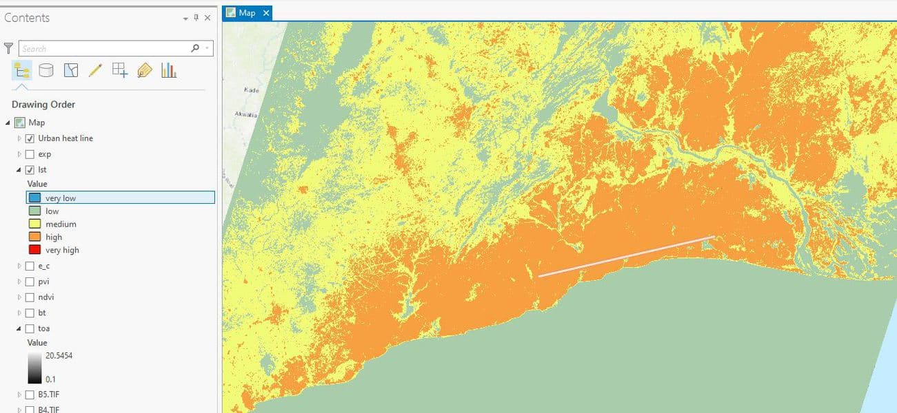
How to Use ArcGIS Pro to Map Urban Heat Islands
This ArcGIS Pro tutorial demonstrates how to assess urban heat in a region.

Survey Markers and Benchmarks
Benchmarks are a type of survey markers whose elevations have been surveyed as accurately as possible based on the technology at the time.

Review | Talking at the Gates: A Life of James Baldwin
Talking at the Gates by James Campbell is a biography of James Baldwin, one of the most influential American writers of the twentieth century.

2020 Global Land Use Data
A GIS dataset of land cover for the entire world was recently released.

The Sonoran Desert is Losing Plants Due to Climate Change
Between 1984 and 2017, a team of researchers utilized Landsat imagery to examine changes in vegetation in the Colorado Desert in Southern California.

Robinson Map Projection
The Robinson map projection is a compromise project that minimizes distortion across the map.

6 Open Source Powered Projects to Enrich Your GIS Programming Skills
This article presents six projects with suggested tools, prerequisites and learning resources that would help you to improve your geospatial programming skills.

California’s Largest Lake
Floodwater from a broken irrigation canal gate in 1905 created California's largest lake.

Efforts to Combat Map Vandalism in OpenStreetMap Data
Map vandalism is the deliberate wrong change or update to map data, such as adding an incorrect name for a street or place.

Alaska’s Coastline is Longer Than All the Other 49 States Combined
Here are some geography facts about Alaska's coastlines.

How Ocean Currents Move Pollution Around the World
How does pollution from plastic, trash, and oil spills move around Earth's oceans?
GDAL: Geospatial Data Abstraction Library
The Geospatial Data Abstraction Library (GDAL) is a set of software tools used by GIS platforms such as ArcGIS, QGIS, and GRASS GIS.

Geography Facts About the Rocky Mountains
The Rocky Mountains form the longest mountain range in North America. Here are some geography facts about this mountain range.

Datacubes in GIS
Increasingly, Earth observation (EO) data are stored as datacubes, helping to assist the analytical process.


Super-resolution Imaging
Super-resolution is a technique derived from computer vision approaches that tries to increase the quality of an image by employing algorithms and upsampling to improve image sampling.
