
Articles

Learn to Use GIS to Map and Analyze Surface Water Data
Esri Press recently published a book to teach users how to use GIS to analyze surface water using the National Hydrography Dataset produced by the USGS.

Swarm Satellites Bring New Findings About Ocean Magnetism
In 2013 the European Space Agency (ESA) launched a trio of satellites called “Swarm”, which are specialized in capturing Earth’s magnetic activity including ocean current magnetism

More Animals Are Becoming Nocturnal Thanks to Human Activity
Researchers from UC Berkeley undertook a study that looks at the effect of human activity on the daily activity patterns of wildlife.
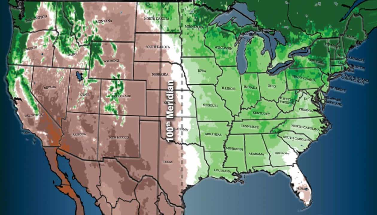
The North American Climate Boundary is Shifting East
The North American 100th meridian west climatic boundary is shifting, bringing dry climate patterns further east.

Ready for Summer – Remote Sensing of Bathing Water Quality
Remote sensing is being used to help researchers monitor water quality in lakes and coastal areas.
The Modifiable Areal Unit Problem and GIS
For most GIS practitioners, modifiable areal unit problem (MAUP) is something to be aware of when different analytical techniques are applied.
Run Image Processing Tasks in Your Browser with the EOS Platform
This guest article by EOS introduces the newly upgraded EOS platform, a set of mutually integrated cloud products for searching, analyzing, storing, and visualizing geospatial data: Landviewer, Processing, Vision, Storage.
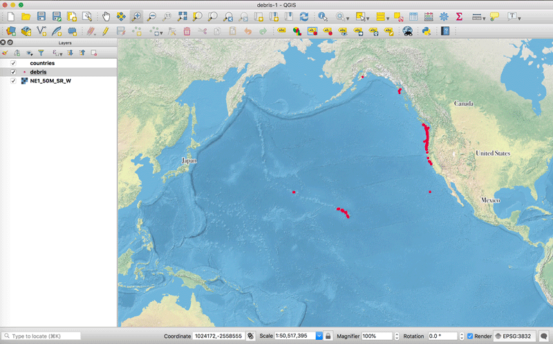
QGIS Tutorial: How to Change the Map Projection to be Centered Over the Pacific Ocean
This quick tutorial shows you how to recenter your map project in QGIS so that the center of the map view is on the Pacific Ocean.

How to Use the Color Blind Preview Option in QGIS
With the release of QGIS 3, you can now preview how your maps will look for those with two types of red-green color blindness.

How Much Do GIS Jobs Pay?
Your potential salary as a GIS professional is going to vary depending on several factors such as the location of the job, the title, and experience.

Mapping and Assessing Landscape Suitability for Bee Migration
Research highlights how GIS and remote-sensing techniques can be used to evaluate and map areas that are suitable for bee populations.

Regulations Affecting the Use of Drones in India
Bankim Chandra Yadav, a Ph.D. student at Indian institute of Technology Roorkee, discusses unmanned aerial vehicles (UAVs) technological implications under the Indian government laws.

The Rise of African Mapping Technologies
Stuart E. Hamilton, GIS Graduate Director at Salisbury University in Maryland, discusses why he considers East Africa to be a leader in geospatial education and opportunities.
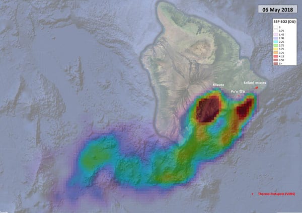
Sentinel-5P Tracking Emissions from Hawaii’s Kīlauea Volcano
Researchers are using data from the Sentinel-5P satellite to map out sulphur dioxide emissions from Hawaii's Kīlauea volcano.

Lava from Hawaii’s Kilauea Volcano Reaches the Ocean
This image captured by the USGS-HVO shows the active ocean entry of a branch of lava from the Kīlauea Volcano in Hawaii.
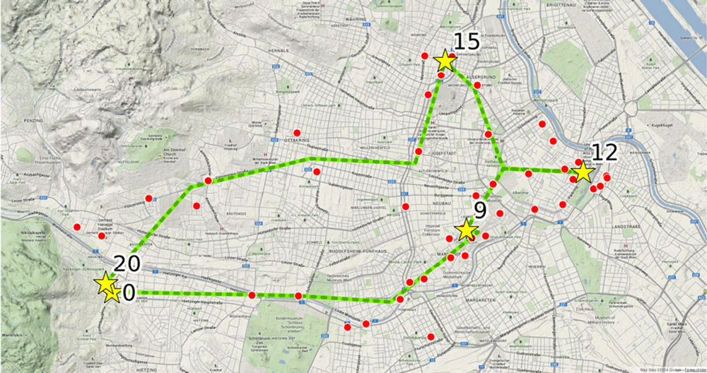
Using Cell Phone Data to Map Urban Activity Patterns
Mapping mobile cellular data has a major potential in allowing a better understanding of how we use urban spaces, including transport networks and access to events and venues.

Spatial Challenges of Navigating Rural Roads for Self-Driving Cars
Researchers from MIT are testing the use of GPS and LiDAR to enable autonomous navigation in rural areas lacking detailed 3D maps.

Monitoring and Mapping Microplastics in Marine Ecosystems
Advancements in satellite remote sensing techniques are paving the way toward the development of high resolution and temporal maps of marine microplastic distribution.

Using Drones and Remote Sensing for Mapping and Counting Animals
Remote sensing data from satellite and UAV imagery has been used by researchers in the mapping and observation of wildlife, in particular counting the number of animals in remote locations.

The Aorounga Crater in Northern Chad
The Aorounga Crater is an impact crater located in northern Chad just south of the Tibesti Mountains in the central Sahara desert.

How Much Would You Need to be Paid to Give Up Digital Maps?
A trio of economists sought to figure out just how much money it would take users to give up digital services like Google Maps.

Black Marble: Nighttime Lights Data from NASA
NASA's Black Marble provides a suite of nighttime geospatial data acquired from Suomi satellite's Visible Infrared Imaging Radiometer Suite instrument.

What are Weird Polygons?
The straightforward definition of a weird polygon is a GIS data feature that is missing nodes.
Department of the Interior is Considering Charging for Landsat Data
The Department of the Interior (DOI), which oversees the USGS, has tasked a federal advisory committee with exploring how instituting a fee for Landsat data might impact scientists and other users
Using Machine Learning to Speed Up Electrical Grid Mapping
Development Seed, working for the World Bank Group, created a methodology for integrating machine learning with manual mapping in order to speed up the mapping of high-voltage (HV) grids in developing countries.

Where to Find GIS Data for Historical Country Boundaries
Finding historical GIS data can be hard to find. Listed here are available sites that offer historical country data in GIS file formats.