
GIS tutorial
Pan Sharpen Landsat Imagery in QGIS
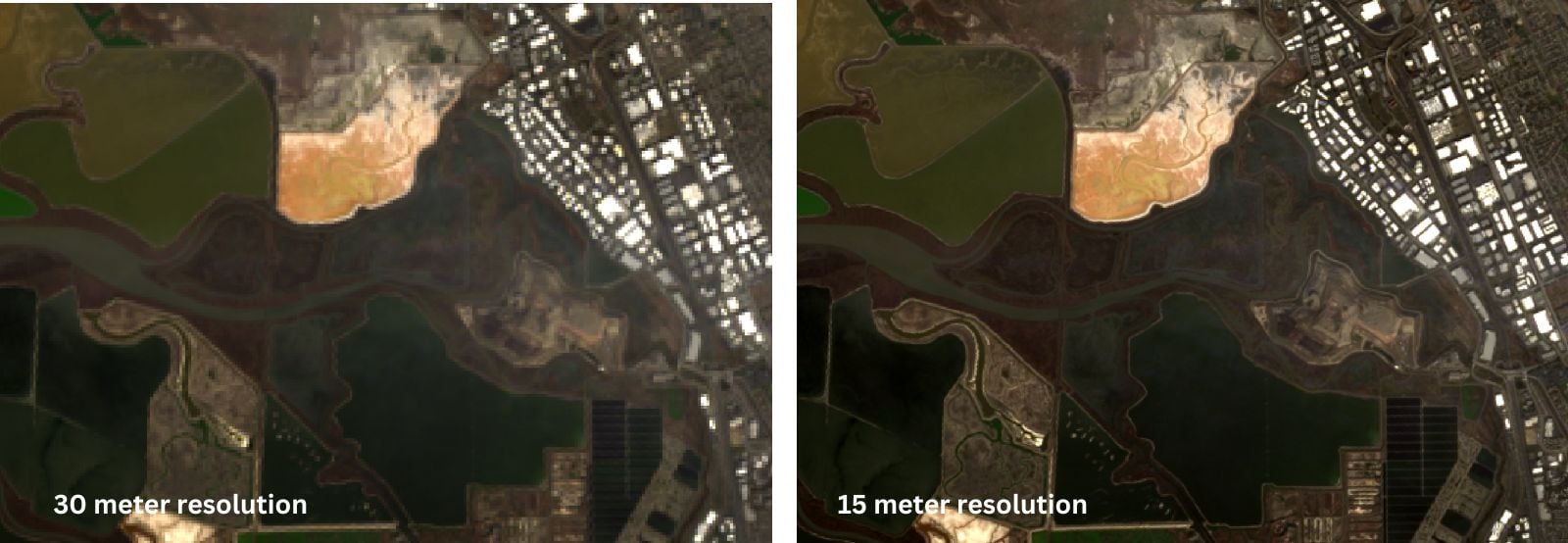
This QGIS tutorial guides you through pan sharpening Landsat imagery by combining the 15-meter panchromatic band with lower-resolution multispectral bands.
How to Find the URL to an ArcGIS Online Web Map and Add it to QGIS
Learn how to find URLs for older feature and map servers hosted on ArcGIS Online so they can be added to QGIS.

How to Use Esri File Geodatabases in QGIS
Learn how to load both Esri vector and raster file geodatabases in QGIS.
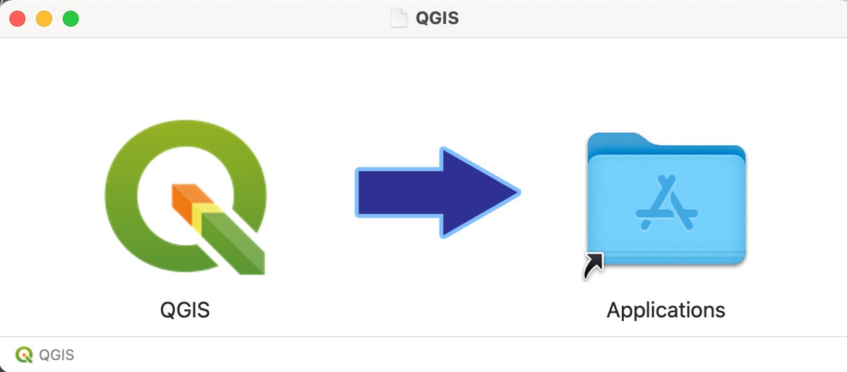
How to Install QGIS on a Mac Computer
Follow these step-by-step instructions on how to install QGIS on a Mac.

Collecting GIS Data in the Field Using QGIS and QField
This QGIS tutorial takes you through the steps to synchronize a map project with QField in order to collect GIS data using a mobile device.
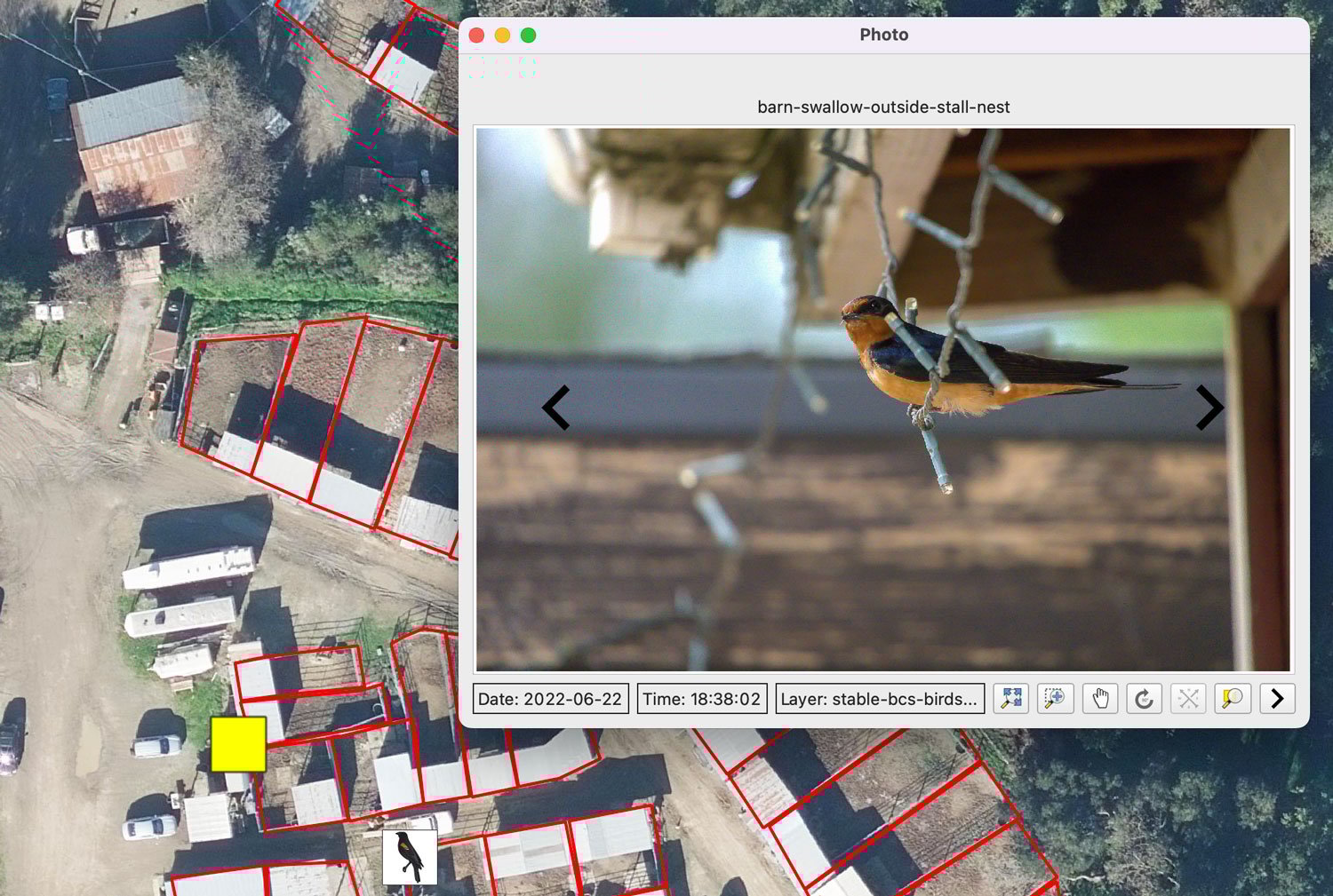
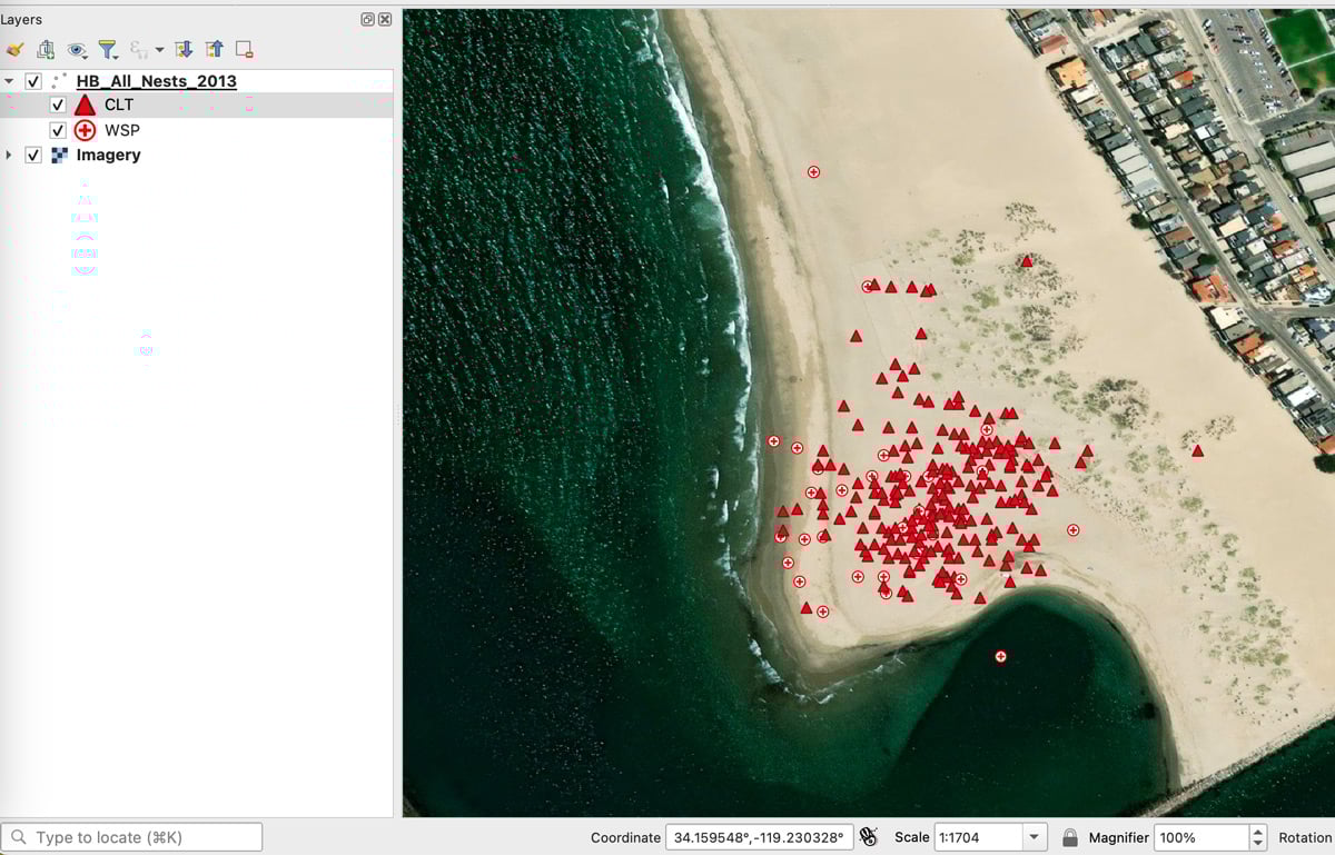
Mapping Geotagged Photos in QGIS
Geotagged photos can be easily mapped out in QGIS by following this GIS tutorial.

Learn How to Georeference a Map in QGIS Using GIS Data
Learn how to georeference scanned maps in QGIS using reference GIS data and control points when no coordinate grid is available.

Change Detection Using Kernel Density Analysis in ArcGIS Pro
This GIS tutorial provides step-by-step instructions for how to use two point datasets to detect changes in ArcGIS Pro using kernel density.

Georeferencing Scanned Maps in QGIS Using Graticules
This GIS tutorial teaches you how to assign geographic coordinates to a scanned map in QGIS using a process known as georeferencing.

Using interpolation to create a surface layer with contours in QGIS
This GIS tutorial shows you how to find elevation data points and create a surface layer and contours using QGIS.
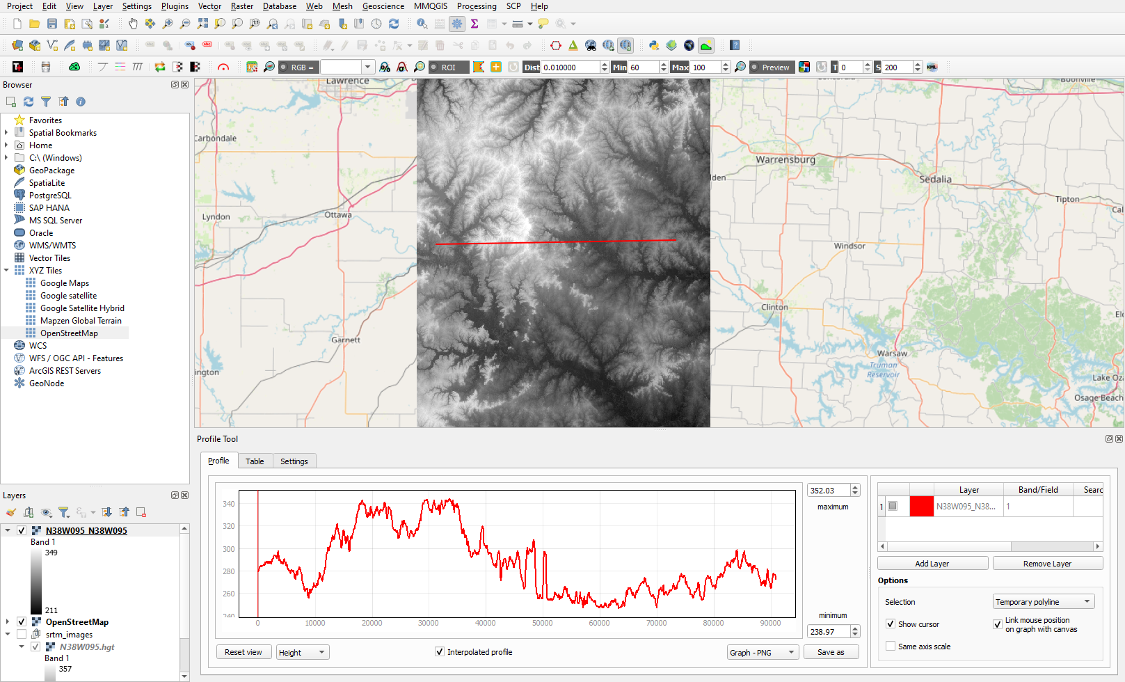
Creating Elevation Cross-Section Profiles with QGIS
Learn to create elevation cross-sections in QGIS with the Profile Tool plugin and SRTM elevation data.

How to Create Isochrone Maps in QGIS
Learn how to create isochrone maps in QGIS to visualize travel times, find the fastest and shortest routes, and analyze accessibility.

Getting Started with the ArcGIS Business Analyst Web App
This GIS tutorial provides a brief introduction to using the ArcGIS Business Analyst Web App.
GIS Tutorials
Online GIS tutorials from Geography Realm for mapping and data analysis.
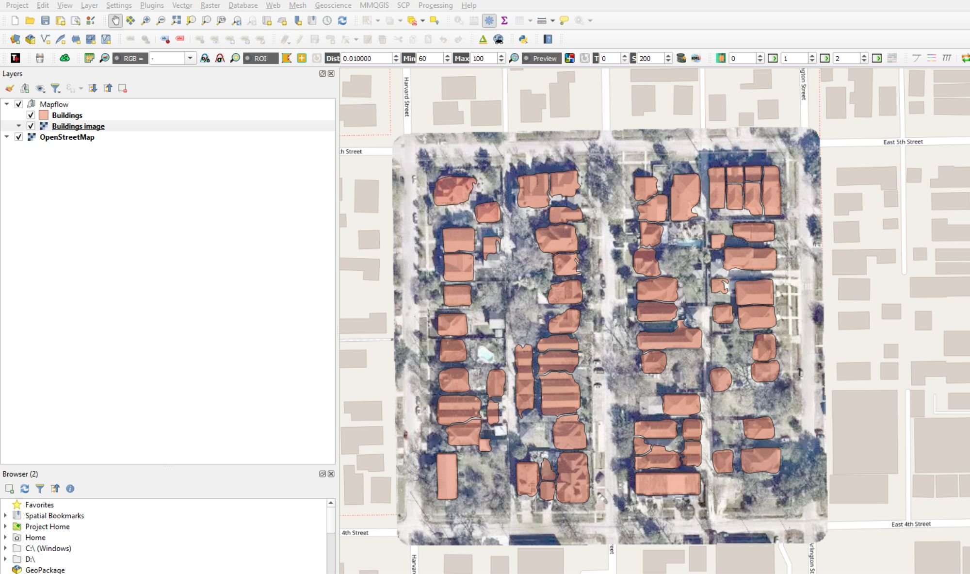
Automatic Digitizing of Imagery Using QGIS
This QGIS tutorial takes you step-by-step through the process of automatically digitizing building footprints using the Mapflow plugin and OpenStreetMap aerials.
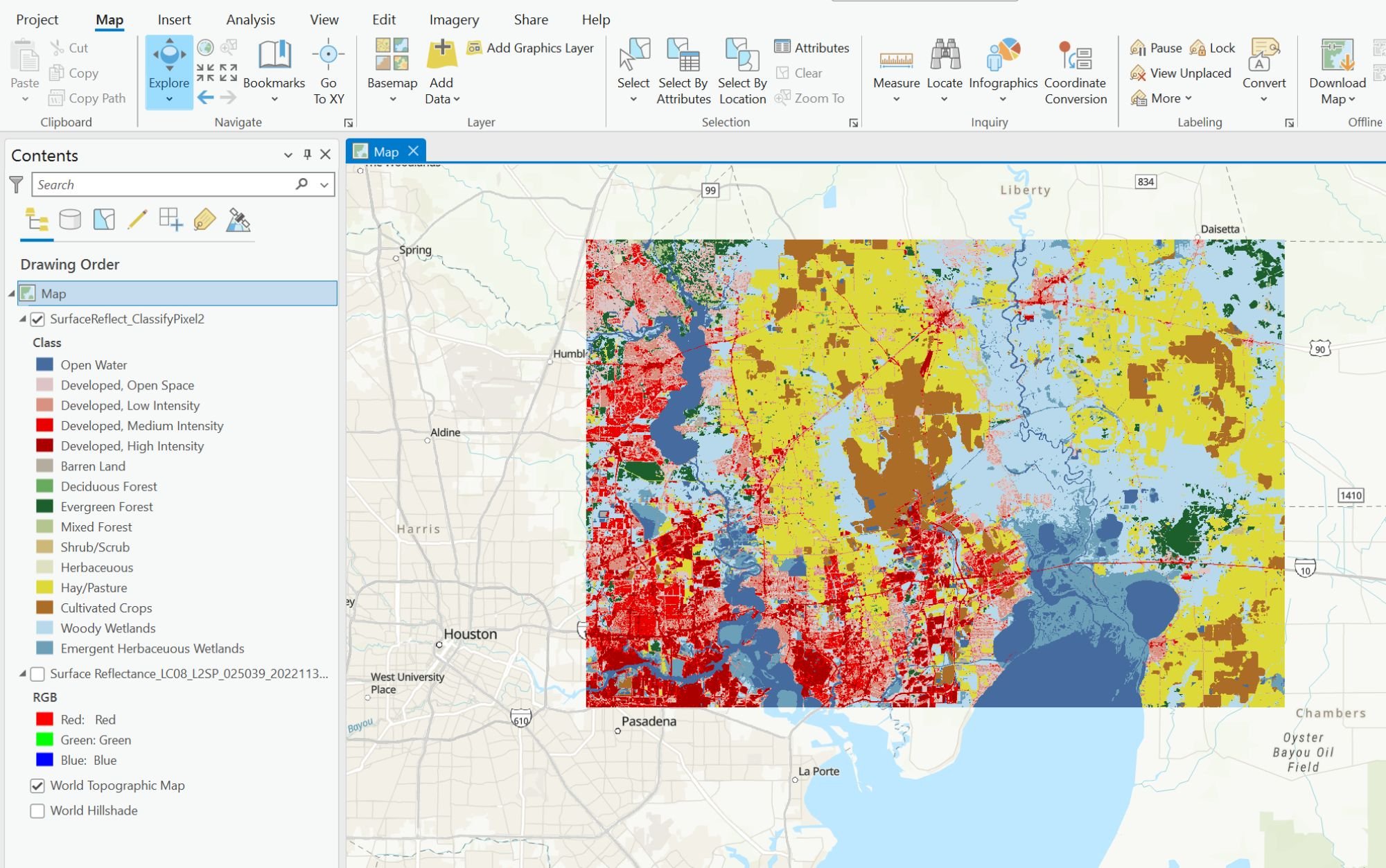
Using Deep Learning to Map Land Cover in ArcGIS Pro
This GIS tutorial provides step-by-step instructions on how to use deep learning models and Landsat 8 satellite imagery in ArcGIS to classify land cover.
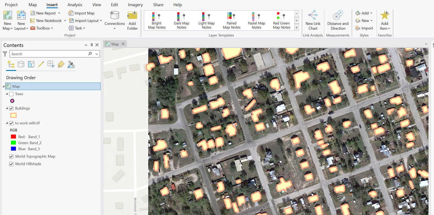
Extracting Building Footprints and Trees from Imagery Using ArcGIS Pro
This tutorial teaches you how to extract trees and building footprints from satellite imagery using ArcGIS Pro.

Mapping Earthquakes with ArcGIS Pro
This step-by-step tutorial shows you how to use USGS data and ArcGIS Pro to map earthquakes and geological faults.

Create a Bathymetric Map Using ArcGIS Pro
This step-by-step GIS tutorial shows you how to create a bathymetry map using ocean data from GEBCO.

Mapping Buildings in 2.5D Using ArcGIS Pro
Learn how to find and use building footprint data from OpenStreetMap to create a 2.5D map in ArcGIS Pro.
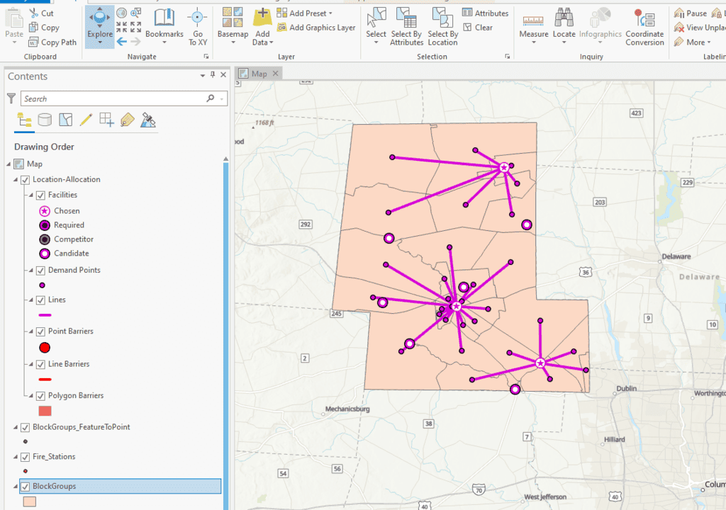
How to Perform Location Allocation Analysis in ArcGIS Pro
This ArcGIS Pro tutorial uses hospital and fire station GIS data to analyze services areas and location allocation.
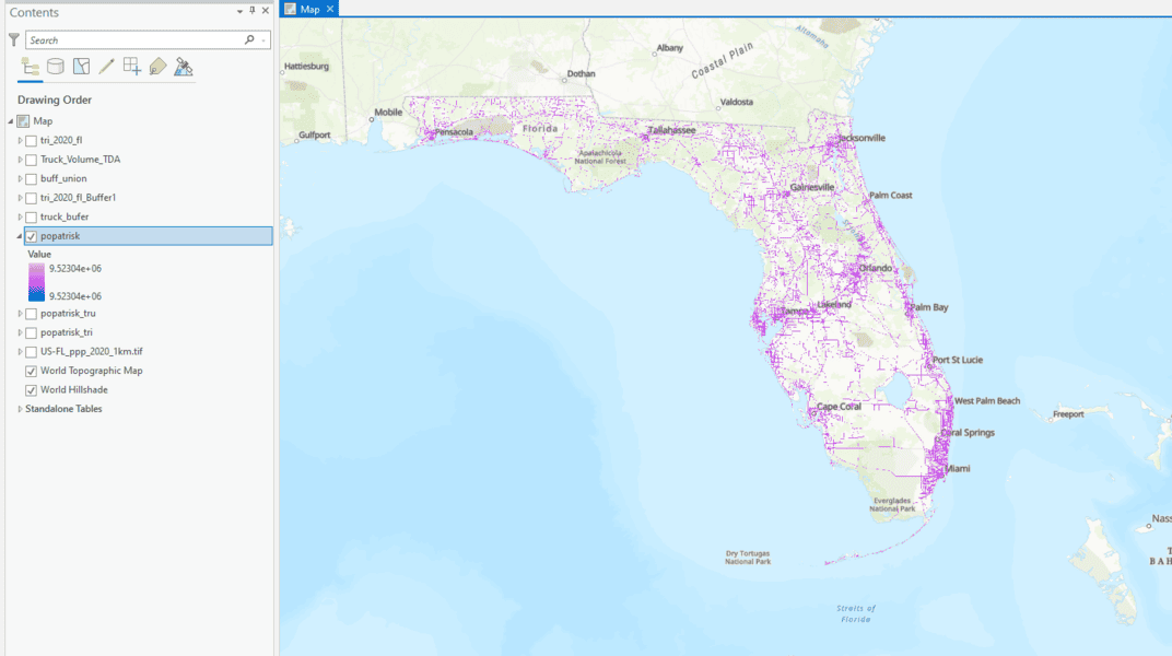
How to Use ArcGIS Pro to Determine the Population Impacted by Air Pollution
Learn to estimate air pollution's impact on people with geospatial methods using ArcGIS Pro and data from Toxic Release Inventory, Worldpop, and ArcGIS Hub.
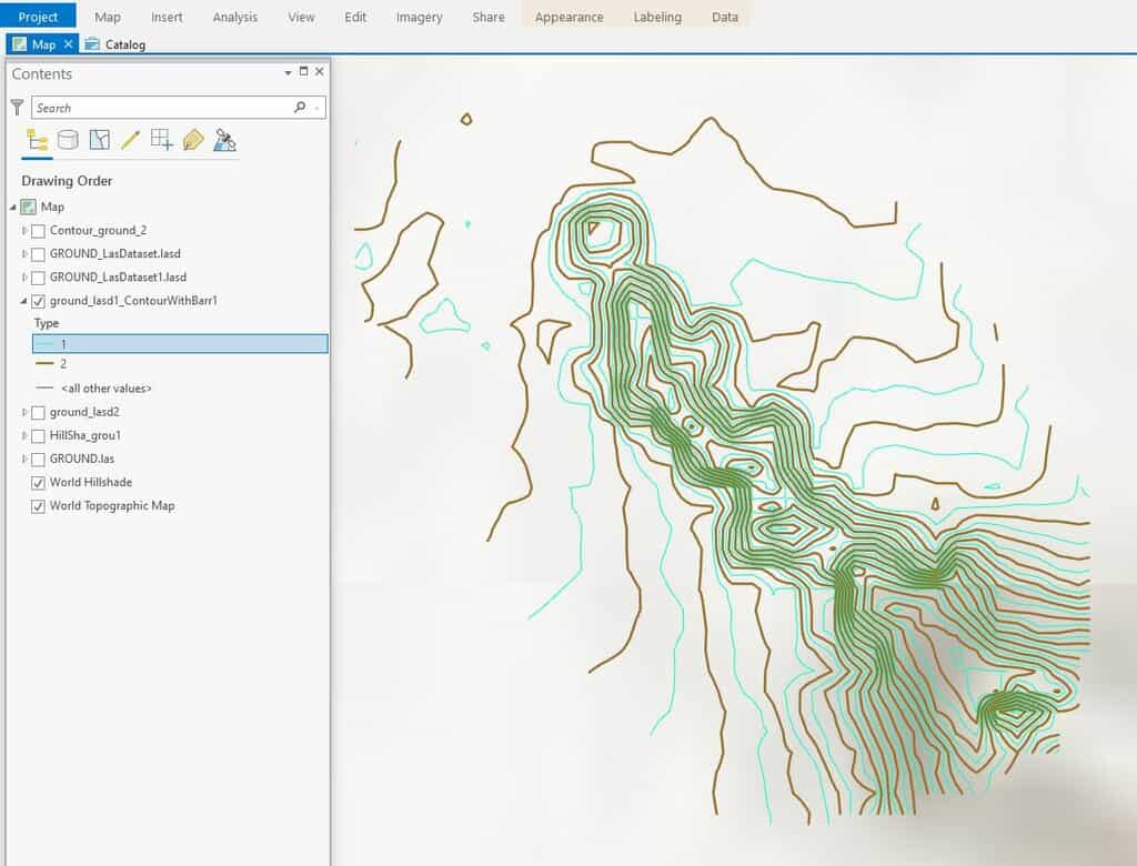
How To Create Contours in ArcGIS Pro from LIDAR Data
This ArcGIS Pro tutorial shows how to add LIDAR data from the National Map to ArcGIS Pro and create topography contours.
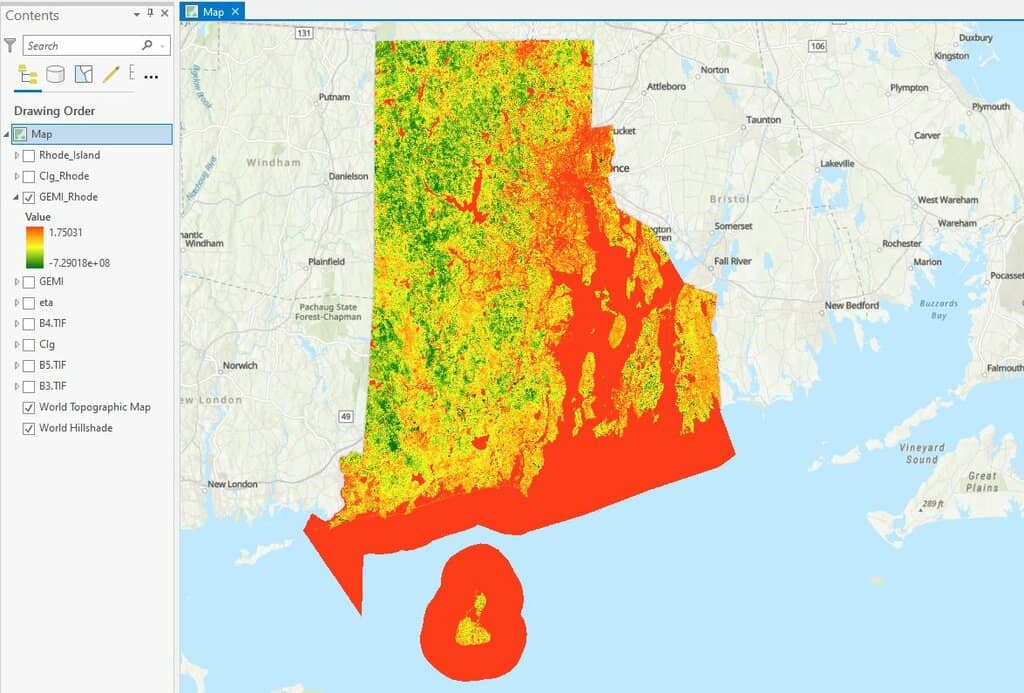
How to use ArcGIS Pro and Landsat 8 Imagery to Calculate Chlorophyll Index and Global Environmental Monitoring Index
Learn to create a chlorophyll index using Landsat 8 imagery in ArcGIS Pro with this step-by-step GIS tutorial.

How to Add Data from ArcGIS Online to QGIS
Adding data from an ArGIS Online Map Service or Feature Service into a QGIS map project is fairly easy and quick in most instances.
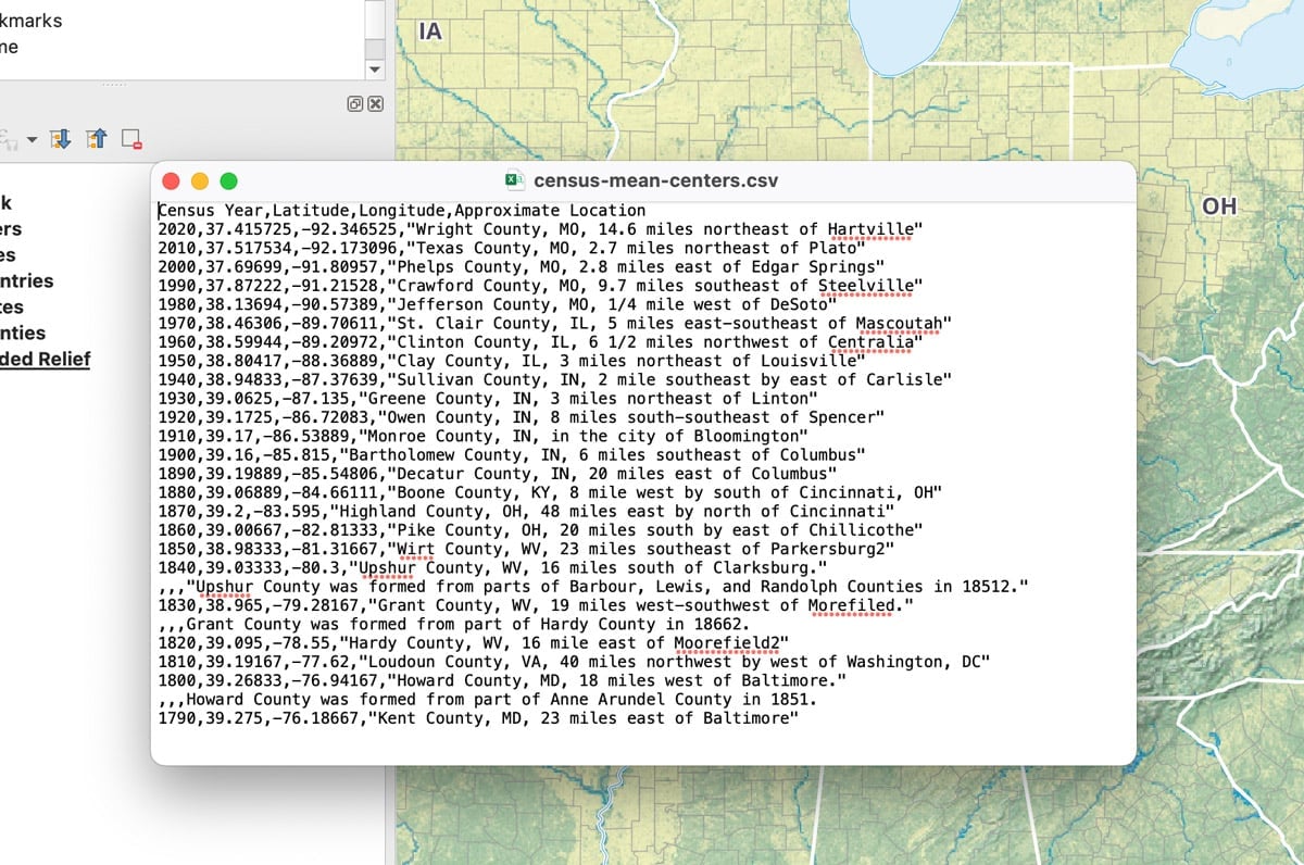
How to Add Latitude and Longitude as a CSV File in QGIS
This quick QGIS tutorial takes you through the steps of how to add a CSV file with latitude and longitude coordinates.