
Articles

Glaciers in the Antarctic Peninsula are Moving Faster During the Summers
Antarctic Peninsula glaciers are speeding up: Analysis of 10,000+ satellite images from 2014-2021 shows increased seasonal velocity in 105 glaciers.

How to Create an Air Pollution Map Using ArcGIS Pro
This GIS tutorial outlines how to use ArcGIS Pro to map air pollution using data from the United States Environmental Protection Agency.

Geography of Alaska
Alaska's geography is characterized by its vast and rugged wilderness, diverse wildlife, towering mountains, expansive coastlines, and unique geological features.

Changes in Ice Cover on the Great Lakes
Ice cover on the Great Lakes varies annually depending on factors such as air temperature, wind, and lake depth.

Why are Most Meteorites Found in Antarctica?
More meteorites have been found in Antarctica than all other continents combined. Why is that?

Europe’s Longest Road and Railway Bridge
The Øresund Bridge connects Denmark and Sweden, spanning the Øresund Strait with a 16-kilometer-long bridge-tunnel.

Universal Transverse Mercator (UTM) Coordinate System
UTM is a precise, grid-based coordinate system ideal for regional mapping and navigation, utilizing 60 zones to minimize distortion.
Real-time Satellite Tracking
N2YO.com is an online service that offers satellite tracking and information in real-time.

Mapping Social Vulnerability to Natural Hazards
Geospatial technology can be used to map social vulnerability to natural hazards, aiding in disaster planning and response.

Solutions for Greening Cities
There are various solutions for implementing green infrastructure in cities including the removal of on-street parking to create space for tree planting.

What is a Closed Lake?
Closed lakes are bodies of water that do not drain into an ocean or river.

Over One Million Barriers on European Rivers
Over one million barriers disrupt Europe's rivers, impacting their flow, ecology, and economies.

Changes to the Global Water Cycle
Researchers are using Earth observation satellites to track changes to the global water cycle.

GIS 101: Learn About GIS
This GIS 101 page is the launch page for accessing information about GIS and geospatial technologies on GIS Lounge.

Type of Map Perspective: Bird’s Eye
Bird's-eye maps are created from an elevated perspective, showing an area as seen from above.

A to Z Geography: Alabama
Here is an alphabetical list of words that relate to Alabama and its geography.

New Techniques for Measuring Biodiversity With Remote Sensing
New satellite imagery techniques make it easier to observe plant biodiversity and map changes over time, allowing conservationists to plan for the future.

Geography of Bees
Bees, crucial pollinators, inhabit every continent except Antarctica. With over 20,000 species, they face threats from climate change and habitat loss.

Wonderful Words to Describe How We Experience Geography
There are some unique words to describe some of how we experience the world around us.
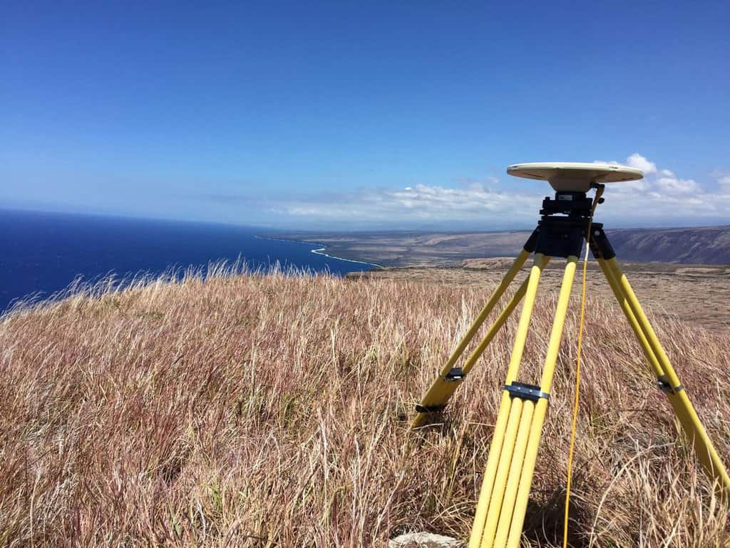
Improving the Accuracy of GPS and GNSS
To improve accuracy and signaling of GPS and GNSS, a new technique that depends on ground-based systems has been developed.
Women in GIS Networking Groups
Web sites with information specifically regarding peer support for women in GIS.

Haboobs in the United States
Haboobs, also known as convectively-driven dust storms, are intense, large-scale dust storms that occur in arid regions in the United States.

Mapping Coastal Ecosystem Change
A collaboration initiative, called coastTrain, helps to provide data so that scientists can better address challenges coastal regions face.

Using Ancient DNA to Reconstruct Past Ecosystems
Two-million-year-old DNA from Greenland's permafrost reveals a rich ancient ecosystem, including mastodons, showing past climate impacts and adaptation.
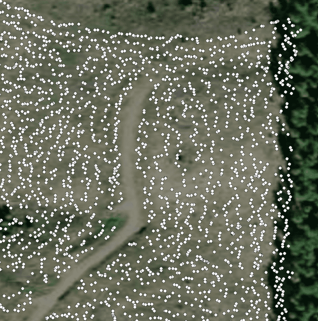
Mapping Trees During Planting
STA Logger, developed by TerraLab, can be fitted with tree planters to map the location of newly planted trees.
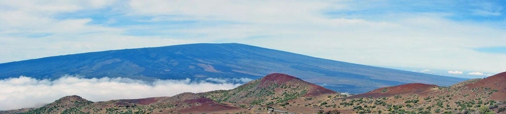
Geography Facts About the World’s Largest Active Volcano
Hawaii's Mauna Loa is the world's largest subaerial volcano as well as the world's largest active volcano.