
Articles

Five Basic Types of Sand Dunes
Sand dunes are mounds, hills, or ridges of sand built by wind. Learn about the five basic types of sand dunes.

GIS and Map Contests
Current map and GIS related competitions listed in order of the competition deadline.

Removing Groundwater is Affecting the Earth’s Axis
Researchers have found that the enormous amount of groundwater being pumped is changing the Earth’s tilt and increasing sea level rise.

Forecasting Wildfire Behavior: Earth Observation and GIS
Advances in GIS, remote sensing, and machine learning are leveraging land and weather data to improve fire prediction models.

R Packages for Spatial Analysis
Looking for R spatial packages? Listed here is a brief look some of the spatial packages in R that are available.

El Niño Has Arrived
After a triple dip of La Niña conditions spanning three years, researchers have officially declared the onset of El Niño on June 8, 2023.
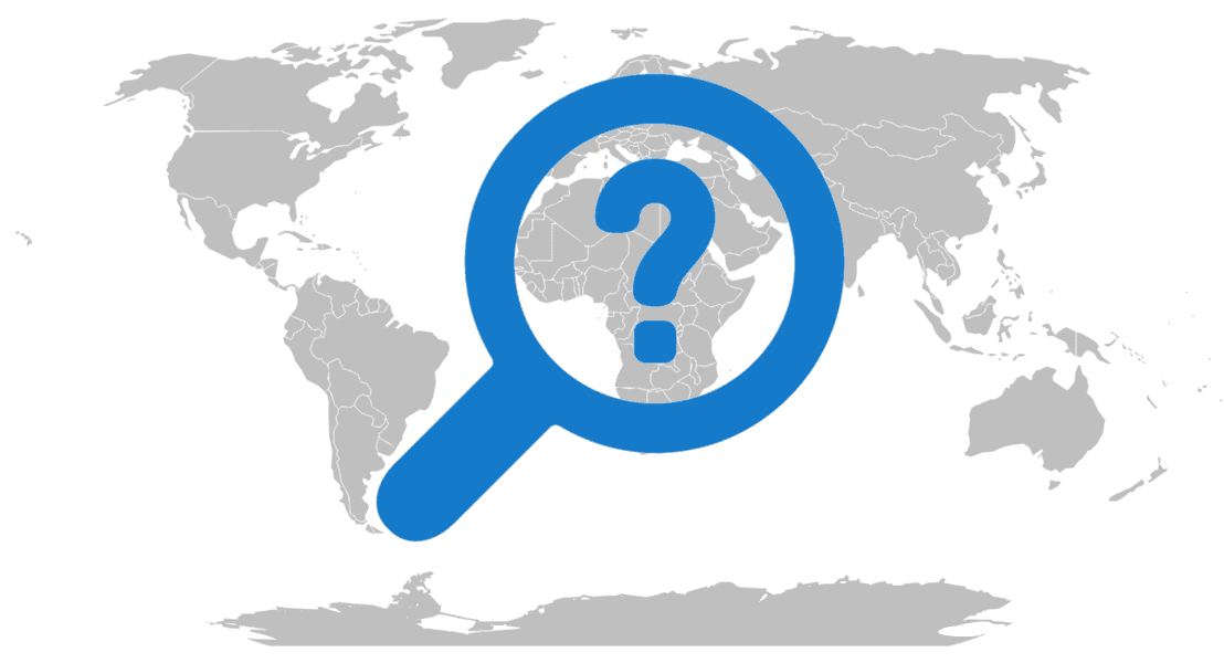
Where Should You Ask Your GIS Questions?
Here are some excellent resources for you to get peer assistance for your GIS related questions.

Causes of Wildfires in the United States
Every year, thousands of wildfires rage across the United States, consuming millions of acres.

Wildfire Smoke From Canada is Affecting Parts of the United States
Smoke from the June 2023 Canadian wildfires is affecting the Midwest and northern regions of the United States.

Zombie Forests in the Sierra Nevada
Climate change is creating a vegetation climate mismatch in the conifer forests of California's Sierra Nevada.
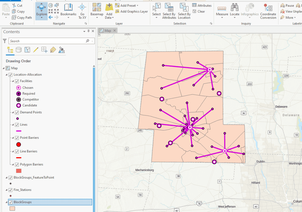
How to Perform Location Allocation Analysis in ArcGIS Pro
This ArcGIS Pro tutorial uses hospital and fire station GIS data to analyze services areas and location allocation.

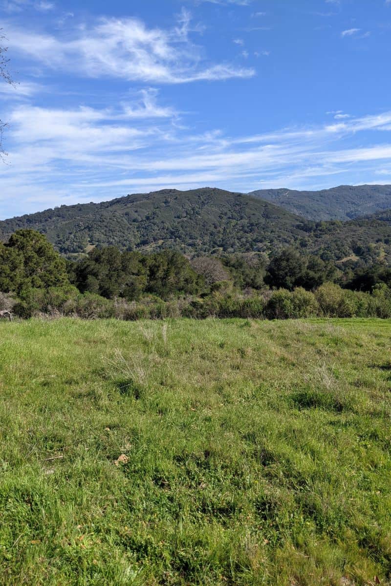
Chaparral in California
Chaparral ecosystems in California are characterized by dense shrubs and rocky terrains and span from maritime zones to mountain slopes.

Blue Carbon Explained
Blue carbon is the carbon captured and stored by the world's oceanic and coastal ecosystems.

Certification in GIS
GIS certification is a professional credential that validates an individual's proficiency in using and understanding geographic information systems.

Geography of Vultures in the United States
The United States is home to three species of vultures: turkey vulture, black vulture, and the California condor.

Cities are Changing Cloud Formations
Researchers looked at cloud patterns over urban areas for 447 cities in the United States using satellite imagery.
Basic Uses of GIS
What are the basic uses of GIS? This article reviews some of the most common and basic users of GIS including mapping data, proximity analysis, buffers, cluster mapping, and querying a geographic area for features.

Scurry Zones Around California Shrubs
Scurry zones are areas of low-lying vegetation that form a ring about some shrubs in Northern California near grasslands.

Examples of Absolute and Relative Location
Here are some examples of the same location described as a relative location and an absolute location.

Mapping Tornado Tracks with Satellite Data
Researchers used satellite imagery and remote sensing to map tornado tracks.

How the Earth’s Terminator Changes With the Seasons
The Earth's terminator is the shifting boundary dividing day and night as a result of our planet's rotation and its position relative to the Sun.
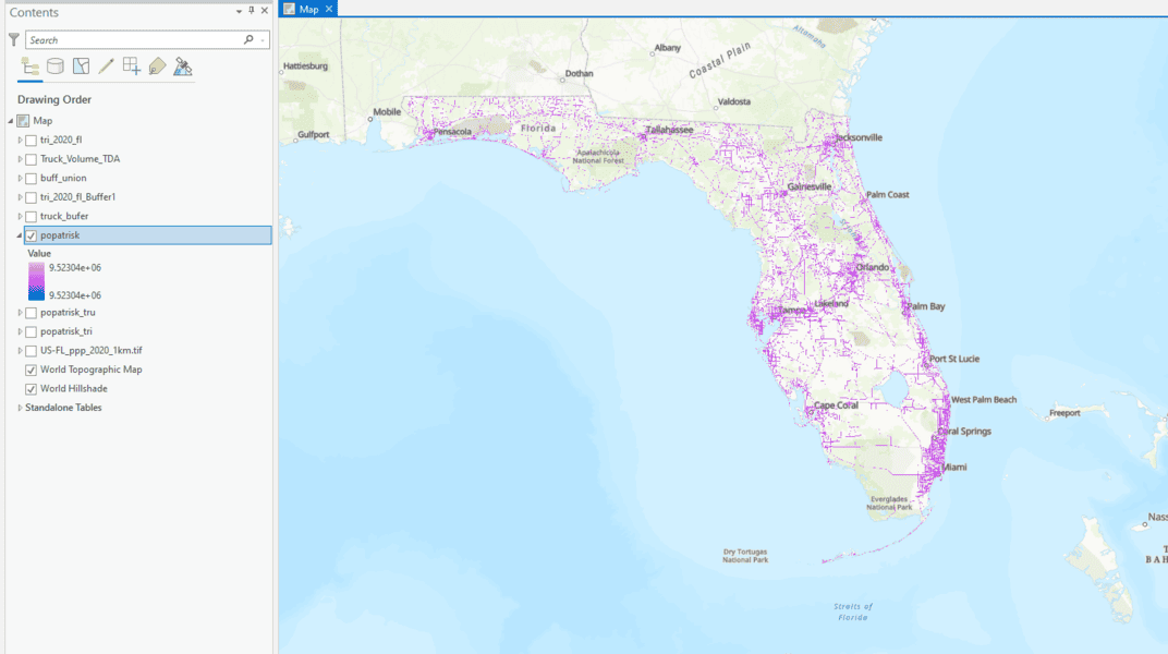
How to Use ArcGIS Pro to Determine the Population Impacted by Air Pollution
Learn to estimate air pollution's impact on people with geospatial methods using ArcGIS Pro and data from Toxic Release Inventory, Worldpop, and ArcGIS Hub.
Free Ways to Learn QGIS
If you want to start learning how to use QGIS, a free and open source GIS software package, there are some excellent free resources out there.

Green View Index for QGIS
Green View Index is a QGIS plugin that uses street-level imagery to measure the amount of vegetation visible to the human eye.
Using Open GIS Data to Map Public Urban Green Spaces
Satellite imagery like Sentinel-2 can help map green spaces. Using OpenStreetMap (OSM) can help to distinguish public and private green spaces.

Snowmelt is Starting in California’s Sierra Nevada Mountains
Due to colder weather and more strong atmospheric rivers, the 2023 Sierra Nevada snowpack levels in California are significantly above average.