
Caitlin Dempsey

Geospatial Data Available: Global Sea-surface Salinity
Data from three satellite missions has been merged to produce a global time-series showing sea-surface salinity measurements between 2010 and 2018.

Thanksgiving Maps and Geography
Thanksgiving maps about this holiday involving major feasting. Maps shown include distribution of turkey, green beans, sweet potatoes, and cranberries by Zellmer and a similar interactive map by Esri.

24 Days of QGIS Tips
Using the #24daysofqgis hashtag, North Road, a geospatial company based out of Australia, will be tweeting out a QGIS tip or trick for 24 days starting on December 1.
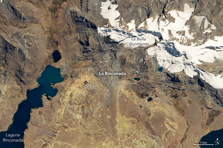
Highest Permanent Settlement in the World
Located at 5,000 meters (3 miles) above sea level, La Rinconada in southeastern Peru is the highest permanent settlement in the world.

Arctic Permafrost is Now Releasing More Carbon Than it Stores
The researchers found that the Arctic region has transitioned from a carbon sink to a source of carbon emissions.
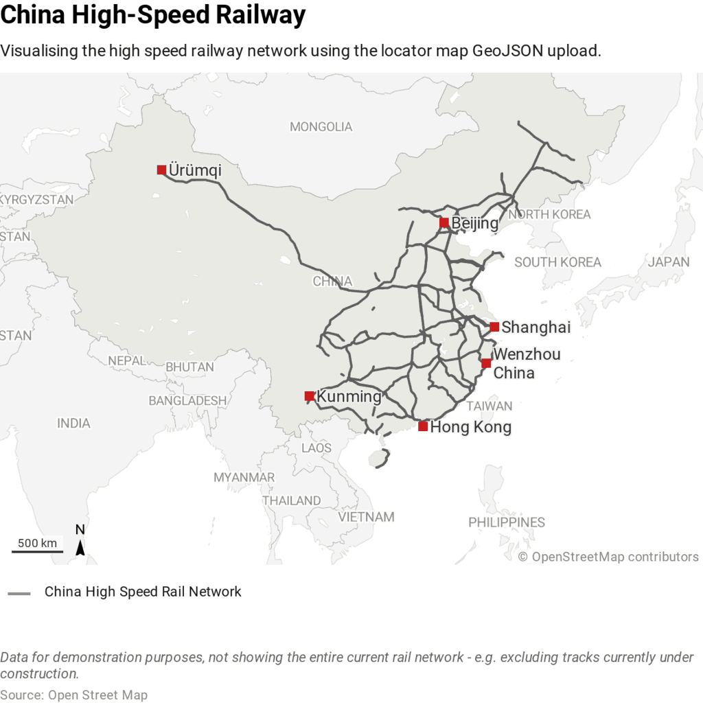
Which Country Has the Most High Speed Rail Lines?
While China only started developed its HSR network in 2003, it has quickly become the country with the most high speed rail lines.

Artificial Intelligence Was Used to Discover a New Nasca Line
Researchers tested out the use of artificial intelligence to assist with finding new Nasca lines.
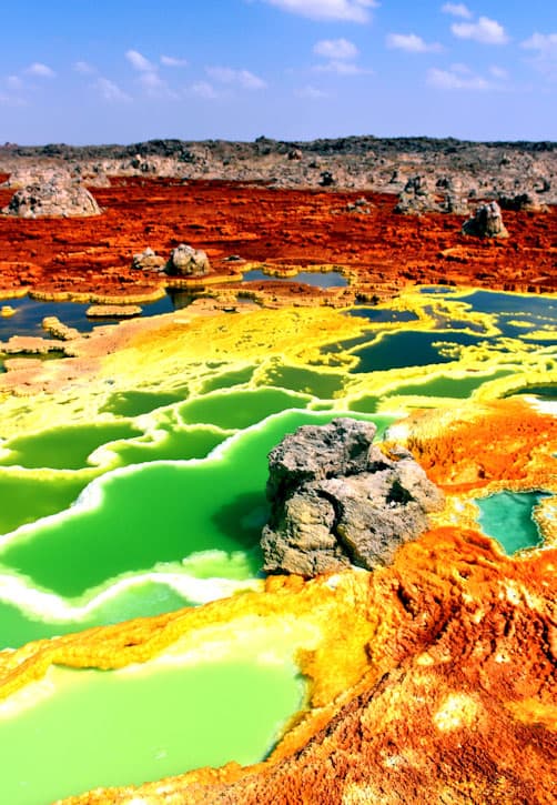
A Place on Earth Where No Life Exists
Researchers recently discovered at least one location on Earth that lacks any discernible life forms.

How New York City is Protecting Its Subway System Against Flooding
A flex-gate is a highly flexible covering that can be quickly deployed to protect a subway's entrance and underground structures in the event of a flood.

View From Space: Australia’s Wildfires
The Moderate Resolution Imaging Spectroradiometer (MODIS) on NASA’s Aqua satellite acquired a natural-color image acquired this image of smoke rising from wildfires burning in New South Wales (NSW) and Queensland.

Small-scale Deforestation is on the Rise in the Amazon
Researchers analyzed forest loss rates across the entire Amazon between 2001 and 2014.

I’m a…. the GIS Profession in One Word
How do you describe GIS as a profession in as few words as possible?

How Ice Balls Form
When conditions are just right, a strange phenomenon called ice balls or ice eggs can form along beaches during the winter months.
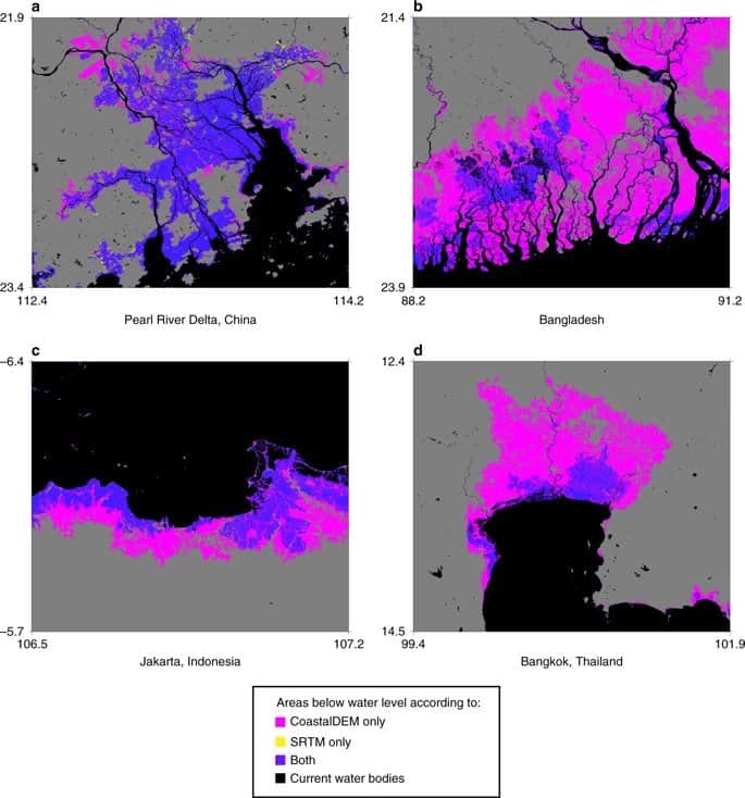
Researchers Estimate Triples the Number of People Affected by Sea Level Rise
New estimates from Climate Central estimate that 340 million to 480 million people would be affected by flooding in coastal areas due to sea level rise.

What is the Difference Between an Earthquake Swarm and Aftershocks
Learn about the difference between an earthquake swarm and an aftershock.

Mapping Out California’s Methane Emissions
With half of the methane emissions originating from human activities, researchers from NASA wanted to map out point-source emitters in California to understand where the highest volume of methane emissions occur.

PennVet Uses GIS to Identify Disease Hot Spots
Dr. Meghann Pierdon with the University of Pennsylvania’s School of Veterinary Medicine has developed a secure website that uses GIS to map out the incident of diseases among pigs or birds.

Largest Expanse of Sand in Ukraine
Located in southern Ukraine is the largest sand area in the country.
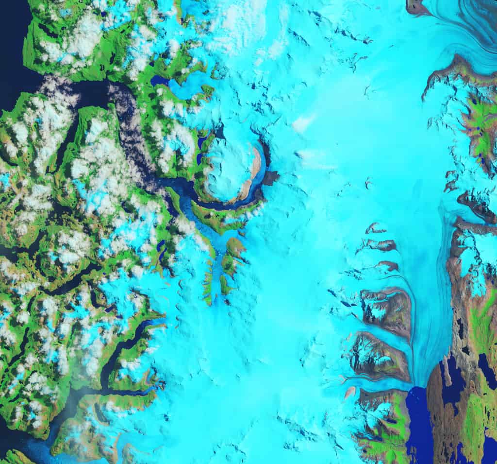
Fastest Thinning Glacier
Hielo Patagónico Sur 12 (HPS-12) in Patagonia is believed to be the fastest thinning glacier in the world.

New Report Values Economic Benefits of Landsat Archive at $3.45 billion
A newly released report from the USGS has estimated the 2017 domestic and international economic benefits of Landsat imagery to be $3.45 billion.

Earliest Published Research Linking Carbon Dioxide with Global Warming
163 years ago, Eunice Newton Foote was the first scientist to research the link between increased carbon dioxide and a warmer atmosphere.

How to Use GIS to Make a Lego Map
Depending on the GIS software you want to use, there are a few different ways to create a Lego-style map.

First High Resolution Map of the U.S. Food Supply Chain
A team of researchers used data from several federal sources and the Oak Ridge National Laboratory to produce the first high resolution map of how food moves around the United States.

Portable GIS
Portable GIS is a collection of open source GIS software applications and tools that can be run from a portable drive.

Malvinas Current
The Malvinas Current is a cold water current that flows northward along Patagonia's Atlantic coast.

This Lake is Home to the Highest Concentrations of Lesser Flamingos in East Africa
The protective salt marshes that ring Lake Natron in Tanzania have nurtured the highest concentrations of lesser and greater flamingos in East Africa.