
Caitlin Dempsey

Physical and Chemical Weathering of Rocks
Weathering is the breaking down of rock material by physical or chemical processes.

Nature Emerges as People Shelter-in-Place During the Coronavirus Outbreak
As people shelter-in-place during the coronavirus outbreak, animals come out to roam and skies are clearer in some places.

Urban Fish Get Less Sleep
Researchers looked at the effect of different nighttime light levels on the production of melatonin in European perch.

Gerrymandering Map Font
Designers Ben Doessel and James Lee created a free font that forms the letters of the alphabet using congressional district shapes.

Can GPS Work on the Moon?
NASA researchers found that existing GPS satellites can provide navigational signals to the moon, aiding astronauts in future lunar missions.

What is the Difference Between Elevation and Altitude?
The geography terms altitude and elevation have slightly different meanings.

As the Ozone Layer Recovers it is Changing Wind Patterns
Researchers from the University of Montreal used satellite data and climate modeling to understand how the recovery of the ozone layer has affected the Earth's atmosphere.

Open Access Novel Coronavirus Data
A newly published article in Nature's Sci Data decribes how epidemiologists collected and curated individual-level novel coronavirus data from a variety of national, local, and news sources.

See the First Atlas Created of a Country
The "Atlas of the Counties of England and Wales," published in 1579, is the first atlas produced for any country.
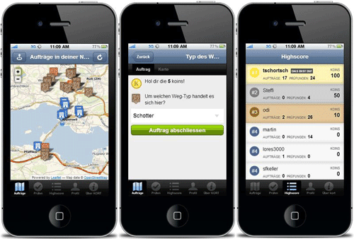
How to Volunteer Your GIS and Cartography Skills
Those with GIS and cartography skills that want to volunteer to help out can do so remotely with these calls for actions as mapping non-profits respond to the coronavirus pandemic.

GIS and Cartography Material Available for Online Teaching
Several institutions and professors have offered up readily available online resources that can be used to virtual teach cartography and GIS courses.

Higher Carbon Dioxide Makes Grasslands Less Nutritious for Grasshoppers
One group of researchers looked at more than 40 species of grasshopper in the Konza Prairie in Kansas to see the effect of changing plant nutrients on insect populations.

Fire and Drought in the Amazon is Decimating Dung Beetle Populations
Fire and drought are killing off dung beetles in the Amazon.

Access Open GIS Data for Almost 11 Million Trees with OpenTrees
Developed by Steve Bennett, OpenTrees.org lets you visualize and download GIS data for almost 11 million city and park trees around the world.
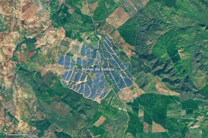
Europe’s Largest Solar Energy Plant
With 1,430,000 solar panels, Núñez de Balboa in Spain is currently Europe's largest solar plant.

Updated Global Elevation Data Released by NASA
A new global digital elevation model (DEM) has been released by NASA.

This Detailed Map Shows 119 Years of Earthquakes
The USGS has released a highly detailed and updated map of seismicity from 1900 to 2018.


Using Twitter to Map Nuisance Flooding
To get a better understanding of localized flooding, the researchers mined Twitter data for geolocated tweets to fill in the gaps in data about flooding.

Most Tourists Don’t Stray Far From the Road When Taking Photos in National Parks
Cartography students mapped out 800,000 geotagged photos posted to Flickr to analyze how far those pictures were taken from a road.

Mumbai Police Fighting Noise Pollution With Enforced Patience
In an effort to lower noise levels, the Mumbai Police have set up noise meters at select traffic signals around the city called "Punishing Signals".
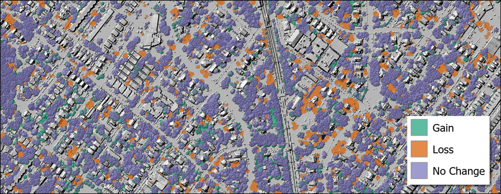
Using GIS to Assess Urban Tree Canopy
The University of Vermont Spatial Analysis Lab used spatial analysis to map out how the city of Philadelphia's tree canopy changed between 2008 and 2018.

How to Add Leader Lines to Labels in QGIS
The release of QGIS version 3.10 brought with it the native capability to add leader lines to labels.

Why Do Groundhogs Really Emerge on February 2?
Why do groundhogs emerge around February 2? Hint: it's more to do with Valentine's Day.
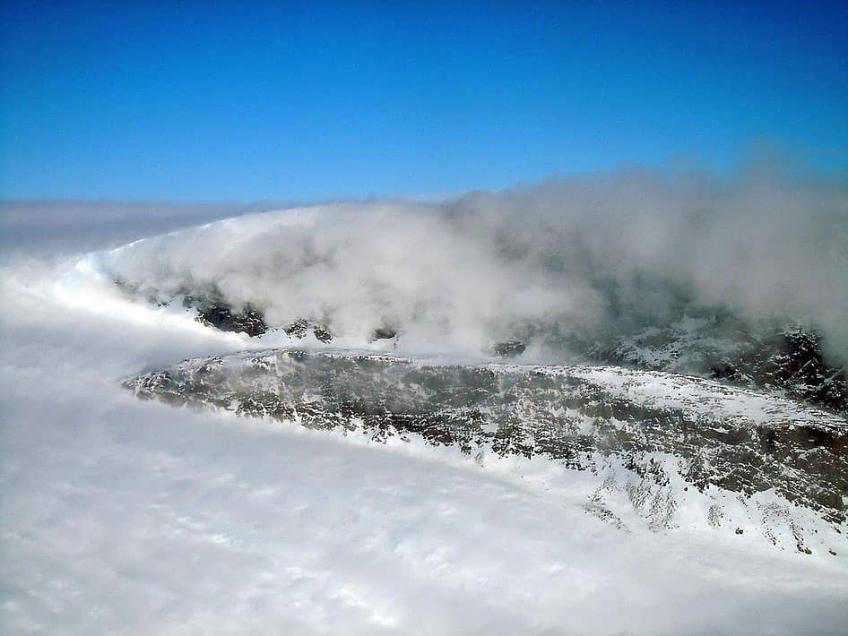
What is a Snow Devil?
Miniature vortexes of wind can stir up snow in a formation known as a snow devil.

GIS Data of the Moon’s Geology
The USGS has released GIS data from its new Unified Geologic Map of the Moon.