
GIS and Geospatial Technologies
Articles focusing on the application of geographic information systems (GIS), geospatial technologies, remote sensing, LiDAR, and Global Positioning System (GPS). These technologies serve as critical tools for understanding and interacting with our physical environment. GIS allows for the mapping and analysis of spatial data Geospatial technologies refer to the various tools used to measure and analyze Earth’s lands and resources. Remote sensing provides a way to collect data from a distance, often via satellites or high-flying aircraft, and is commonly used for environmental monitoring and military applications.
GIS subcategories :
GIS Career | GIS Data | GIS Industry | GIS Learning | GIS Software | GPS | Remote Sensing | Spatial Analysis

A Story Map Journalism Experience
Eudel Cepero shares his experience developing a popular story map for Diario de Cuba using ArcGIS Online.

Seeing the World with Data: 3D LiDAR with MapD and Uber’s deck.gl
Dipti Kothari, an intern with MapD, has developed an open source project that uses LiDAR to create a 3D visualization of tree coverage around buildings and the impact of rising sea levels on buildings on Jekyll Island, GA.

PaleoDEMs: Map the Earth’s Changing Topography Over the last 540 Million Years
Users can download paleogeographic datasets reconstructing paleotopography and paleobathymetry dating back to 540 millions years ago

GIS and Cancer Screening
GIS can aid cancer screening, especially for cancers linked to environmental, socio-economic, and resource factors.
Mapping Elephant Distribution with Remote Sensing and GIS
A variety of applications using GIS, remote sensing and GPS tracking of individuals per collars have advanced in the last years and are increasingly used for mapping and tracking elephants.

Accessing Real-time Satellite Imagery and Data
NASA's LANCE and EarthNow, a space imaging business, are paving the path to real-time and near real-time satellite data.

Ocean and Land Observation Data From Sentinel-3B
The main mission of the recently launched Sentinel-3B is to provide quality ocean and land monitoring. As part of the Copernicus program, GIS data and imagery will be made freely available.

Creating Ground-level Views from Satellite Imagery
Recreating a ground-level image and perspective using satellite imagery has only recently been developed.

A New Global Peatland Map Expected for 2020
A new global high-resolution peatland map is expected for 2020.

Geospatial Artificial Intelligence: Emerging Trends and Challenges
There are both challenges and opportunities that Artificial Intelligence (AI) has in applying geospatial and GIS knowledge that also addresses issues of time and spatial bias.
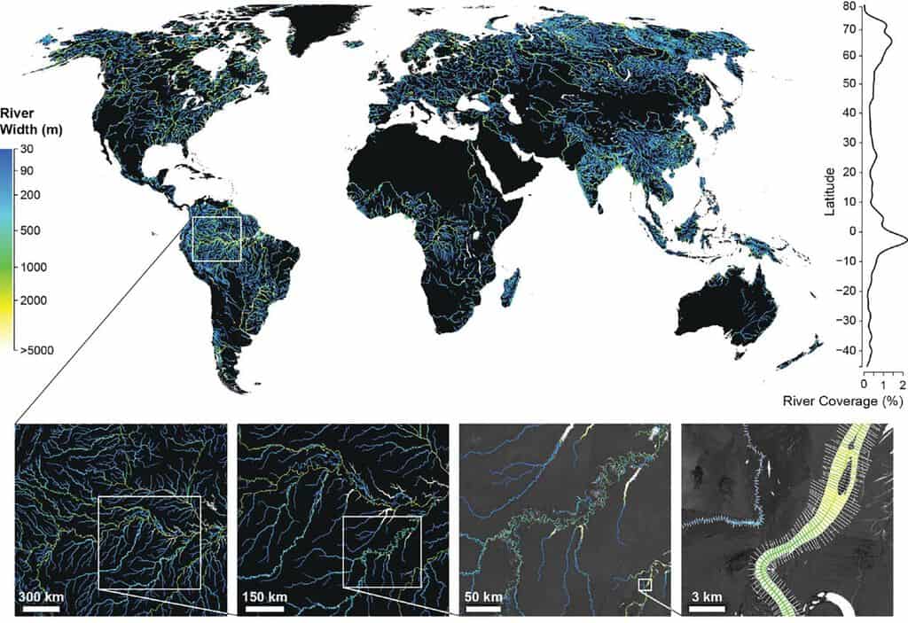
Global Dataset of River Widths Developed from Landsat Imagery
Researchers used a combination of satellite imagery and field measurements coupled with statistical modeling to calculate worldwide river and stream surface measurements which is now available as a GIS dataset.

Future of Mobile Spatial Applications and Image Recognition
Image recognition software and algorithm development is likely to be increasingly applied with spatial applications.
125 Million Building Footprints in the US Now Available as Open GIS Data
Microsoft has made 124,885,597 footprints from all 50 U.S. states available as open data.

Improving Geospatial Data Search
Open standards and protocols have facilitated data sharing and application for spatial information on the web such as using Web Map Service (WMS).

Learn to Use GIS to Map and Analyze Surface Water Data
Esri Press recently published a book to teach users how to use GIS to analyze surface water using the National Hydrography Dataset produced by the USGS.

Swarm Satellites Bring New Findings About Ocean Magnetism
In 2013 the European Space Agency (ESA) launched a trio of satellites called “Swarm”, which are specialized in capturing Earth’s magnetic activity including ocean current magnetism

Ready for Summer – Remote Sensing of Bathing Water Quality
Remote sensing is being used to help researchers monitor water quality in lakes and coastal areas.
The Modifiable Areal Unit Problem and GIS
For most GIS practitioners, modifiable areal unit problem (MAUP) is something to be aware of when different analytical techniques are applied.
Run Image Processing Tasks in Your Browser with the EOS Platform
This guest article by EOS introduces the newly upgraded EOS platform, a set of mutually integrated cloud products for searching, analyzing, storing, and visualizing geospatial data: Landviewer, Processing, Vision, Storage.
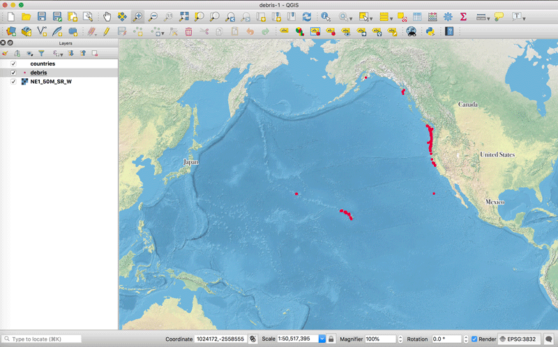
QGIS Tutorial: How to Change the Map Projection to be Centered Over the Pacific Ocean
This quick tutorial shows you how to recenter your map project in QGIS so that the center of the map view is on the Pacific Ocean.

How to Use the Color Blind Preview Option in QGIS
With the release of QGIS 3, you can now preview how your maps will look for those with two types of red-green color blindness.

How Much Do GIS Jobs Pay?
Your potential salary as a GIS professional is going to vary depending on several factors such as the location of the job, the title, and experience.

Mapping and Assessing Landscape Suitability for Bee Migration
Research highlights how GIS and remote-sensing techniques can be used to evaluate and map areas that are suitable for bee populations.

Regulations Affecting the Use of Drones in India
Bankim Chandra Yadav, a Ph.D. student at Indian institute of Technology Roorkee, discusses unmanned aerial vehicles (UAVs) technological implications under the Indian government laws.

The Rise of African Mapping Technologies
Stuart E. Hamilton, GIS Graduate Director at Salisbury University in Maryland, discusses why he considers East Africa to be a leader in geospatial education and opportunities.
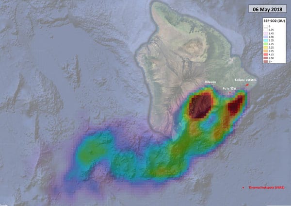
Sentinel-5P Tracking Emissions from Hawaii’s Kīlauea Volcano
Researchers are using data from the Sentinel-5P satellite to map out sulphur dioxide emissions from Hawaii's Kīlauea volcano.