
Caitlin Dempsey

Canada Geese Migrate Less from Urban Areas
With the expansion of urbanization, more Canada geese are becoming year round residents instead of migratory.

GIS Reference Books and Materials
Here are some books and GIS reference resources that are valuable for both the novice and seasoned GIS user.

How Ships Create Clouds Over the Oceans
Ships can create a trail of clouds as they travel over the world's oceans.
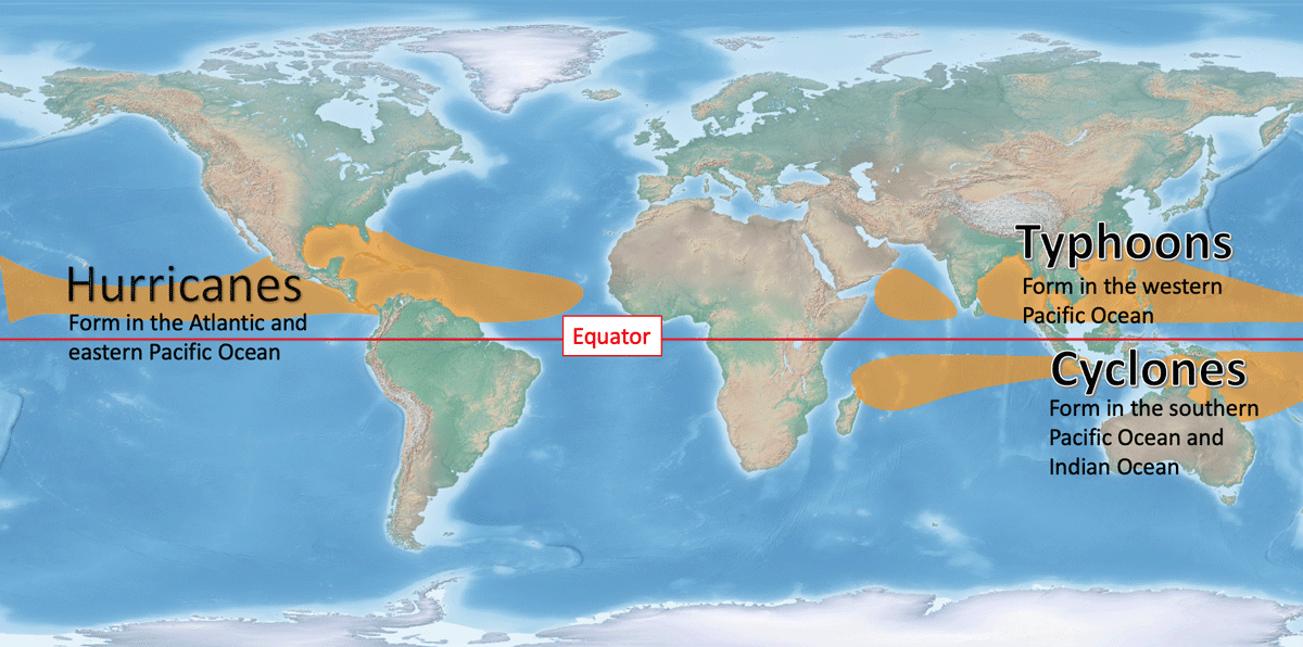
Tropical Cyclones: Hurricanes, Typhoons, and Cyclones
Depending on where the storm system develops, it will be called a hurricane, typhoon, or cyclone.

Geography Facts: Rhode Island
Learn geography trivia about the smallest state in the United States.

Circumhorizontal Arc: Rainbow in the Clouds
When conditions are just right, clouds can act like prisms, turning the rays of the sun into a brilliant color show.

Cartographic Resources
Discover effective spatial data display and map design. Access resources on color representation, map layout, and showcasing geospatial information.

Early Wildfires in New Mexico
Wildfires in New Mexico are are starting earlier each year due to warmer and drier conditions.
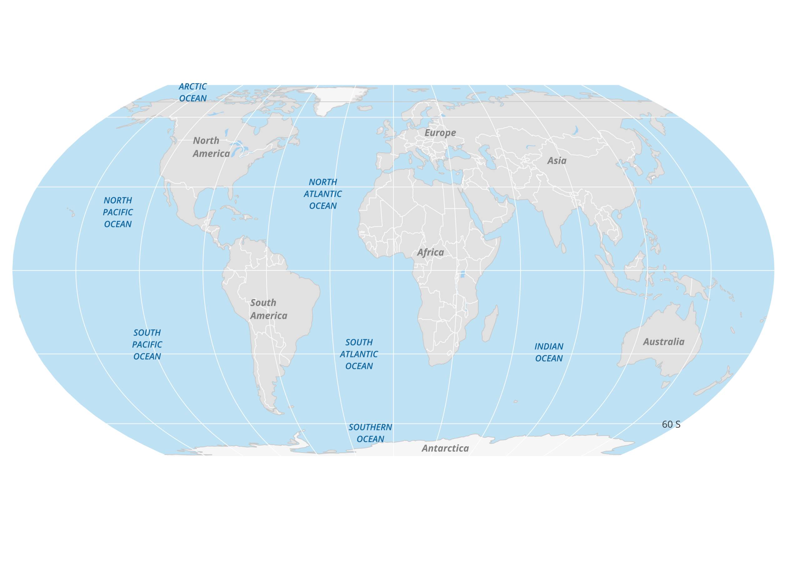
Geography Facts About the Atlantic Ocean
The Atlantic Ocean, named after the Greek god Atlas, is the second-largest ocean in the world.
GIS Job Definitions
What are the different types of geospatial job listings out there? Listed here is the list of different GIS, which ...

Bewick’s Wren
The Bewick's Wren (Thryomanes bewickii) is a small songbird native to North America.

Lidar Explained
Lidar is a technology developed to map the elevation of features on and below the surface of the Earth.
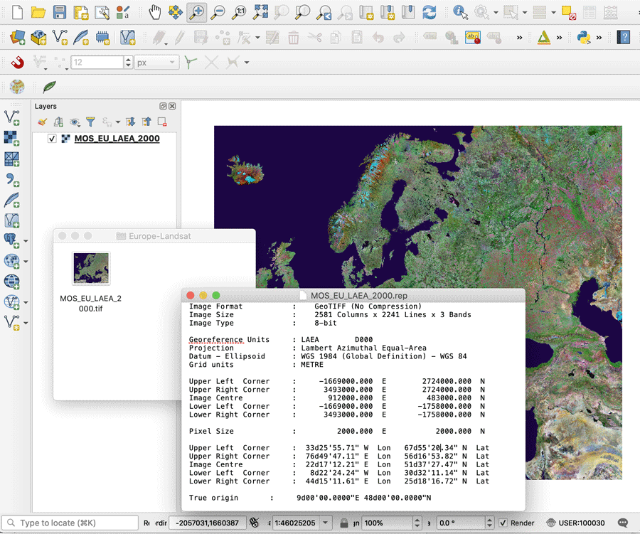
What is a GeoTIFF?
A GeoTIFF is a public domain metadata standard which has the georeferencing information embedded within the image file.

ZIP Codes in the United States
It’s likely that if you routinely send mail to a location within the United States, you know how critical it ...
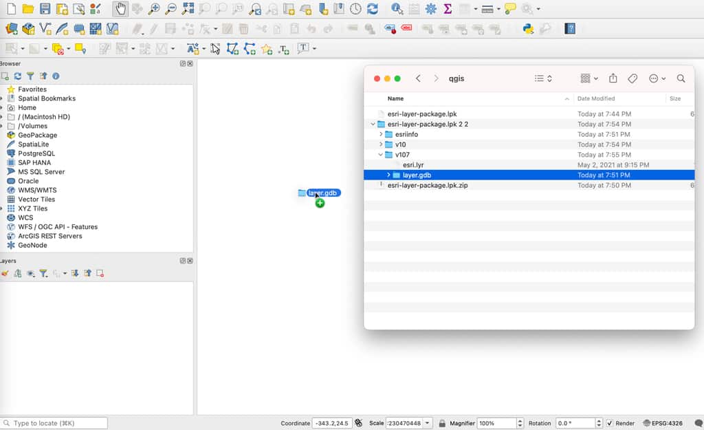
How to Import an Esri Layer Package in QGIS
While QGIS cannot directly read an Esri layer package, there is a simple technique to unpack the file and import it into this GIS software.

Endemic, Native, Non-native, and Invasive Species
Learn what the terms endemic, native, non-native, or invasive mean for animals and plants.

Study: Afforestation Can Lead to More Cloud Cover
Increased forest cover can lead to more low lying clouds which helps to cool the Earth.

First Maps
These maps are the earliest known representations of a particular geography, name, or geographical phenomenon.

Which U.S. States are Landlocked?
There are 27 states in the United States that are single, double, or triple landlocked.

Curling Stones Come from Two Quarries in the World
Almost all of the granite harvested to create curling stones comes from a small isle off the coast of mainland Scotland.

Hearts on Earth
Geographers have a spatial way to celebrate Valentine's Day with these natural heart-shaped land features.

Distance Decay in Geography
Distance decay between two groups of people gives rise to things like languages and regional customs, and distance decay across biomes contributes to the earth's natural diversity.

Test Your Knowledge of World Geography with these Online Games
Geoguesser is an online game that uses images from Google Street View to display a small section of the world.

Largest Plateau in the World
The Qinghai–Tibet Plateau is the world's largest plateau.

Arctic Circle
The Arctic Circle is a circle of latitude encompassing the northernmost pole of the Earth and is located at approximately 66°33′45.6″ north of the Equator.
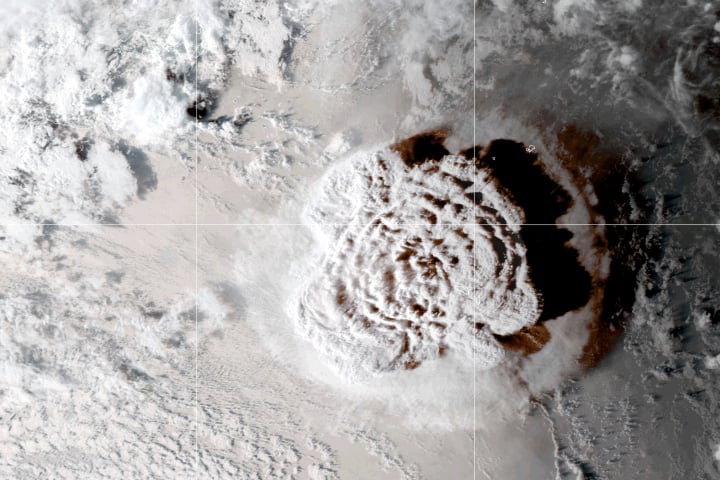
How Big Was the Tonga Volcanic Eruption?
Tonga was rocked by an undersea volcano eruption on January 15, 2022, which sent shockwaves throughout the planet.