
Caitlin Dempsey

Cloud Streets
Cloud streets are cumulus clouds that form in long bands along cylinders of rotating air and are roughly parallel to the ground.

The First Newly Formed Island to Survive in the Satellite Era
The first newly formed island to survive in the age of remote sensing is Hunga Tonga-Hunga Ha'apai.

Groundwater on Earth
Groundwater can be divide into two major zones: unsaturated and saturated.

The Largest Cactus in the United States
The Saguaro Cactus is the largest cactus in the United States

Oldest National Park in Europe
Established in 1909, Sarek in Sweden is Europe's oldest national park.


Geography Facts About Yellowstone National Park
Learn some quick and fun geography facts about Yellowstone National Park.

Only Two Towns in the World Have an Exclamation in Their Name
Only two towns in the world have an exclamation mark as part of their formal names.

Six Things You Should be Doing to Enhance Your GIS Career
Here are six focus areas you should be working on to further your GIS career.

GIS Day and PostGIS Day Are Coming Up
November 18, 2020 marks the 21st anniversary of GIS Day. The following day is PostGIS Day.

Geography of Corn in the United States
The United States produces one-third of the world's corn.

Using Giant Arrows to Guide Airmail Flights
The Transcontinental Airway System guided nighttime airmail flights before the invention of radio navigation and GPS.

Geography of Igneous Rocks in the United States
About 15% of the Earth's present land surface is made up of igneous rocks.

Melting Glaciers and Larger Lakes
A global survey that used satellite data has determined that overall, glacial lakes have increased in volume almost 50% since 1990.
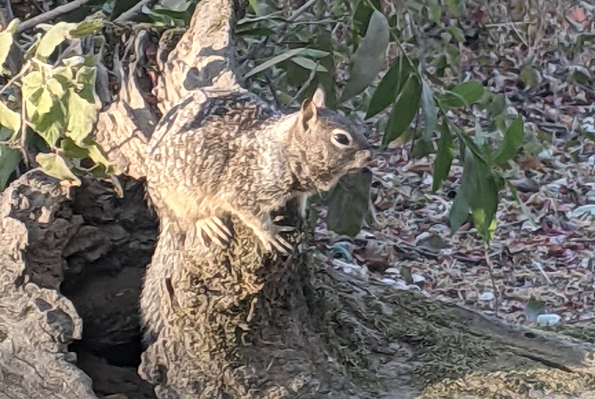
Camouflage: Ways Animals Blend in With Geography
Camouflage is a way for animals and insects to blend in with their surroundings in order to avoid detection.

Geography Facts about Kīlauea
Kīlauea is the youngest and most southeastern volcano on Hawaii island.

The Shortest River in the United States
The shortest river in the U.S. is Montana's Roe River, which stretches only 201 feet.

Geography of Pumpkins in the United States
Pumpkins are a popular gourd for Halloween and Thanksgiving in the United States.


Which Country is the Least Densely Populated?
Found out which country is the least densely populated and which territory is the least densely populated in the world.

Making Joy Plots with GIS
Joy plots is a cartographically creative way to show topography on a map. Learn how to create joy plots using GIS.

53% of U.S. Ocean, Coastal, and Great Lakes Waters are Unmapped
According to a new report by the United States' federal Interagency Working Group on Ocean Coastal Mapping, 53 percent of the country's ocean, coastal, and Great Lakes water is still unmapped.

Geology Quick Facts for Each U.S. State
Listed here are the official state rock, gemstone, mineral, and fossil for each U.S. State.

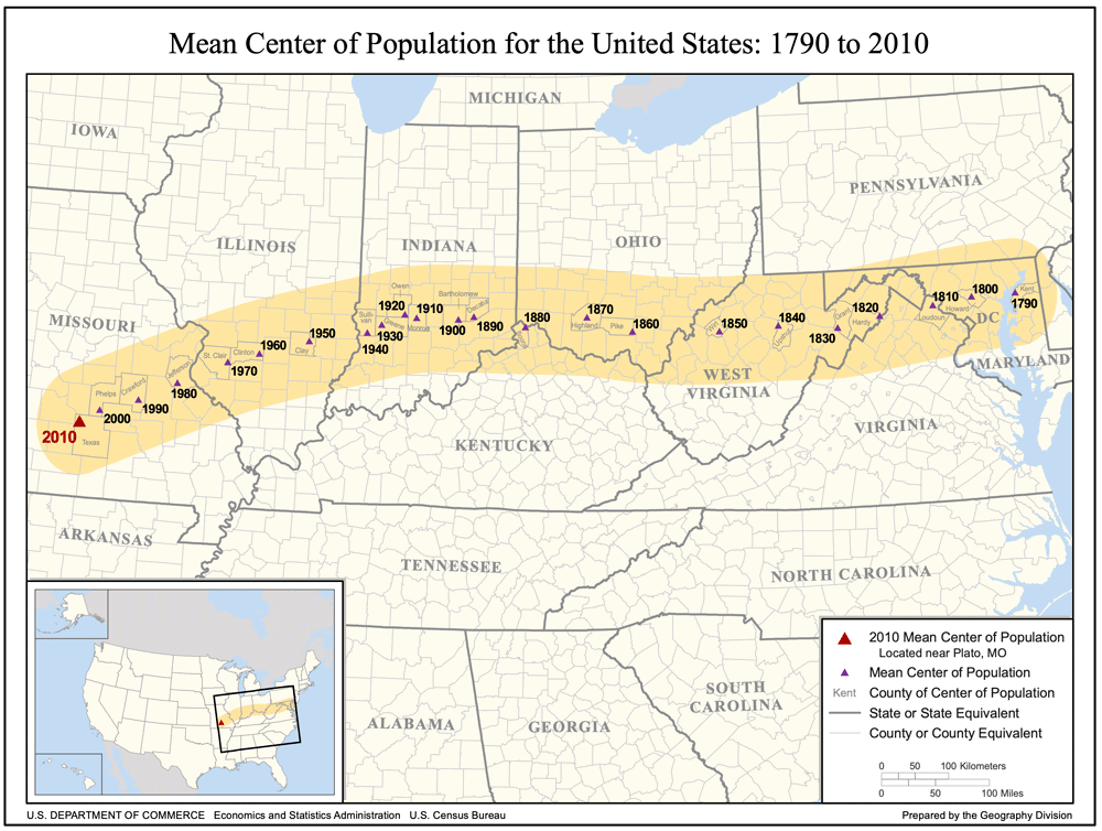
Population Geography of the United States
The United States represents a vast area of land with 3.79 million square miles (9.83 million square kilometers) in size. A ...
![[Map of California shown as an island], Joan Vinckeboon, ca. 1650.](https://www.geographyrealm.com/wp-content/uploads/2021/08/map-california-island-1650-Vinckeboons.jpg)
California as an Island
Well into the 17th and 18th centuries, cartographers created maps of the region showing California separated from the mainland by a strait.