
Caitlin Dempsey

South America’s Only Natural Oasis
Located in the sand dunes in southwestern Peru on edge of the Atacama desert is the only natural oasis in the continent of South America.

The World’s Human-Made Materials Weigh as Much as All Life on Earth
Researchers have calculated that 2020 is the year that the mass of human-made materials exceeded the mass of all living organisms on Earth.

The Sea of Galilee’s Water Levels are on the Rise
Heavy rains have helped the water level in the Sea of Galilee to rebound.

Understanding and mapping ZIP Codes
Resources for accessing ZIP code data. Ben Fry has created zipdecode that shows the location of all the ZIP codes in the United States.

Free Online Geocoder
Online geocoder services will generate latitude and longitude coordinates for a list of addresses.
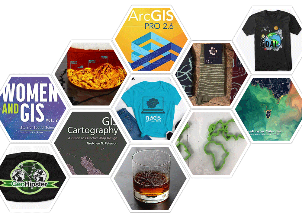
2020 Gift Guide For the GIS Person in Your Life
Looking for a gift for your favorite GIS person? Here's a list of geo-related suggestions for a range of budgets.

Geography of Thanksgiving
Each November, families in the United States gather to celebrate Thanksgiving.

QGIS Style Sharing Repository
A new tool has been deployed that lets QGIS users share style files.
Sub-branches of Human Geography
Human geography focuses on the role that human play in the world.

The Only Metric Highway in the United States
Currently, only three countries in the world have not adopted the metric system as the standard: The United States, Myanmar, and Liberia.

What is the AP Human Geography Exam?
The AP Human Geography exam requires in depth knowledge and analytical skills in a range of topics in the sub-branch of geography.

Halloween GIS Fun
Looking to add a little geo to your Halloween beyond the proliferation of Halloween Trick or Treater online maps? Halloween ...

Three of Colorado’s Wildfires are the Largest in Recorded History for the State
Widespread drought and heat waves are helping to fuel a record-breaking fire season in Colorado.
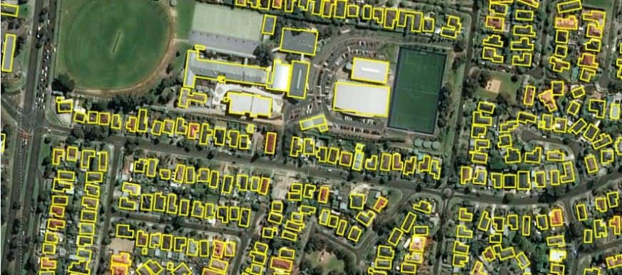
11,334,866 Building Footprints for Australia
Microsoft has released 11,334,866 building footprints covering the country of Australia.

Blue Moon on Halloween 2020
For the first time since 2001, October will have two full moons.
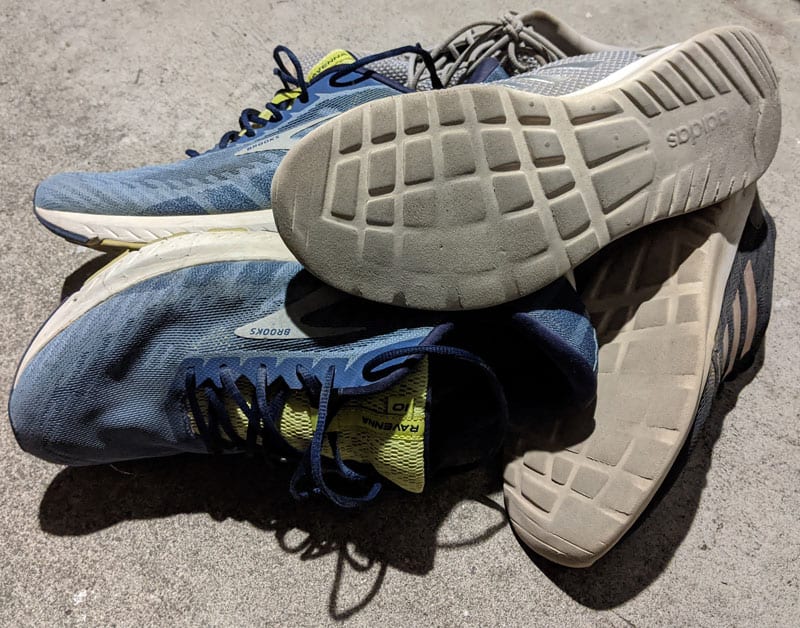
How to Recycle Sneakers
There are a few options for recycling or donating your old sneakers.

This Island is the Westernmost Point of the United States
Located towards the end of the Aleutian Island chain, this Alaskan island is the westernmost spot in the United States.

What is a Mountain?
While it is widely assumed that a mountain is higher than a hill, there is no universally accepted definition of a mountain.

What are the Top Geography Programs in 2020?
The latest QS World University Rankings by Subject reveal updated rankings for Geography departments around the world.

Mapping Crops: Filling in Data Gaps with Landsat Archives
A recent study analyzed twenty years of Landsat data to look at corn and soybean crops across the US Midwest from 1998-2018.

Why Do Crows Flock in Large Numbers?
Why do crows start gathering in large numbers at certain times of the year?

Paulette Returns as a Zombie Storm
Paulette briefly evolved back into a tropical storm, making it a zombie storm according to NASA and NOAA.

Survey of GIS Professionals
A quick look at GIS professionals, their educational background, and the software tools and programming languages they use in their jobs.

What is a Medicane?
Medicane is a tropical-like cyclone that forms in the Mediterranean Sea.

Carbon Monoxide from the California Wildfires
As wildfires burn in California, carbon monoxide is rising high up into the atmosphere where a NASA satellite is capturing readings.

Five Tropical Cyclones in the Atlantic Basin
There are currently five tropical cyclones active in the Atlantic Basin.