
GIS and Geospatial Technologies
Articles focusing on the application of geographic information systems (GIS), geospatial technologies, remote sensing, LiDAR, and Global Positioning System (GPS). These technologies serve as critical tools for understanding and interacting with our physical environment. GIS allows for the mapping and analysis of spatial data Geospatial technologies refer to the various tools used to measure and analyze Earth’s lands and resources. Remote sensing provides a way to collect data from a distance, often via satellites or high-flying aircraft, and is commonly used for environmental monitoring and military applications.
GIS subcategories :
GIS Career | GIS Data | GIS Industry | GIS Learning | GIS Software | GPS | Remote Sensing | Spatial Analysis

GIS 101: Learn About GIS
This GIS 101 page is the launch page for accessing information about GIS and geospatial technologies on GIS Lounge.
Women in GIS Networking Groups
Web sites with information specifically regarding peer support for women in GIS.

Mapping Coastal Ecosystem Change
A collaboration initiative, called coastTrain, helps to provide data so that scientists can better address challenges coastal regions face.

Mapping Long-term Land Use Change with Remote Sensing Data
Discover how remote sensing technology is used to map land use changes, providing valuable insights into environmental impacts and aiding conservation efforts.

GIS Data: A Look at Accuracy, Precision, and Types of Errors
What are the types of error found in GIS data? This article reviews the difference between accuracy and precision and explains the most common types of error found in GIS data.
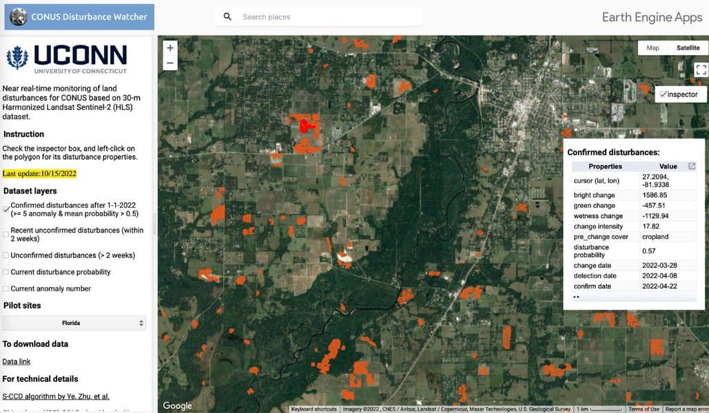
Using Geospatial Technologies to Map Hurricane Response
Using satellite data and artificial intelligence, researchers have developed a way to rapidly map hurricane destruction.
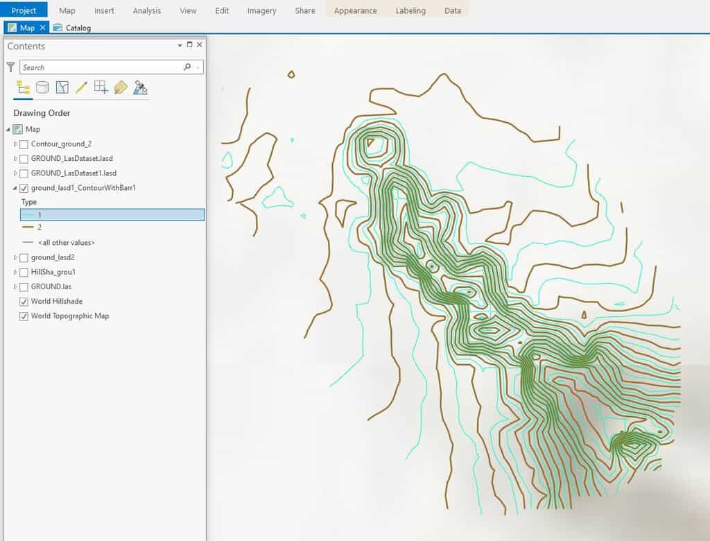
How To Create Contours in ArcGIS Pro from LIDAR Data
This ArcGIS Pro tutorial shows how to add LIDAR data from the National Map to ArcGIS Pro and create topography contours.

GIS and Spatial Interpolation Methods
The use of spatial interpolation methods in GIS have proven vital from areas such as public health to interpreting weather patterns.

Open Source GIS and Freeware GIS Applications
There are many open source GIS and web mapping applications to choose from.

Heat Maps in GIS
Heat mapping, from a GIS perspective, is a method of showing the geographic clustering of a phenomenon.

What is the Difference Between GIS and Geospatial?
There are differences in what the terms GIS and geospatial mean.
Free GIS Books
Most of these free GIS books are available in downloadable PDF format and can be read from a computer or on an eBook reader.
Ten Tips to Prepare for a GIS Job Interview
Got a portfolio? Kristina Jacob presents ten tips for preparing for a GIS job interview.
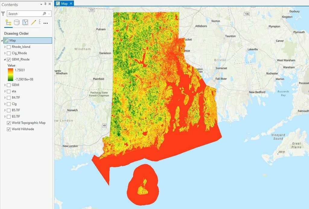
How to use ArcGIS Pro and Landsat 8 Imagery to Calculate Chlorophyll Index and Global Environmental Monitoring Index
Learn to create a chlorophyll index using Landsat 8 imagery in ArcGIS Pro with this step-by-step GIS tutorial.

Finding GIS Data and Using QGIS to Map Caves
Dackery Geiman outlines the challenges he encountered finding geospatial data about caves and using QGIS to map cave density in Missouri.

GIS in Land Use Planning and Surveying
Michael Parks explains how he used GIS data and imagery to develop geospatial analysis and maps to recommend potential base camp sites.

Using GIS to Map Fly Fishing Destinations
William Bakemeyer describes how he used QGIS and open source data to create a fly fishing map.

Remote Sensing for Carbon Offsetting
Remote sensing and geospatial technologies are being harnessed for carbon offsetting efforts.

QGIS from a Graduate Student’s Perspective
Kent Campbell writes about how he has come to view the benefits of using QGIS as a graduate student.

Mapping Heat Vulnerability from Satellite Data
Satellites are being used to measure heat not only on urban heat islands, but also on farms and other locations where rising temperatures are having an impact.

Mapping the Earth’s Freshwater Bodies
Over 95% of the world's lakes, rivers, and freshwater reservoirs will be measured by a new satellite mission called Surface Water and Ocean Topography (SWOT).

Crowdsourcing Archaeological Data with Participatory GIS
People with little or no training in archaeology or geographic computing systems can build GIS data using Humap's Placemaker.

Using Open Source Geospatial Data in Journalism
Geospatial data such as satellite imagery can be used by journalists to verify news stories.

How to Add Data from ArcGIS Online to QGIS
Adding data from an ArGIS Online Map Service or Feature Service into a QGIS map project is fairly easy and quick in most instances.

Landsat: Longest Running Earth Imagery Program
With satellites in orbit since 1972, the Landsat program is the longest running Earth observation program.

A Roundup of Geospatial Podcasts
Here's a list of GIS / geospatial podcasts you can listen to.