
Articles
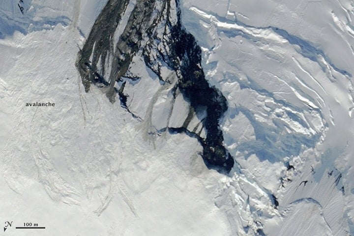
Forecasting and Mitigating Avalanches Using GIS
GIS and computational specialists have been developing models and methods to better forecast the likelihood of avalanches.

Review | The Selected Letters of Cassiodorus: A Sixth-Century Sourcebook
A millennium and a half ago, or so, if you wanted to break away from the western Roman Empire, you simply called in the barbarians.

How to Communicate with Maps
Making maps requires a careful balance between science, art, and knowledge of your target audience. Features a MapScaping podcast with Esri's John Nelson.
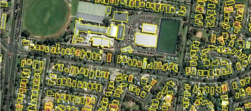
11,334,866 Building Footprints for Australia
Microsoft has released 11,334,866 building footprints covering the country of Australia.

Blue Moon on Halloween 2020
For the first time since 2001, October will have two full moons.

WWF Report: Wildlife Has Declined 68% Since 1970
In their latest Living Planet 2020 report, WWF revealed that global wildlife is facing catastrophic decline.
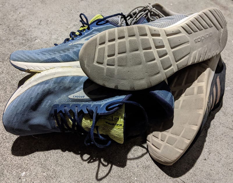
How to Recycle Sneakers
There are a few options for recycling or donating your old sneakers.

This Island is the Westernmost Point of the United States
Located towards the end of the Aleutian Island chain, this Alaskan island is the westernmost spot in the United States.

What is a Mountain?
While it is widely assumed that a mountain is higher than a hill, there is no universally accepted definition of a mountain.
Recent Developments in Spatial Analysis and Computer Vision
Computer vision offers spatial analysts the possibility to conduct a variety of analyses without using traditional spatial tools.

GIS and SQL
One way to leverage the power of GIS as a data service and analytical tool is to better integrate relational database capabilities.

What are the Top Geography Programs in 2020?
The latest QS World University Rankings by Subject reveal updated rankings for Geography departments around the world.

Mapping Crops: Filling in Data Gaps with Landsat Archives
A recent study analyzed twenty years of Landsat data to look at corn and soybean crops across the US Midwest from 1998-2018.

Using Spatial Methods to Combat Gerrymandering After the 2020 US Census
The challenge for GIS is to create methods that can better determine what less biased district maps look like that are acceptable to the judiciary.

Review | Dreamers and Schemers
Barry Siegel's "Dreamers and Schemers" features William May Garland who propelled LA's early development into a major metropolis through his ‘irresistible life force’ of salesmanship.

Why Do Crows Flock in Large Numbers?
Why do crows start gathering in large numbers at certain times of the year?

Paulette Returns as a Zombie Storm
Paulette briefly evolved back into a tropical storm, making it a zombie storm according to NASA and NOAA.

Review | The 99% Invisible City
The 99% Invisible City explains the small mysteries in our everyday urban geography.

The Important of Mapping Trees for Wildfire Management
The California Forest Observatory, created by Salo Sciences, has applied a new artificial intelligence tool that maps every tree in California.

Self-employment in GIS
Self-employment in the GIS industry may seem daunting, but a recent MapScaping podcast with Kurt Menke, founder of Birds Eye View GIS, discusses how to build your own business.

Study Forecasts World Population to Peak in 2064
A report recently published by the University of Washington has estimated that the global population would peak in 2064 at 9.7 billion before declining to 8.8 billion in 2100.

Survey of GIS Professionals
A quick look at GIS professionals, their educational background, and the software tools and programming languages they use in their jobs.

What is a Medicane?
Medicane is a tropical-like cyclone that forms in the Mediterranean Sea.

Using GIS to Improve Hurricane Evacuation and Preparedness
As hurricane season gets underway in the Atlantic, GIS is being use to better prepare communities and property from the devastating effects of storms.

Carbon Monoxide from the California Wildfires
As wildfires burn in California, carbon monoxide is rising high up into the atmosphere where a NASA satellite is capturing readings.

Five Tropical Cyclones in the Atlantic Basin
There are currently five tropical cyclones active in the Atlantic Basin.