
Articles

Groundwater on Earth
Groundwater can be divide into two major zones: unsaturated and saturated.

The Largest Cactus in the United States
The Saguaro Cactus is the largest cactus in the United States

Open-Source Science in the Cloud Collaboration
NASA and the European Space Agency (ESA) released a new open source and science tool called the Multi-Mission Algorithm and Analysis Platform (MAAP).

Oldest National Park in Europe
Established in 1909, Sarek in Sweden is Europe's oldest national park.

Mapping Ocean Currents
Mapping ocean currents and understanding how they vary is critical for geographers and scientists, especially as our globe changes.
How to Create a Time-lapse of Satellite Imagery With Google Earth Engine and Streamlit
Qiusheng Wu explains how to make a 60-second satellite timelapse of any location on the globe.

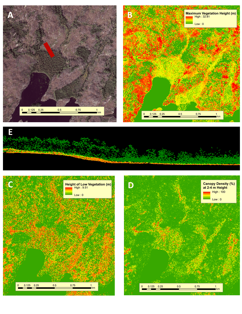
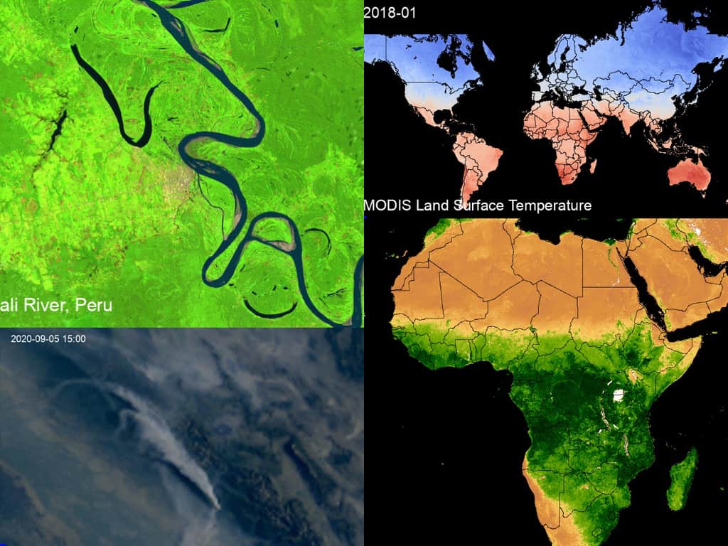
Mapping Ecosystem Health through Satellite Data
Remote sensing techniques, particularly those based on satellite, drone, and aircraft data, have revolutionized collecting ecosystem data.
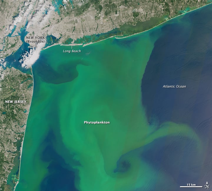
Geography of Sewage Contamination in the Ocean
80% of the sewage produced by the global population makes its way into the world’s oceans untreated.

Mapping the World’s Fungi
Scientists have created a collaborative effort, called the Society for the Protection of Underground Networks (SPUN), which aims to map and protect large areas of fungi.
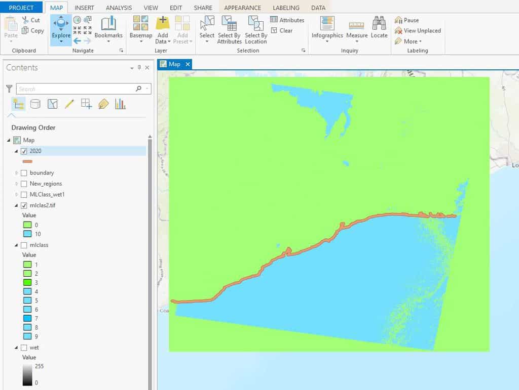
How to Use ArcGIS Pro for Automatic Shoreline Delineation from Landsat Imagery
Learn how to extract shorelines in ArcGIS Pro using the Tasseled Cap and NDVI indices with the Landsat toolkit for automatic shoreline delineation.
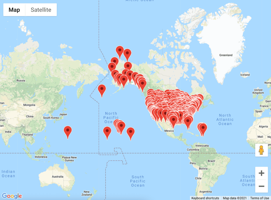
A Guide to Building Interactive Google Maps with R Shiny
Dario Radečić demonstrates how to build interactive Google Maps with R, and how to include them in R Shiny dashboards.

Building It Back – Beaver Reintroductions Across the World
Since the 1920s, beavers have been artificially re-introduced to many habitats across their former range.

What are Desire Paths?
Desire paths (also known as social trails) form when people or animals consistently take direct routes instead of using designated paths.

Mapping Natural Carbon Storage
Scientists have created a map of the Earth where carbon needs to be stored to keep climate goals from Cop26 possible.

World Flood Mapping Tool
The World Flood Mapping Tool, developed by the UN University's Institute of Water, Environment, and Health, aims to help countries with limited data construct flood maps.

Geography Facts About Yellowstone National Park
Learn some quick and fun geography facts about Yellowstone National Park.

Only Two Towns in the World Have an Exclamation in Their Name
Only two towns in the world have an exclamation mark as part of their formal names.

What are Actinoform Clouds?
Actinoform clouds are typically found along large Western landmasses over the ocean and were first seen on satellite imagery in the 1960s.

You Are Here: How Google Improves Mobile Location Accuracy
Ed Parsons explains how Google continues to innovate in the location technology sector.

Geography of Montana
The fourth largest state, Montana has a diverse geography that stretches from grass prairies to mountainous terrain.

Six Things You Should be Doing to Enhance Your GIS Career
Here are six focus areas you should be working on to further your GIS career.

GIS Day and PostGIS Day Are Coming Up
November 18, 2020 marks the 21st anniversary of GIS Day. The following day is PostGIS Day.

Geography of Corn in the United States
The United States produces one-third of the world's corn.

How to Perform a Site Selection Analysis in ArcGIS Pro
Using this tutorial, ArcGIS Pro users will learn how to do a site selection analysis, which includes analyzing travel times and accessibility to a location via various modes of transportation.

Where to View the Milky Way in the United States
Wilderness areas and national parks, particularly in the western half of the United States, are excellent places to observe the night sky.